Summary: hide the bike at the Height-of-the-Land on route 17 and start the hike from Pleasant Mountain Road towards AT. That is the most unexplored and untried section of the trial. Reach AT by 6 PM and the coveted camp spots by 6:30.
04:20 – first unsuccessful attempt to wake up
05:06 wake up at home in Boston on a second attempt – +10°C.
05:38 – ODO 00.0 – depart from home – the sun is up already since 05:21
06:44 – 07:44 – ODO 73.7 – first stop at Maine State Visitor Information Center – Kittery – Duolingo triple points session
09:08 – 09:33 – ODO 160.8 – +17°C – Hannaford at Turner, ME. I buy 3 slices of watermelon and raspberry for immediate consumption, and blueberries and oranges to take with me on the hike – $14.32. The sky is clear. I found a secluded table on the side of supermarket where I can relax and write my notes.
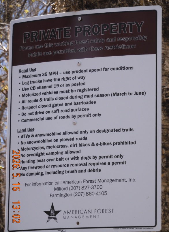
10:35 – ODO 208 – ODO 208.0 – +19°C -I arrive at the gate of Mount Pleasant Rd. that is locked by the gate and has Private Property sign – that is unexpected. I will return here in couple of hours after I deposit my bike at the end of the trail.
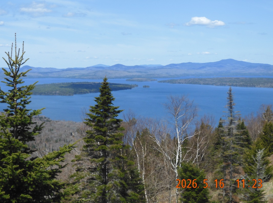
10:52 – 11:28 – ODO 216.8 – Route 17 Height of Land landmark. I hid the bike into the forest, added water bottle and one orange for the time of my return and departed back to the beginning of the hike
 |
 |
| View from Height of Land onto Toothaker Island on Lake Mooselookmeguntic | Looks like American Forest Management hold the lands along Pleasant Mountain Road and opens the gate in July |
11:43 – 12:06 – ODO 223.7 – park the car on Houghton Rd. in Byron, ME. That way I am not parking on anybody’s property. Weather is great. I need to walk about 1 mile down the road from Houghton Rd. to so called Pleasant Mountain Rd. that is blocked by the gate and marked as private property.
12:25 I started walking on a grassy branch of the road and discovered that it was in the wrong direction. The whole area after the gates is a large open square with traces of construction activity and boulders pushed to one side of the road. It is not easy to understand where to go. I feel a bit calmer. Let the adventure begin.
Sun is intense. I am covering face with sunscreen. Spring is in its early stages – no leaves on the trees yet and there is no shade.
I didn’t take sunglasses on purpose, but I did take a gun with me for safety. It is extra wight, but I will be crossing some really wild places.
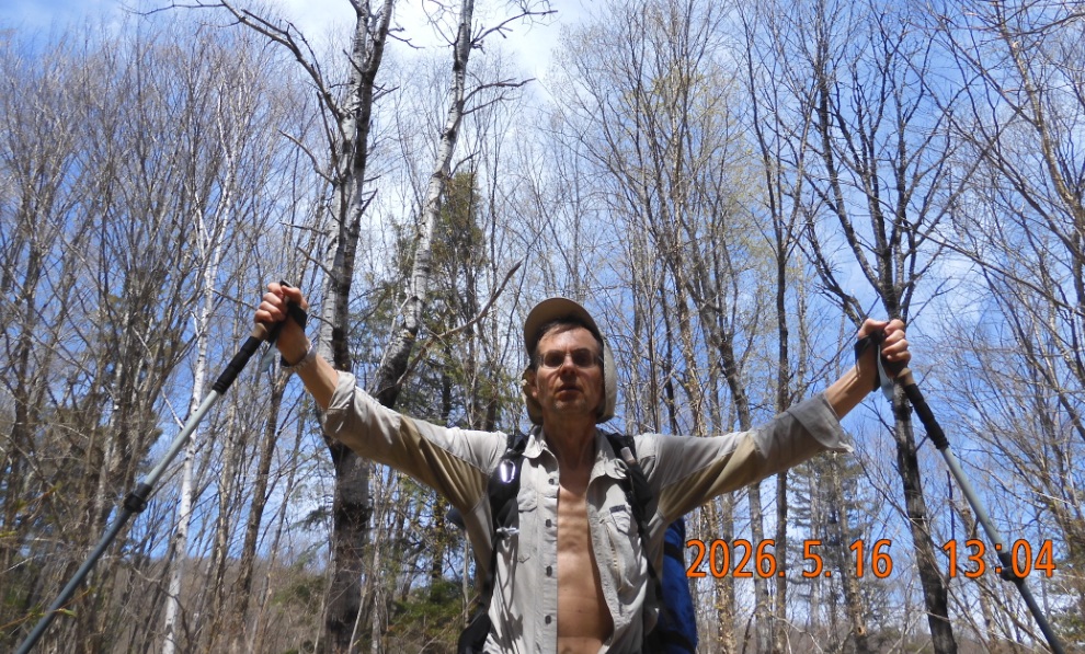
12:46 My first stop on the trail or private road. The road is good, well established. It goes parallel to the West Branch Swift River. Weather is cooperating. I am taking all the layers of clothes to stay on only in shorts and a hiking shirt with long sleeves.
13:02 Finally, I understand the secret of this private road. I see the sign on a tree posted by American Forest Management. The sign states that during mud season (Mar to Jun) the road is closed. Ok. That explains the locked gate. The road goes visibly up and up. While walking on that road, I need to gain all the elevation from 1000′ back to 3000′ where AT is passing.
13:33 Ok. First important milestone – one more gate on a side road to some maintenance buildings not visible from the main road.
13:47 The remains of the road ahead are a complete washout – a narrow canyon with steep sides and large boulders on the bottom with a river running between them. Not a good venue to travel. There is no signal, but it appears I can send messages via satellite. This is something new for me.
 |
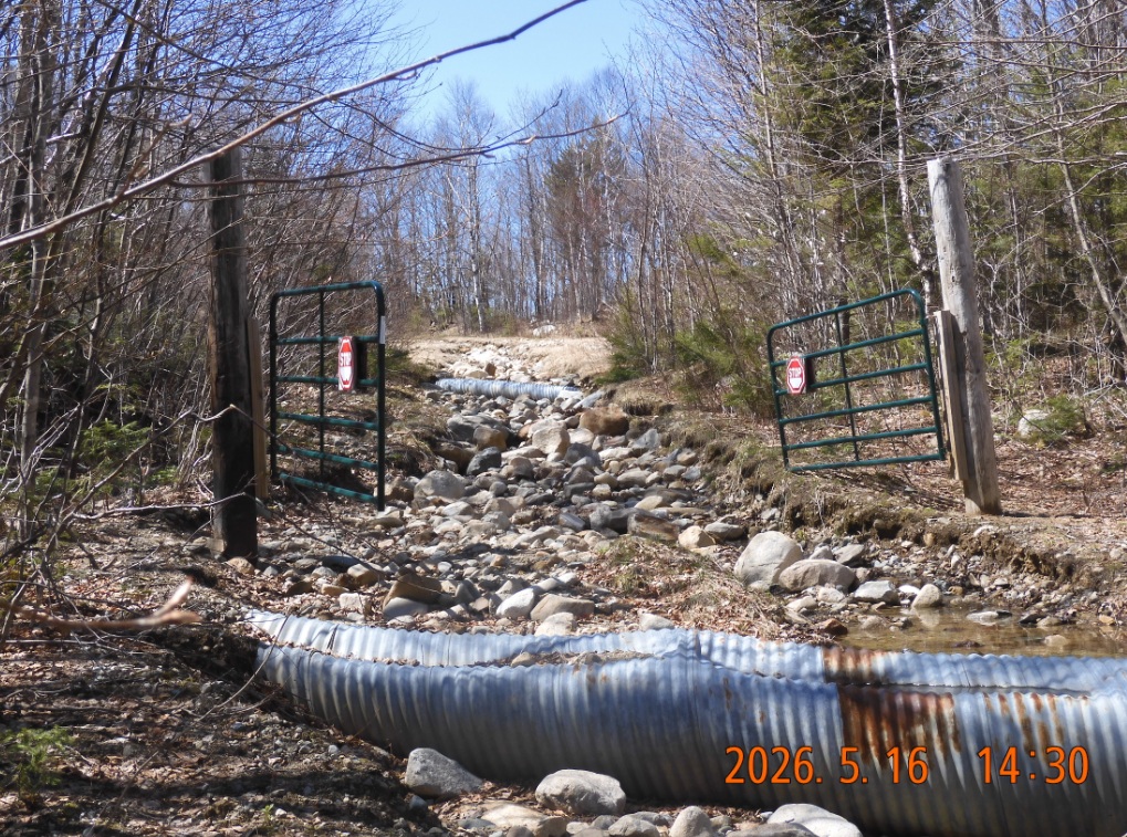 |
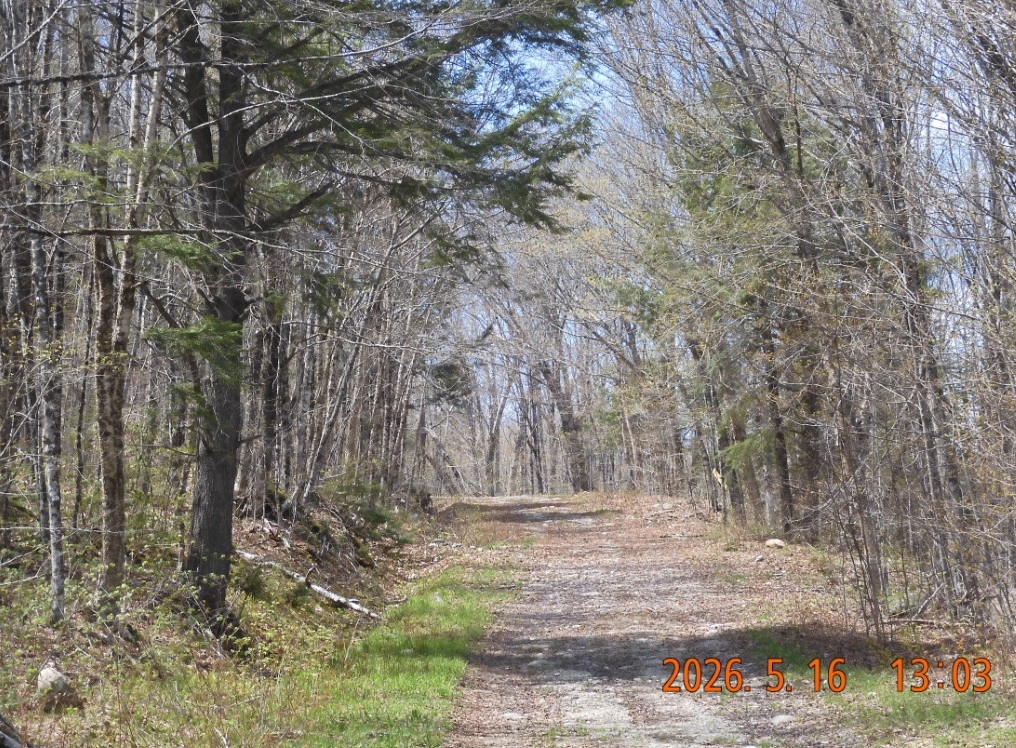
| There is a beautiful forest Pleasant Mountain Rd first mile into the forest | The same road is compltely washed out 3 miles in, but the gates are standing strong |
14:30 road is completely ruined but another set of gates is still standing strong.
14:44 According to my map, I need to make a turn, but there is nowhere to turn to. There is no sign of any road or any passage. I begin to climb to a steep side embankment constantly checking with GPS on the phone. No. Nothing. While struggling to extract myself from the endless bush I noticed that I lost Anti Sink plastic ring on one of the trekking poles. It is impossible to go back and search, because my forest musings are random and untraceable.
15:18 After going without any road, I finally begin to see some traces of former path.
15:37 – 15:47 walked 5.4 mi – elev. 2568′ – It feels like I am approaching the AT. The road (or what is left of it) is covered with moose poop. Every 5 or 10 steps there is a large moose dump. Interestingly, there are no more pictures for next 3 hours. It is unusual but I am hungry on the first day on the hike. I decide to eat a Lärabar with water from home. Insects’ presence is very light.
17:14 the dying path begins to curve away from AT, and now I need to cut right through the forest. But I can’t – it is too thick. Then I decided to return and see where I might have missed the turn. With difficulty I find my way back, but there is not a hint of a road or a path where it is supposed to be. Now, I resume on a path that I already walked and examine if I can make a more intelligent turn into the thicket.
17:46 The most dramatic 30 min of the whole trip began. I must go perpendicularly to the logical and natural forest direction, and I must constantly check with the phone to keep the direction right. My feet are completely wet. Dead but strong and sharp spruce branches hanging low and attacking my legs from all corners. There are dead tree trunks blocking the way in the direction I need to go. The ground is uneven with hidden boulders and secret holes covered with leaves and moss. And I am carrying the backpack that also catches on branches and sticks. Brutal. The only good news – it appears that I am slowly approaching the trail. The brain constantly tricks me to go in easy direction away from where I need to go. Unbelievably I must check the direction every 10 steps, but eventually the method works and I am on a straight course to AT. The last steps are especially nerve-racking because I should be already on the trails, but I do not see anything. In dark somber woods, you could be standing on the trail and still miss it.
18:11 Finally, I am at Appalachian Trail, but there was no joy. It took too long and it was much harder than I expected. There is no time to celebrate. The trail itself is also wet and unwelcoming. But at least, I don’t have to guess the direction of travel. Now I can go north all the way to route 17.
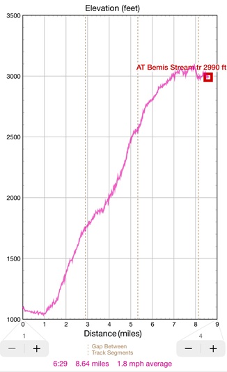
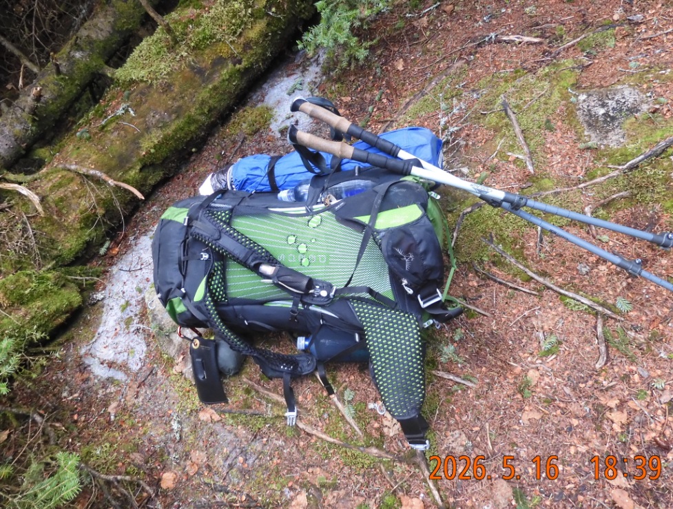
18:39 – walked 8.64 mi – elev. 2990′ – I haven’t met anyone so far today. After half a mile on AT, I found my old set of camping spots where I stayed in July 2022. The place is still good, secluded and close enough to the trail. The forest is tall, roomy and light. The trees have branches only very high in the air, almost like palm trees. That allows plenty of light to reach the surface. I selected one of the more remote spots. To reach there one needs to hop over several fallen trunks.
19:00 – collect the water from crystal-clear puddles of water stealthily and leisurely crossing AT here. Sandals were a good choice for this trip. They at least have a chance to dry out some time tomorrow when I will start walking.
For warmth at night I found a new way to attach the trap to hammock – diagonally using gromets. That gives extra layer of insulation from the elements. Good find!
 |
 |
| Day’s hike elevation profile. I was seedily climbing up from 1000 to 3000′ without really noticing it | This is it. Afte 9 mi of hiking the backpack is on the ground – time to get water and set the camp. No one is around. A perfect spot seem in a dream a few days ago. |
21:08 There is even a very weak cell signal – I was able to send my location for tonight. To free up a paper cup for tea I had to temporary dump dried nuts into a plastic bag. It is unusual that I am so hungry on the first night of the trip.
21:16 I and unusually early in May this year – about a week earlier, and the leaves here not yet unfolded. And patches of snow are visible here and there.
21:51 – it is not in in forecast, but a light rain has started. I must emerge from my cocoon and hide backpack and everything under a rainfly.
Navigate through the List
- 01 2026-05 Preparations for the trip one (2026/05/15)
- 02 2026-05-16 SA ME from Route 17 to AT on Pleasant Mount Rd (2026/05/16)
- 03 2026-06-17 SU ME on AT and Bemis Trail and without a trail (2026/05/17)
- 04 2026-05-18 MO ME return to bike and ride under a surprise rain (2026/05/18)
- 05 2026-05 ME short AT trip lessons and consequences (2026/05/19)
- 01 AT NH 2026-05 second trip preparation (2026/05/20)
- 02 2026-05-21 THU - jump into action mid-day (2026/05/21)
- 03 2026-05-22 FRI - first half of the AT section (2026/05/22)
- 04 2026-05-23 SAT - second half of the AT section (2026/05/23)
- 05 2026-05 Lessons of the second May trip (2026/05/24)


Be the first to comment