
Summary: wake up at the north end of Mahoosuc mile and walk along Bull Branch brook on an unofficial trail marked with pink ribbons. By 8:40 am I’ve reached a public road at Wright Trail parking. Proceed on the road, take a swim, and reach car by 10:12.
05:33 I am up in a hammock woken up by a woodpecker nearby. Good. It is time to go anyway. The night was warm and full of stars and a bright lunar disk that made everything look mysterious in the forest. I woke up twice at 23:19 and 01:31.
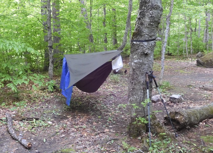
I managed to take pictures of my shelter before I started to disassemble everything.
05:51 I am spreading all the things on a tarp – very convenient for packing, Bugs are sluggish but slowly are waking up and going for a kill.
 |
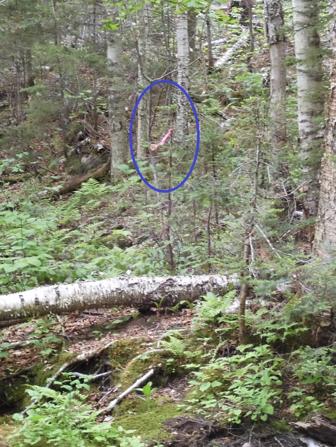 |
| When it warm and dry in the forest – it is wonderful. And the summer is just starting. And bugs are too lazy to wake up at this hour. | The mysterious path is marked with pink ribbons |
06:51 I am starting the hike. It is not cold this morning. First, descend sharply down to the river, then almost immediately cross the river and have a relatively easy hike following an unofficial trail marked with pink ribbons. The trail is clearly visible on the ground from previous foot traffic. I notice a big fresh bear hoofprints on the wet sections on the trail. To avoid unexpected encounters, I started to whistle.
07:16 I am most definitely out of the woods and on the old unused section of Bull Branch Rd. Now it is just a matter of walking toward the car for several miles. Road is deformed by tranches at regular intervals from the old, removed culverts.
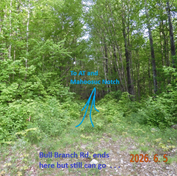
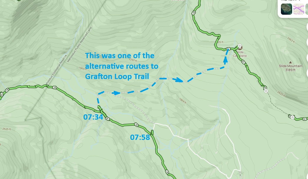
07:34 – 07:44 I missed the unnamed road – the path I could have taken for my loop option #2. To discover the trail you would need to know what you are looking for. The trail is there and it is very straight like a road. To test the option, I followed the path till the first washed-out bridge.
 |
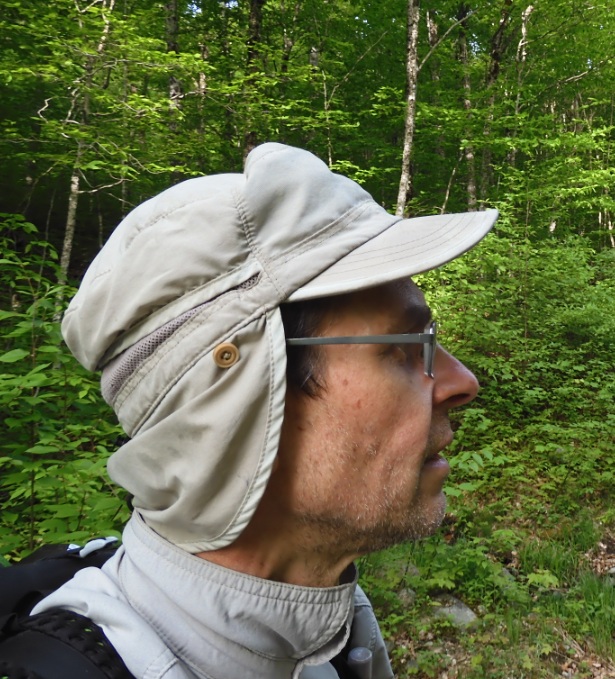 |
| Another mystery of the trip is solved – you can walk from Bull Branch Rd, to AT and Mahoosuc Mile using unofficial but very visible trail. | By 7:30 you need a full protection from unexpected landings bites. We are ready. |
 |
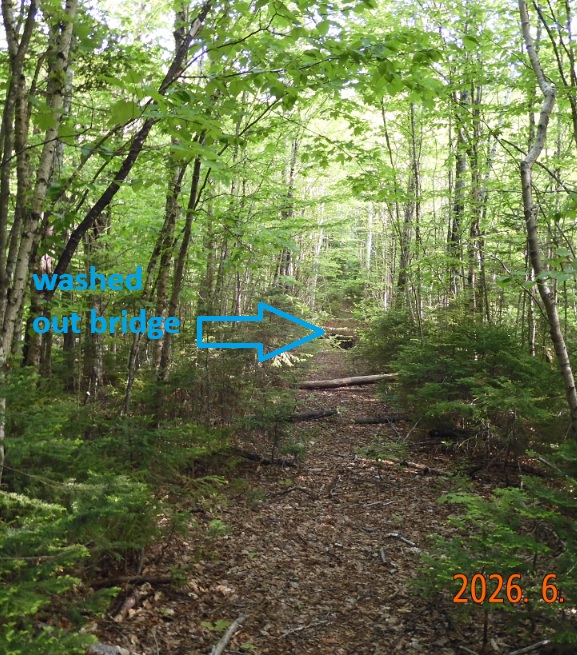 |
| One of the trip options was to drop the car at Wright Trail parking and walk on Bull Branch Rd. to reach an abandoned road that ends too far from Grafton Loop Trail | And the road does exists and is pretty visible to follow and use |
07:57 – with a new merge, now the road becomes very real, wide but still interrupted by frequent tranches.
08:36 – road reaches a widening. It looks like a sand carrier going up the slope. For the first time I see lazy, slow mosquitoes landing on my arms and they don’t even bother to fly away.
08:40 – 09:00 – I hiked 3.83 mi – Evel. 1285 ‘ – First signs of return to civilization. Now begins the open-for-car section of the road. It is the Wright Trail Parking. Parking is ample, but there is only 1 car and one other car arrived while I was there – an old Volkswagen van with Massachusetts plates. The guy inside was from Scituate, MA. He just arrived to explore and walk the dog. He gave me a cold can of Seltzer from Hannaford. Interestingly, will see this van 3 more times today.
09:09 – 09:32 – road approaches the Bull Branch brook. I take an opportunity to take a swim. Water is very cold. I can only stay in water for a few seconds. Multiple emails and messages begin to ping. I see old Volkswagen van flying on the road back for a second time.
09:48 – I am passing a strangely named Frenchman’s Hole – a deeper and wider section of the river with a parking lot and picnic tables. Here I see the old Volkswagen van parked for the third time.
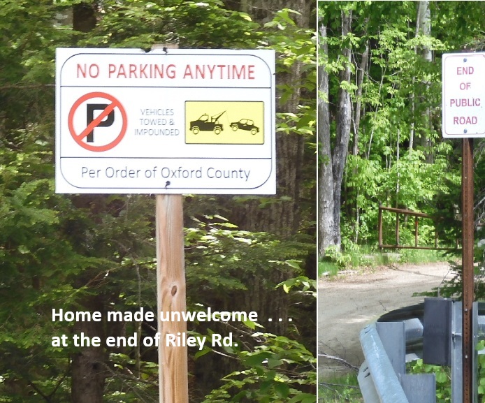
10:11 I am approaching the bridge after which I dropped the car. Just before reaching the spot, I see a homemade sign “No Parking per Order of Oxford County”. On the bridge itself there is small “End of Public Lands” sign. Am I in trouble? No. I am good – the car is standing right there where I left it – the spot is too remote to cause any trouble. I do not even see any fresh tire marks in the ground.
The most magical moments of returning to civilization – retrieving valuables hidden all over the car, turning on Wi-Fi and Bluetooth, changing socks and shoes.
10:20 ODO 194.5 +23°C – let’s start driving home via Sunday River, roots 2, 26 and 95 through Paris, Norway, Poland and Gray, ME. When driving through Bethel, ME I see the mysterious Volkswagen van for the fourth time.
 |
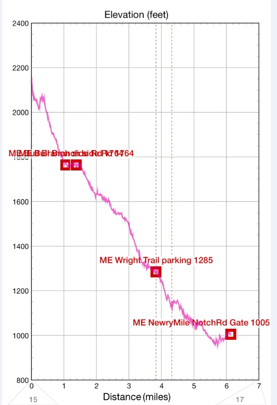 |
| There is a sort- 0.4 mi Riley Rd. and it is blocked by two gates at the end. I didn’t notice that they do not want you to park before are after the bridge. | The hike was imperceptibly down all 6.1 mi today from 2200′ to a 1000′ |
11:45 convenient gas stop (Gulf) at Poland, ME 15.446 * $4.969 = $76.75
13:21 – I stop at NH Liquor & Wine outlet on route 95 to do a session of Duolingo.
14:31 – ODO 388.6 +32°C – I arrive home after a significant Friday traffic on route 128.
17:00 – with Lira we go out to Pho & Spice in Waltham.
Navigate through the List
- 01 2026-06 Preparation for a third trip (2026/06/02)
- 02 2026-06-03 WE - Private Mile Notch Rd. to Grafton Loop Trail (2026/06/03)
- 03 2026-06-04 TH - from Old Speck MTN over AT to Mahoosuc mile (2026/06/04)
- 04 2026-06-05 FR - local shortcut to Bull Branch and alternative roots (2026/06/05)
- 05 2026 06 Lessons for all three May-June trips (2026/06/06)
- 01 2026-06 Preparations for the fourth trip (2026/06/26)
- 02 2026-06-27 SA bike fast without rucksack, hike slow without gusto (2026/06/27)
- 03 2026-06-28 SU Fourteen miles in fourteen hours over Mount Washington (2026/06/28)
- 04 2026-06-29 MO - up to Mount Madison and down to the car (2026/06/29)
- 05 2026-06 Epilog - bite the bullet and do it (2026/06/30)
Be the first to comment