Woke up at 05:51 – the record and without any hesitation I was ready to leave the camp in just half an hour.
06:31 start excursion number 4 – “Pond of Safety”
Road is a mess. All 5 yards of it. Road is very wide here, but it has no foundation. I picked eastern side of the road and moved forward very carefully trying not to get super wet. But to no avail. My feet are sliding. Ground can’t support my weight and my boots just plunging into sticky mud. And I can’t really move forward off the road. It is the same wet mess, but with trees and bushes on the way.
 |
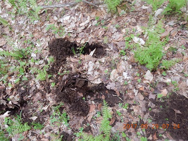 |
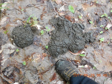
| 06:46 Bear dump stamps – I can see substantial signs of bear activity – both hoof-prints and fresh piles of dung. A little shiver of cold fear in the guts right in the middle of a green muddy forest | 07:24 Massive animal foot prints. They also travel here and their hoofs also go right through the mud. |
 |
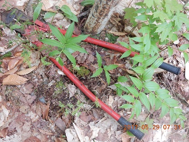 |
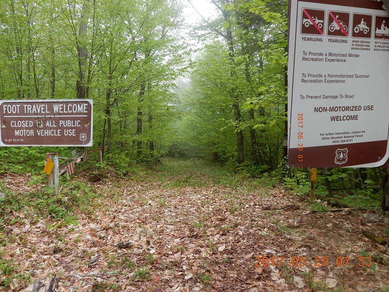
| 07:30 – I reach the apparent pass to the other valley and the end to the muddy unimproved road. Altitude 686 m. I just completed the portion of the road supposed to be closed to motorized traffic unless ground is frozen, but the gates are wide open. Gates are open, but I did not see any damaging tracks of vehicles or ATVs. It seems that only a tank could really pass the boulders and devastation of the road. | Gates are opened by someone who cut the lock by an Industrial Grade Bolt Cutter (something like Home Depot Model 0390MC). Someone cut the lock and dropped the heavy tool right here on the ground. The only explanation I could think of, if they cut the lock, dropped the cutter on the ground so they wouldn’t’ have to haul it around, and then they forget to pick it up of the way back from the trip. Mysterious!? |
This spot near the broken gate used to be a road junction, so it deserved a little exploration. Now everything is covered with vegetation, but visible signs of forest roads remain.
After taking a break and reapplying fresh coat of bug spray I went on a side trip to an unmarked forest road FR along the crest of the hill. I lost and immediately find a glove. This side road leads to no particular target and just dies down into the forest.
08:06 Main road is improved tremendously after the pass. But me feet are wet and cold. Rain did not even think to start. I found a tree trunk to sit on. I am trying to dry my boots and socks. Water is streaming from my dirty socks to the ground.
 |
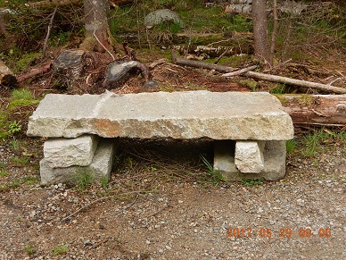 |
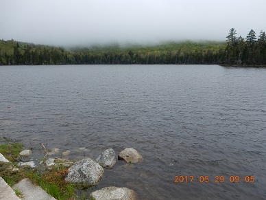
| 09:05 I’ve reached Pond of Safety. Skies are still low and cloudy. There is large and empty parking lot here, and . . . | . . . someone even constructed 2 stone benches. These have stone legs linked up by a large flat stone slabs. Where would someone find not one, but two flat stones like this? Interesting. |
I go further and deeper into the forest on another abandon road. In a few hundred yards, there is no road anymore. Just clearings here and there. I am going back through the bush trying to return to the main road.
09:30 Main road – And what a surprise – by this time sun is breaking through. I immediately spread all my things on the grass by the road and start soaking up the sun. Clouds mysteriously parted for a moment and sun enters the stage with warmth and light. I found another tick traveling on my leg – kill that bandit!
This is the South-most tip of the trip – 44.40500°N 71.34190°W. Road is good here, but still no cell signal even on Verizon. Good thing I told Lira yesterday do not expect to hear from me today.
10:12 As quickly as sun appeared, it is now gone. It is cold and dark again. I am walking back – not a single person or car encountered so far today.
As soon as I thought that a green ranger truck appeared from the South with 2 rangers in it. I was just removing fallen tree from the road.
10:20 I found a link to Four Solders trail. I missed the sing earlier this morning. It means that now I can do a loop from my Camp to Hunters Pass to Cooks Path, to Mount Crescent, to Carlton Notch and to emerge here for the last leg of the loop. I am planning to close this loop during my next trip here in July 2017. This loop might be just a little more than a simple day trip.
Walk back was much more lighthearted. Weather improved again. It seemed that rain just went away completely. I dropped and lost a wet sock sticking out of my backpack and somehow within 50 yards of a loss I’ve sensed that something is missing, checked, discovered the loss, dropped everything and traced my steps back, and found the missing sock within the same minute. I believe it was 11:04.
This time I was going much faster with 2 sticks that helped my balance and I walked on Western side of the road. Although it appears lower, apparently it is better. Even when I had to dive into forest to bypass especially wet spots, it was an easier going than on Eastern side earlier.
11:31 I arrived to the Camp Rain. . This first excursion of the day took exactly 5 hours. I changed, grabbed saved one third of the watermelon (I still have not eaten yet) and started marching to the bike. It is time to explorer Bog Dam Road.
11:51 – depart the camp for a second trip. I remembered to check all around the bike that nothing actually fell out my backpack yesterday. By this time, I remembered much more vividly that I put spare battery in a glove yesterday. Nothing lost, nothing gained – good!
Not a hundred yards up the road I found a large rock that would be my seat and my table at the same time. Breakfast on the rock with watermelon. I had to use small folding knife to cut it this time.
When watermelon already cut into quarters, it is much more manageable even by a small 3″ blade. Perfect, perfect, prefect.
12:48 I am starting the next trip – this time a bike trip on Bog Dam Road to explore the closed section of the road.
13:08 venture out on a forgotten and disappearing Upper Ammunoosuc Trail. Here it is dark, wet, barely visible and not inviting at all (blocked by many obstacles). I walked on it just a little bit. Once again, trail goes visibly down to the river, and that too is not very pleasant in wet conditions.
Ride along many more road bridges, some new, some old. How much money invested here to maintain the road that is happily closed since last July and no one is complaining. Incredible quality of restored bridges! Very good road for quiet contemplation on a bike or simply walking. No cars. No bikes here. Not a single one. Just fantastic dirt road mostly for animals and birds. Bugs are very active.
13:34 I’ve reached another closed bridge – shiny and ready to go. Here too they placed 2 cement barriers, although bridge is 99% ready. Some colored strings are stretched along the railing of the bridge as if they were checking either level or straightness of something? 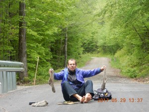 |
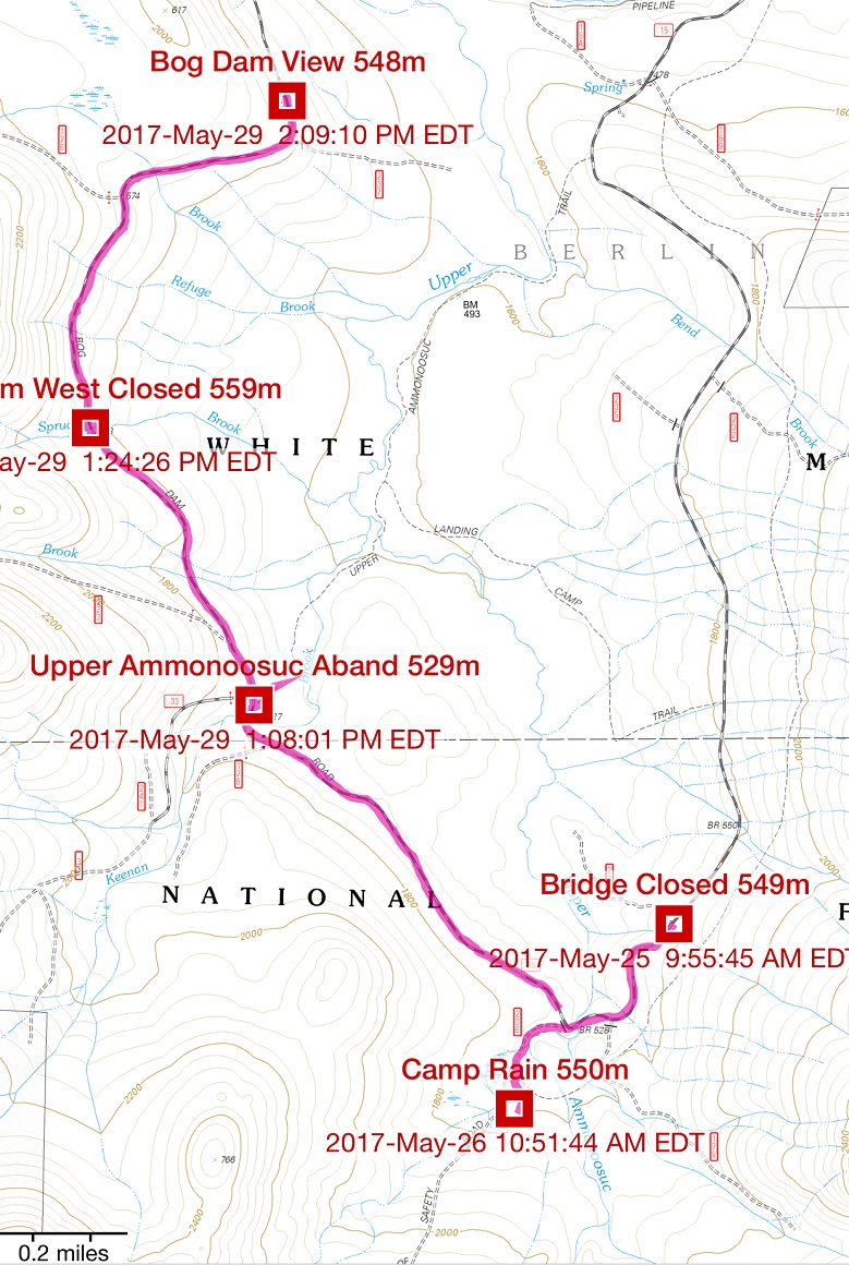 |
| 13:37 I just want to spread my wet stuff on pavement warmed up by occasional sun and let them dry a little bit. As another attempt to keep feet dry I would put on only top section of the sock. It is slightly awkward, but it is better that drenched socks. | 14:13 the furthest I went on Dog Dam Road. I stopped when I saw a clearing and a view facing East – inside the BDR loop |
14:22 check cell signal and . . . there are some cubes on the phone! I see 3G if not LTE. Very strange? I took bike 5 miles further into wilderness and away from civilization on BDR but apparently signal spreads randomly and unevenly in the wild. I let Lira know that I am OK and that it is cloudy, but rain never materialized.
Weather forecast shows 80 to 90% chance of rain all the way till 10 PM.
14:43 The proverbial ink on my electronic message was not yet dry and rain starts. This one is nice and long. It was not a record-breaking rain, but you get wet in 5 minutes. I put on poncho over me and my back pack and started to ride 5 miles back to the camp.
15:00 By 3 PM I am back to the hiding place to my today’s walking sticks and backpack. I need to attach them to the bike and continue on to the car.
 |
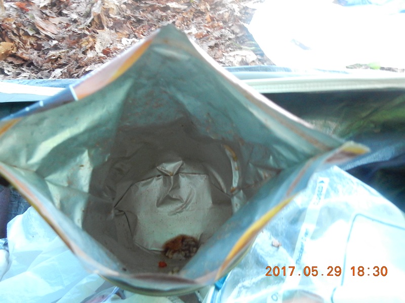 |
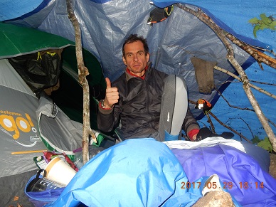
| 18:00 Due to a heavy rain, cooking, changing, eating and keeping entertained – all this in a small cone under the tarp. But it was exiting. I would be the last night in the woods before returning home | 18:30 done eating and discovered a mysterious portrait on the bottom of the meal package. Took multiple pictures with different effects, and saw how the personality of the portrait was changing with every shot. |
One last victim of eating and drinking in a tight space was my tea. I upset close to half of tall tea paper cup on the floor of the tent. It was a very lucky spill as it did not touch any cloth. Within several minutes I drained the spill with a small piece of rug that I picked on my first excursion towards Mt. Cabot.
19:26 – 20:47 – time it took to write down all the events of the day lying down in the tent – 81 minutes!
Navigate through the List
- 01 NH Trip May 2017 - Preparations for the trip to Bog Dam Road (2026/03/09)
- 02 Thursday, May 25 - Drive, Search, Camp and Rain - Perfect! (2026/03/10)
- 03 Friday, May 26 - Remarkably Unremarkable Bunnell Notch Tr. to Mt. Cabot (2026/03/11)
- 04 Saturday, May 27 - Visibly Invisible Trail (Hunters Pass) to Ice Gulch (2026/03/13)
- 05 Sunday, May 28 - Relax to Unknown Pond (2026/03/14)
- 06 Monday, May 29 - Mud, jaws, bridge and rain (2026/03/15)
- 07 Tuesday, May 30 - We are so distracted by day job from our trail lives (2026/03/17)
- 08 May 2017 Bog Dam Road trip - Lessons learned (2026/03/18)
Be the first to comment