Summary: Drive to Unnamed Road in Monson, ME before the Katahdin Ironworks toll booth and hide the bike in the woods. Drive back from Greenville to Moxie Pond. Start a 6 mi hike to Moxie Bald shelter.
04:51 – +16°C – wake up without an alarm in Boston. It is complete darkness outside.
05:14 – ODO 0.0 – start driving. Car shows +19°C outside.
06:39 – ODO 94.5 – +14.5°C – Kennebunk Service Plaza (Northbound). The car behaves reliably and the enqueue does not overheat – very good. I am doing regular morning routines plus my Duolingo.
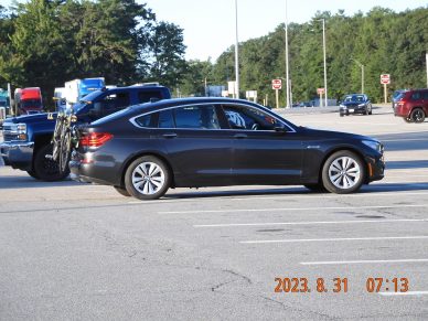
07:13 On the rest area parking lot I see a license plate from Tamaulipas – a state in Mexico bordering USA in the Gulf of Mexico.
 |
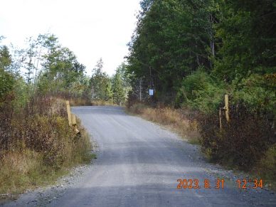 |
| Early morning in Maine rest area. Last day in August 2023. | The gate out of private road was open. It means I can cross over and reach my starting point. |
08:43 – ODO 194.7 – Irving gas station in Fairfield, ME. Price for premium is $4.149 (89). I am listening to Boris Akunin “History of Russian State – Volume I”. 87 miles or 2h and 37 min remains to the target. Everything is good. The constant worries in the head are receding.
10:11 ODO 259.4 – I am in Monson, ME – crossing AT where I will travel 2 days later.
10:29 – ODO 270.1 – I am in Greenville, ME
10:53 – ODO 280.7 – +13.5°C – I stopped 1.2 mi short of the Hedgehog Checkpoint on the hill with elevation bout 1500′.
11:53 – ODO 292.7 +15.5°C – I am driving pass Northwoods Fitness in Greenville, ME on the very corner of Pritham Ave and Depot St. (2 Depot St, Greenville Junction, ME 04442) right after the bridge.
12:06 Completed 20 mi to the beginning of the trail, remains 18 mi. Everything is OK.
12:32 ODO 308.6 or 28 mi from the bike. +16°C. I have passed the second gate – now I know I will get through.
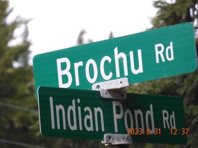
12:37 ODO 309.5 – emerging on the other side from Brochu Rd. to Indian Pond Rd.
12:42 ODO 311.4 – continue straight into unpaved and bumpy Troutdale Rd. There are multiple 15-mph and even 10-mph homemade signs for a good reason – you must navigate from puddle to puddle and from bump to bump to save your axles.
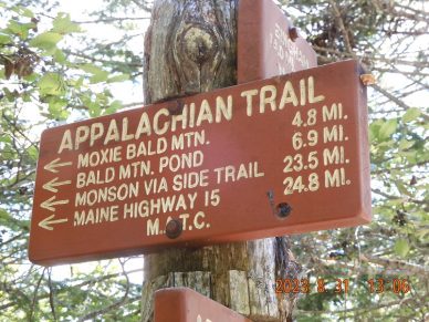
13:06 ODO 319.2 +16°C – I arrived at the beginning of my hiking section on AT parking lot for 2.5 cars at Moxie Pond. The parking spot that I have to take is taken from the forest by force. The car is on an uneven forest floor between the trees, but this is not an official spot. Two other spots are taken. Now I confirmed that for my bike trip in a few days, I would need to travel 38.5 mi (319.2 – 280.7).
 |
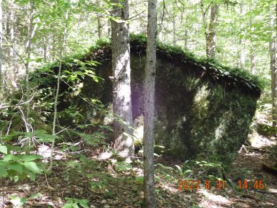 |
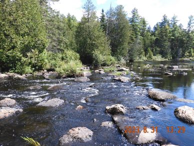
| The very first wet obstacle – I need to cross this brook, and you have to get your feet wet here. | A few yards away from actual shelter you see this boulder that looks just like a shelter |
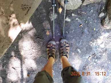
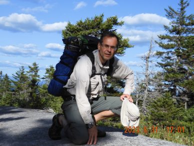
13:26 start the hike after gathering all the things, poles, fruits, and a car key. The very first obstacle is crossing the brook immediately off the road. You must get your feet wet. After crossing the brook, a wall of dense forest meets me – where would I go now? Where is the AT? I am struggling for a while to get back to the trail. I am noticing a slight pain in my coccyx and in my right leg (after a strong hit on a soccer field), but quickly I am forgetting about those. Next, crossing the power lines. The trail is mostly flat. No recollections of the specifics and no pictures.
14:46 – 15:11 – 2.69 mi – I am at Bald Mountain Brook shelter – the first (of two) shelters that I will see today.
16:06 – elev. 2200 – I am taking a bypath that is 0.3 mi shorter than AT trail over the Bald Mountain. Eat one orange. Four miles completed, 2.6 to go.
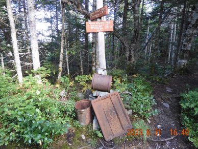
16:38 – join back with AT. This is the highest point of the whole track – about 2,400 ft (instead of max possible 2629′). The advertised spring in a metal barrel in the ground is almost dry and very unappealing.
17:00 I am repeating the steps taken 4 years ago. I will not take a 0.7 side trail to a local mount this time.
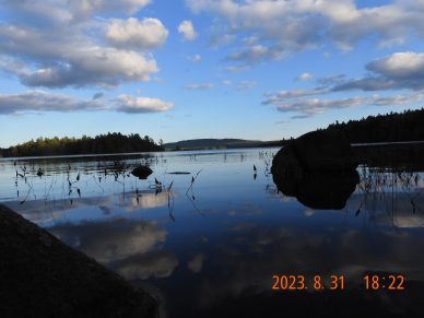
17:42 I arrived at Moxie Bald shelter. There are plenty of people here – mostly NOBOs, and some students from a nearby college. Instead of cramping into the shelter, I spread my hammock between trees close to the water edge. It is a good spot.
18:22 Last picture for the day. I wash my legs in the lake and get ready to eat my porridge from home.
18:52 -19:04 I am eating oatmeal from home, drinking water from home.
19:28 hide all things into backpack from the morning dew. It will be the coldest night – as low as 7-8°C. There is no cell signal here. Tomorrow, I would need to go 14 mi. to Hebron Pond near Monson. I am about 10-15 m from the edge of the water and surrounded by people, but at a good comfortable distance. My legs and back still need to get acquainted with a new load – walking with 30 lb. on my back for 10 hours. As far as the market is concerned, LRCX is up at 702 and the rest of the stocks are down.
Navigate through the List
- 00 AT 2023 Sep - Preparation for the trip (2025/08/30)
- 01 2023-08-31 TH - Taking on wilderness one mile at a time (2025/08/31)
- 02 2023-09-01 FR – The same AT section with a new attitude (2025/09/01)
- 03 2023-09-02 SA – the Wilson Falls are spectacular (2025/09/02)
- 04 2023-09-03 SU – take a raw shortcut to the bike (2025/09/03)
- 05 2023-09-04 MO - crisp morning ride all in one sitting (2025/09/04)
- 06 Summary of the September 2023 trip (2025/09/05)


Be the first to comment