06:33 one of the very comfortable nights ever. I put on pants at 1 AM for warmth and slept very soundly. I discovered something sharp and rounded inside the dawn sleeping bag. But dropped the investigations in the dark, and never returned to it.
07:15 – first drive of the day – is to investigate the connector trail that goes from AT towards Clearwater Brook. On my National Geographic map, the road reached almost to the AT, but there is a very tentative track that leads to a boggy area that might lead to a road. But I stopped and turned around after 0.37 miles of wonderings. But any willing deviation in the path is always very interesting and memorable. Because you never know, what you will find. Side unmarked trails are slowly dying, but they still remain on older topo maps, and explorer still can see these trails on the ground.
08:40 – ready to start the hike. Weather is promising to be sunny and not too hot. Perfect.
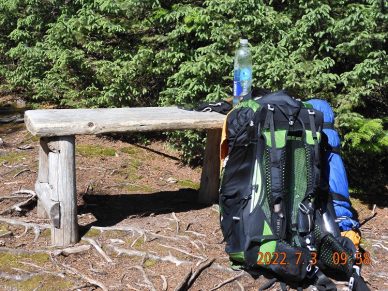
09:23 – 0.67 mi into the hike. Despite this is my last hiking day, but I am not in a hurry. I am sitting with my back to the sun and listening “I love pirates” in Spanish. All the clothing layers are coming off. The destination is just too far to feel any pull of the road. I am at the sunny bench – a spot with a view. I am still to climb Bemis Mountain that is 3555′ high. I am dreaming of the time when I clean my glasses with water and soup. Simple pleasures. These is a weak signal hear, and I can see that soccer game in Boston was moved to 8AM due to hot weather. And here it is 18°C. Very nice.
 |
 |
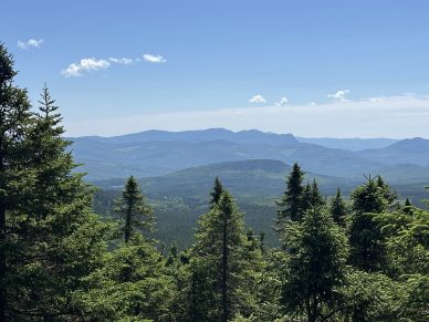
| Shortly before 10AM I spotted this view . . . | . . . from this sunny bench. |
Uncountable endless ups and downs
12:04 a view on route 17 and Height of the Land. I will be there in 2-3 hours.
12:18 – 4.11 mi – 1.5 mph average speed – elevation ~2800 – I am at Bemis Mtn shelter with a group of 5 peacocks. That is their trail name. One of the girls is discussing not publishing her already writer book so not to trigger the readers for unjustified actions. The forecast is getting warmer as I am losing elevation. It is not 25°C and sun set will be at 20:30. About 3.3 more mi to go.
13:37 – at the top of Bemis Mtn – second Peak (2915′) I can see a clear indication 2.0 mi to Bemis Rd. Now it will go more or less consistently down to about 1500′.
14:53 -after hiking 7.63 mi today or 3,51 from the shelter, I’ve reached the Bemis Rd. The last descent was surprisingly easy and unnoticeable. That is both good and strange. At some places6 mosquitoes would be deterred even my moving. That is new. They would stealthily land on the legs while on the march.
15:26 – I found my bike, not with a challenge. Now my bike is strapped, hooked and ready to go. From a very kind people of Trail magic cooler, I took only a bottle of water that I quickly emptied. This empty plastic bottle would travel with me all the way to the car and then to Boston to be recycled.
15:33 first 0.5 mi of biking is complete. I am at the intersection of Shelton Trail and Bemis Rd. I was biking here on May 24, 2018, when I had to stop due to a pain in the knee. Right now, I feel that would be able to complete all 36.6 mile today and tomorrow.
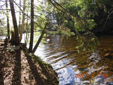
16:41 after a little over an hour of riding the bike and completing just under 9 mi of the mostly flat road I stop at the Metallak Stream that should shortly reach Upper Richardson Lake. I did not even notice how I passed by the old camp site from 4 years ago. Mosquitoes are brutal, but I persist. I dive further into the woods covered with bug spray. My bike stays close the road, and I with my backpack continue along the stream toward the lake.
17:08 – I walked about 0,25 mi into the woods, and I think I found the pristine spot. The task is to quickly drop all the clothes and jump into the water. I stopped at the point where brook is almost completely stops flowing and lake waters takes over. The bottom is still near, the round boulders are just
17:30 after a refreshing swim, I am sitting and eating the last of 4 grapefruits. This one is from a velo bag that was waiting for me at the end. My side of the river is a sunny side. If I completed 9 mi, it means there are no more than 28 mi remains for tomorrow.
 |
 |
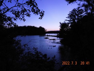
| Metallak Stream finally reaches the lake and creates a great camping spot | Upper Richardson Lake is full of life with bird songs at a sunset |
17:59 – I moved a few yards up and setup my hammock on a sharp bank overlooking the lake. The sun is beaming and reflecting from the water’s surface. And wind. A strong sustaining wind blowing from the lake. Should I move further into the woods?
18:27 No. I am staying here. The wind will die down into the evening and I can relax with the wind.
19:24 to cook food I need to create a definitive wall from my stuff to shelter the stove. There is no time for a simple contemplation. There is always a need to do something especially on the trail.
20:41 it is all quiet and dandy now. The sun is gone, but view is still there. There is no signal here. There are plenty of water birds singing their songs on the lake. My knees and legs are ok after 9 mi. That is a good thing that I am spreading the bike ride load across two days.
My power bar is failing to change the iPhone. This is the first time since I bought it in June 2017.
Calculation for tomorrow – 27 mi I can complete in 5-6H and be at the car around 1 or 2 PM (in reality tomorrow I will reach the cat at 13:24 – not a bad estimate). Tomorrow I will use a power bar in my bike bag to charge the phone.
Navigate through the List
- 01 July 2022 trip to ME - between routes 26 and 17 (2025/06/29)
- 02 2022-06-30 Thursday - very treacherous Garland Pond Rd (2025/06/30)
- 03 2022-07-01 Friday - hike 6 AM to 6PM to cover 13.5 mi on familiar grounds (2025/07/01)
- 04 2022-07-02 Saturday - a dream spot at the end of the day (2025/07/02)
- 05 2022-07-03 Sunday - aspire to Upper Richardson Lake (2025/07/03)
- 06 2022-07-04 Monday - last 28 miles to the car (2025/07/04)
- 07 Travel Lessons and further actions (2025/07/05)


Be the first to comment