
Summary: 8 mi and 8H from Madison hut up to Mount Madison and then down to the Great Gulf Wilderness, crossing Peabody West Branch and going back to Pinkham Notch
04:47 wake at Madison hut on 4 benches clustered together in a dining area. I slept badly until I constructed a big enough pillow from all my clothes. I woke up only once at 02:22. It turns out that my lonely setting on the benches in dining area was much better than rows of banks in sleeping quarters. From there a cacophony of snoring and creaking was heard all night.
05:41 email to work that I will be outside of the signal most of the day. The weather is still very good – sunny and warm.
05:54 – start the hike from the hut up Mount Madison.
06:35 -hiked 0.43 mi (0.7 mph) -elev. 5347′ – I am on top of Mount Madison. There are many back and force hikers here from the hut. They are in hurry to complete first activity before breakfast. However, two hikers started from route 302 at 2am this morning to complete the entire traverse in one day. I can see far, far ahead down the trail that goes on the top of the descending ridge and marked with cairns (cones of stones).
 |
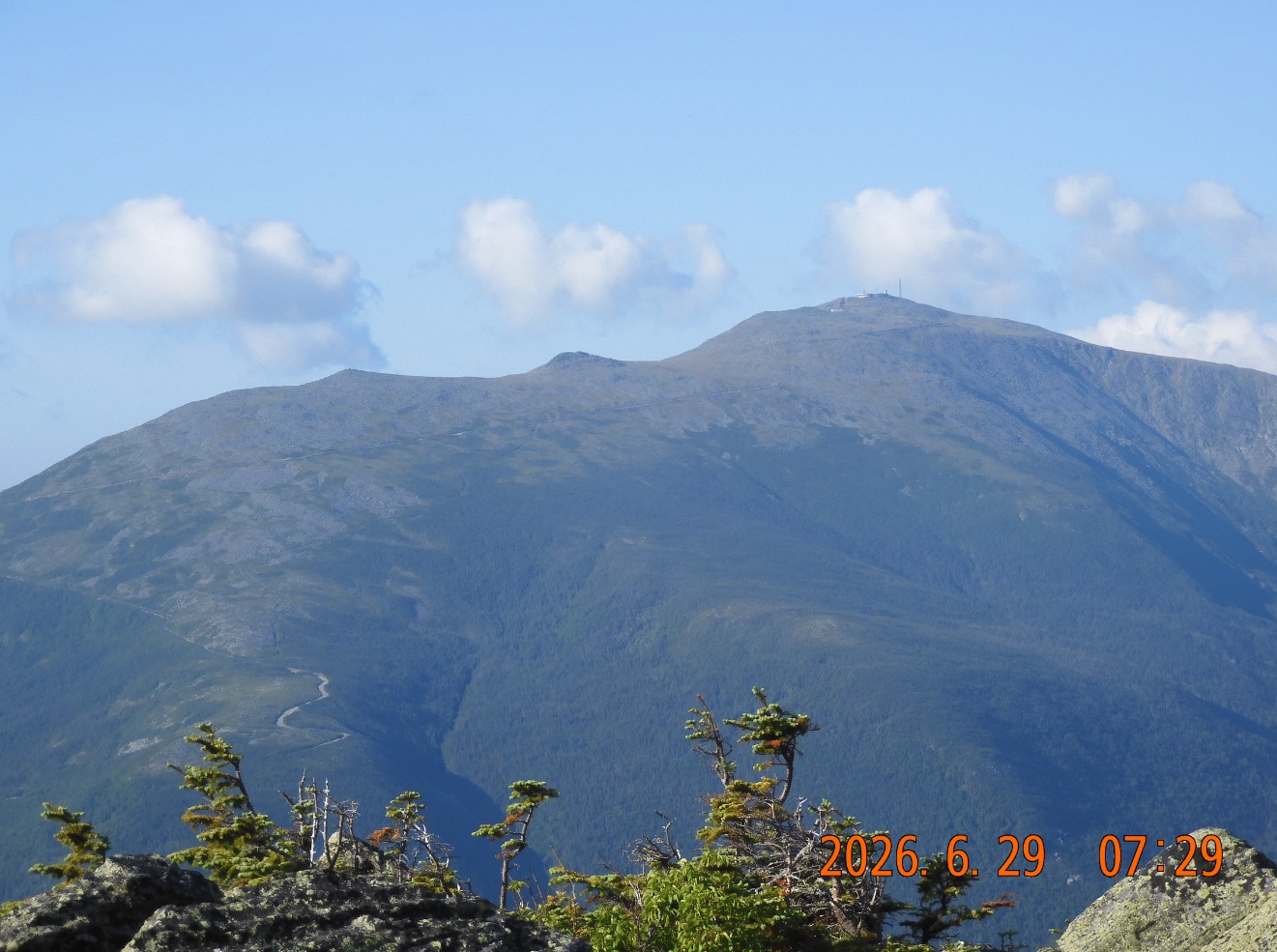 |
| It is Monday 6AM and I he is climbing Mount Madison – the last one in formidable Presidential Range. It is nice and brisk morning. | And yet another clear day in the mountains. Briefly, I could see Mount Washington before it hides behind the clouds. |
07:00 – hiked 0.6 /7.2 mi remains – elev. 5117. I am calm. There is nowhere to hurry now after 2 nights in the wild.
08:04 – hiked 1.43 mi /6.2 remains – elev. 4361. The sun is already at full strength – I already need to apply sunscreen. The views around me are still spectacular. iHike GPS is 88% full, but it will be ok. Next section will go sharply down for 1.3 mi.
I am entering a forested area. No more views or direct sunlight.
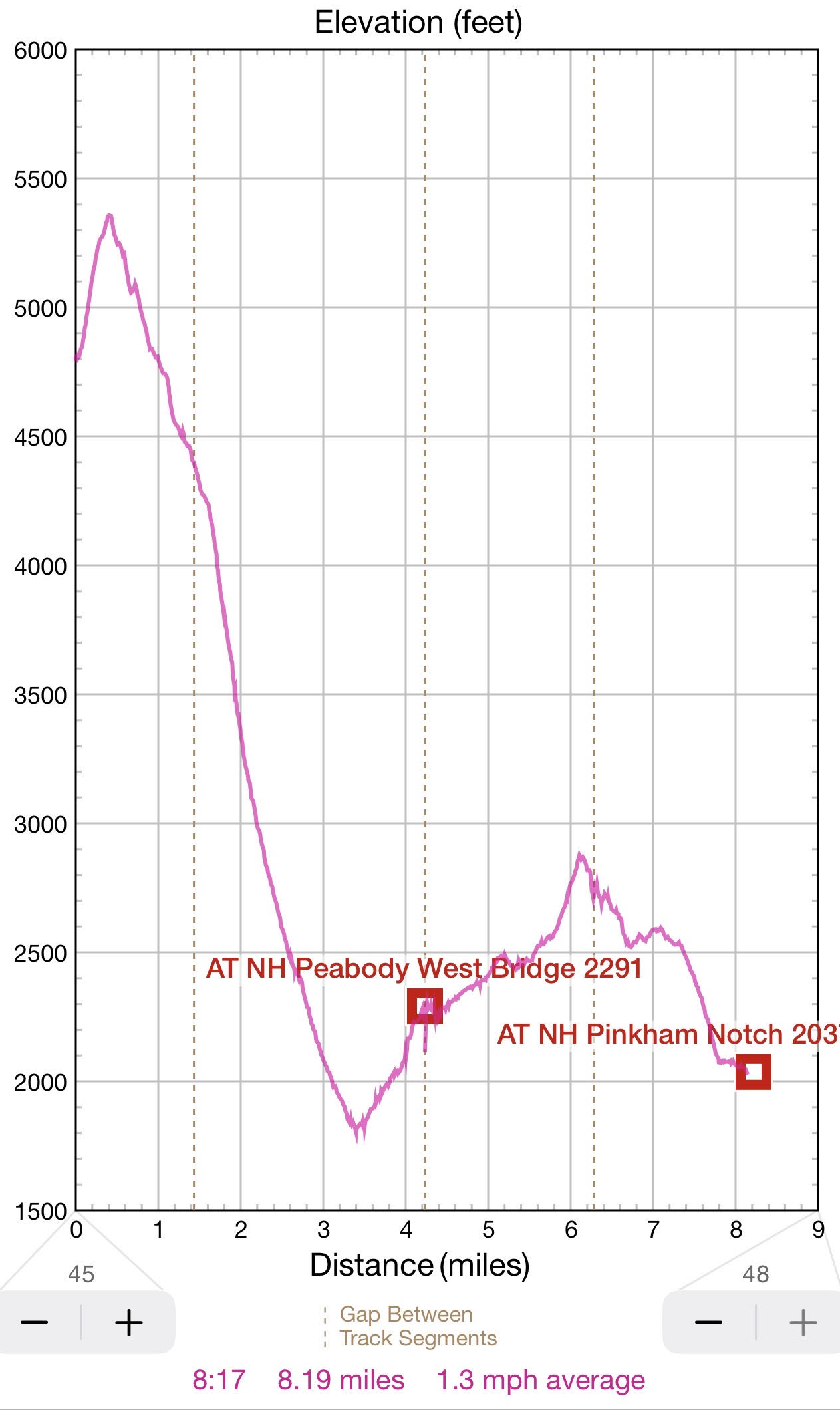
The trail keeps falling rapidly and I need to use all the caution not to twist ancle. This is an exceptionally sharp descend. It a span of 2 mi you are falling from 4361′ to about 1800′. It is about 24% grade of descend.
09:01 – hiked 2.15 / 5.4 remains – elev. 3074. There is no desire for food or drink. It is sunny, but I am in a deep tree shade.
09:28 I’ve reached Osgood Campground and talked to a father of family who stayed here for several nights. He said that the camp is free and not crowded – only a couple of through hikers. I quickly collected some water from a stream. I want to boil it and make tea at home and compare it with tea from our normal tap water. At this point the NIKON camera battery finally runs out and I replace it – it is unusual – with so many pictures this time. As a sign of me being tired after a steep descent, I’ve slipped and fallen on a rather flat spot. No damage, just dirty knees and elbows, but it is a warning for me. I quickly stood up and went down the trail without paying much attention. Very soon the customary trail marks turned into neat plastic white rectangles screwed at regular intervals. What is that? Turns out I took a bypass trail towards Great Gulf Trail and route 16 instead of direct Osgood Cutoff towards the bridge.
10:03 – elev. 1852. Now I need to go back 0.9 mi parallel and up the river to the bridge to return to AT. That mistake thrown me off my set tempo. They masked the original AT so well that I managed to miss it completely. To sweeten the pill, I ate the last orange while walking up and up to the bridge. It was good
10:43 – 11:31 – hiked 4.24 mi / 4.3 remains- elev. I reached the appendix that goes down to the riverbanks and to the closed bridge. New shiny bypass was renewed and re-marked because the suspension bridge didn’t pass the inspection in May 2025, and for safety they blocked the bridge with a sign. This bypass story took me 44 min to fix and to return to the original trajectory. At this spot (on top of the riverbank) there is a strong cell signal, and I am staying here extra-long time to do my Duolingo before 12PM – today it is a 2400-day streak.
11:30 First, trail goes sharply down to Parapet Brook and crosses it seamlessly hoping from stone to stone. Up the banks again where there is marked camp spot with no fire sign and Madison Gulf Trail departs up the river to the north-west.
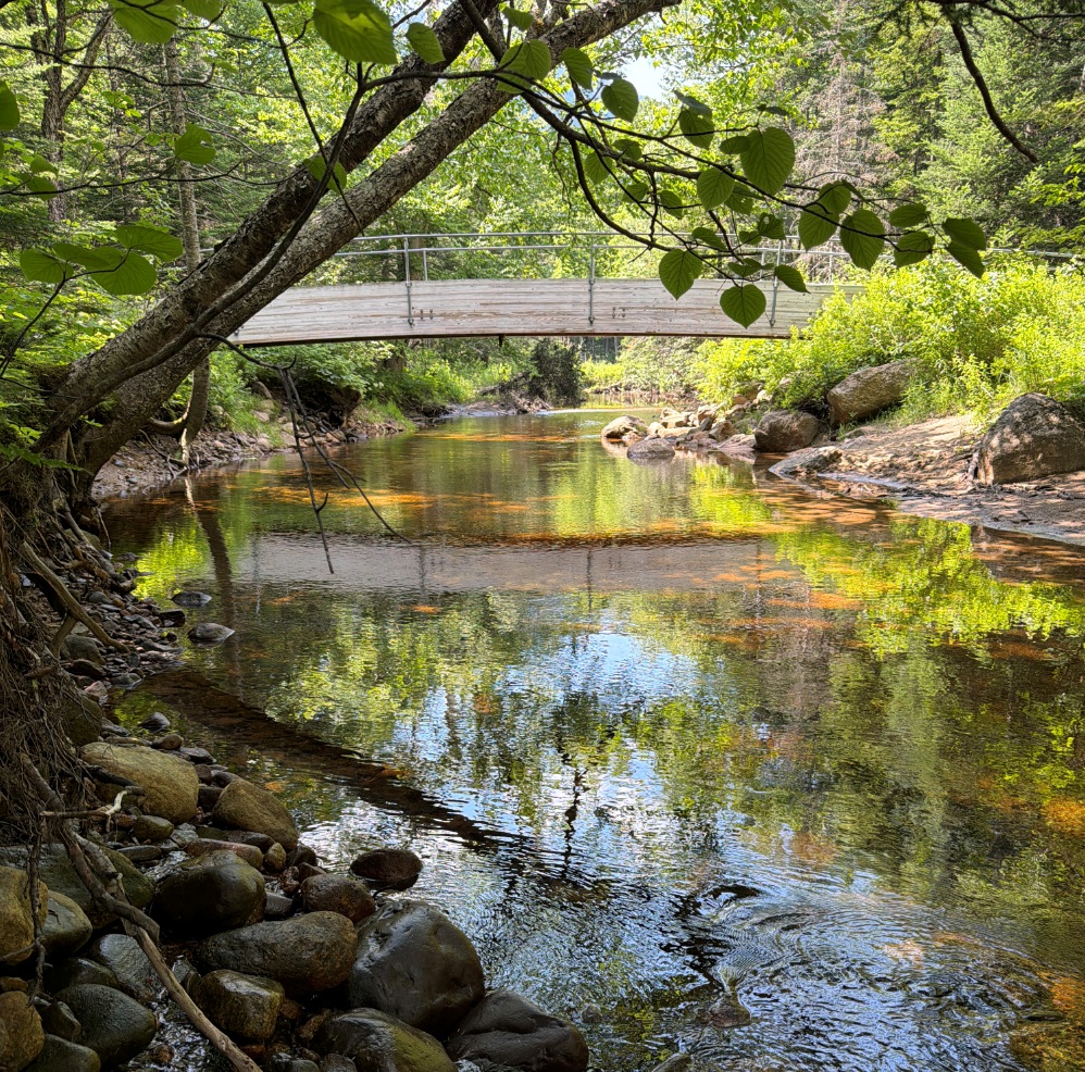
11:38 Down the bank again to the main river – West Branch Peabody River. The bridge is standing strong with two signs attached on both ends: Bridge Closed. Seek alternative crossing or turn back. I didn’t see anyone turning back. If for some reason you do not want to cross over the bridge, the river is crossable, but you will get a bit wet.
11:39 I am on the other side of the river. Now nothing prevents me from reaching the car in a few hours.
11:43 On the other side of the river the Great Gulf Trail and AT are splitting. AT continues endlessly on a typical forest trail crossing brooks and springs, winding blindly – you no longer see or register your progress – there are tall trees all over. And you endlessly anticipating getting somewhere, but the rail keeps going up and up from 2300′ to just about 2900′. This is exhausting, but it also feels necessary to be able to get from wild heights of Presidential Range back to civilization.
12:53 I’ve reached the inconspicuous peak – and finally and inevitably the trail begins to go down.
12:57 trial branches out towards Low’s Bald Spot – some local tourist attraction for Auto Route 0.2 mi hikers.
13:01 – hiked 6.3 / 2.1 remains – elev. 2746. I am making a ritual stop “on the hour” to track my progress. I am practically (0.1) on the private auto road leading to the top of Mount Washington and I can hear the passing cars. My hiking speed is beginning to grow – it is 1.4 mph for the last 2 mi. Total number of hikers met – 22 so far today.
The last dash to the was even faster – 1.8mph. After crossing the auto road (mile maker 2 with a small parking lot) there are plenty of trail deviations on both sides, but the main trail is almost as good as a road, and it is called – Old Jackson Road. Progress is great, and only once I would check GPS on where to turn.
14:07 hiked 8.19 mi 0 elev. 2037′ – I arrived at Pinkham Notch, and car is waiting for me in the main parking lot. Everything is perfect. I drank a bottle of coconut water from a foam cooler.
 |
 |
| A tiny climb in the early morning and then multi-hour descent into the valley. Overall, a good day hike from 6AM to 2 PM. | I am picking up the bike near Webster Cliff Trailhead. I can’t miss this opportunity to take a dip into Saco River that is especially gorgeous here. AT footbridge crosses the river. |
14:15 – ODO 199.0 +24°C – depart from Pinkham Notch.
14:55 – ODO 227.9 +27.5°C – I arrive at Webster Cliff Trailhead to pick up a bike 15:16 – 15:29. . .and take a swim in Saco River
15:47 load the bike on a new bike rack and depart home with ETA 18.34. there is enough gas for the next 161 mi.
17:50 visit a Gulf gas station in Manchester, NH – $67.66.
18:56 ODO 406.6 +26°C – arrive home in a usual weekday traffic.
Navigate through the List
- 01 2026-06 Preparation for a third trip (2026/06/02)
- 02 2026-06-03 WE - Private Mile Notch Rd. to Grafton Loop Trail (2026/06/03)
- 03 2026-06-04 TH - from Old Speck MTN over AT to Mahoosuc mile (2026/06/04)
- 04 2026-06-05 FR - local shortcut to Bull Branch and alternative roots (2026/06/05)
- 05 2026 06 Lessons for all three May-June trips (2026/06/06)
- 01 2026-06 Preparations for the fourth trip (2026/06/26)
- 02 2026-06-27 SA bike fast without rucksack, hike slow without gusto (2026/06/27)
- 03 2026-06-28 SU Fourteen miles in fourteen hours over Mount Washington (2026/06/28)
- 04 2026-06-29 MO - up to Mount Madison and down to the car (2026/06/29)
- 05 2026-06 Epilog - bite the bullet and do it (2026/06/30)
Be the first to comment