07:11 -wake up and plan the folding sequence of wet tarps. I need to fold everything so that all dry stuff will remain dry and all wet covers will loose as much water and possible.
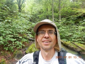
No breakfast, as usual. Just stand up and go.
 |
 |
 |
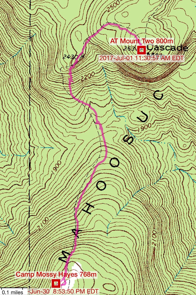
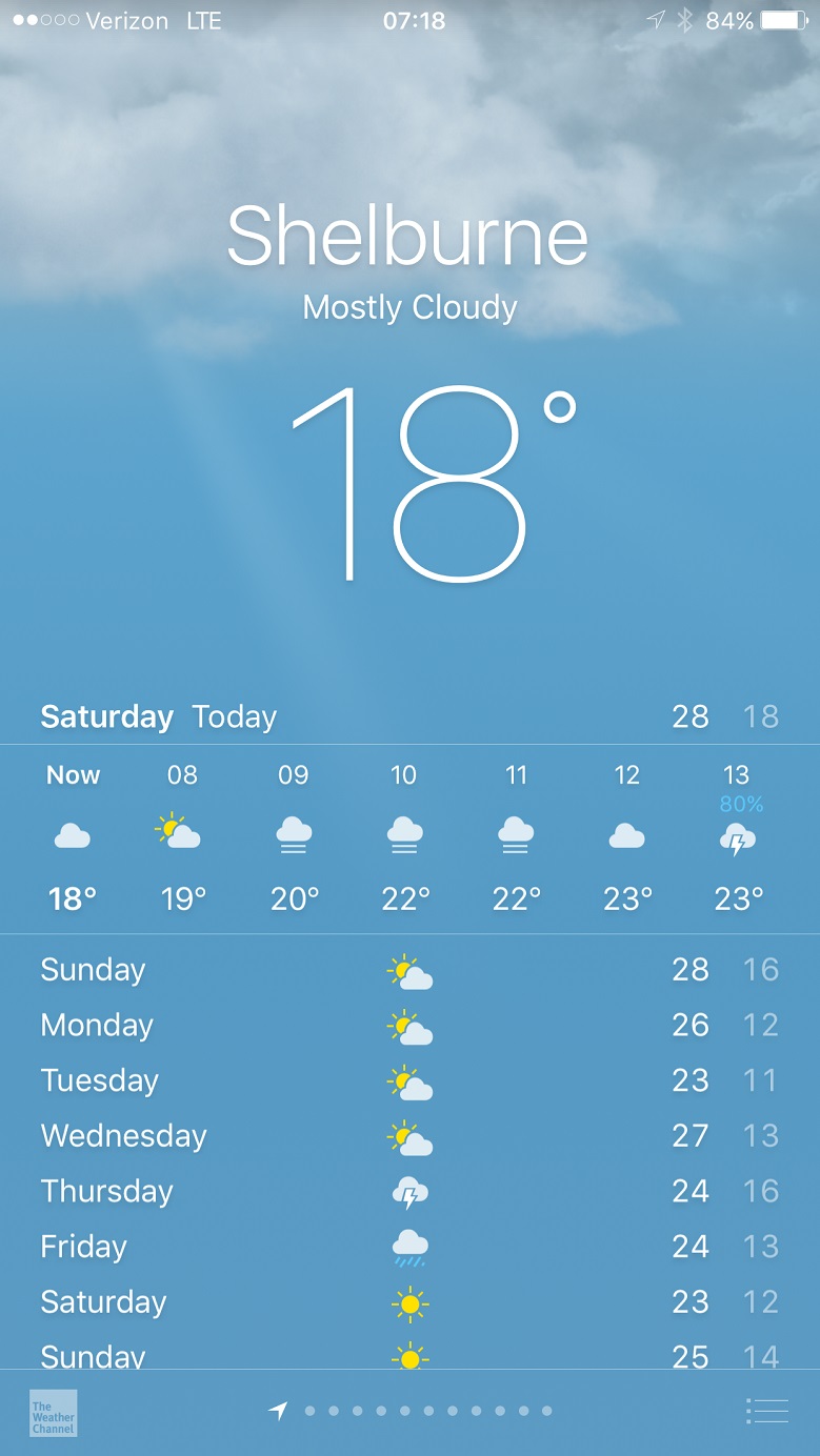
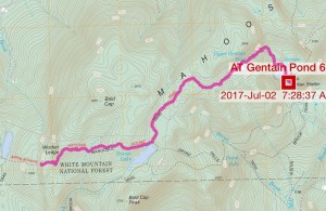
| Map of the first 2 miles of the hike. Everything will be still wet from the rain | There is a cell signal, so weather forecast tells me that rain will come after 12 PM. | I need to go down before I can climb up. This is one of many climbs today. |
 |
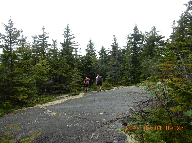 |
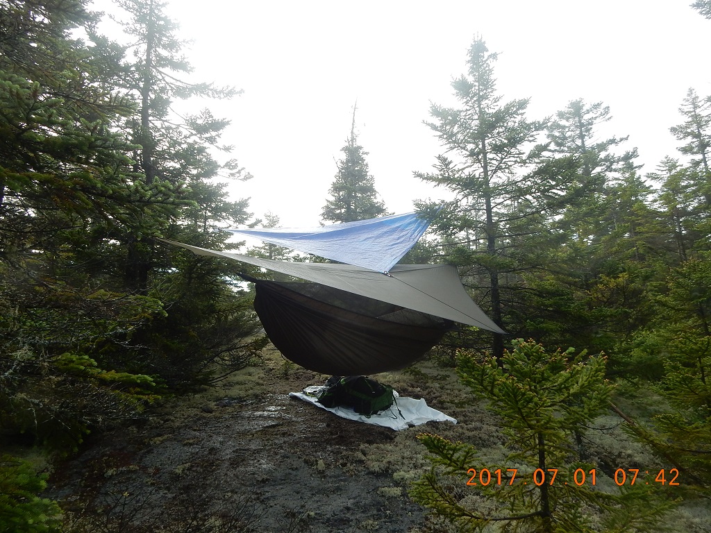
| 07:41 – hammock tarp and extra tarp helped each other to keep me dry all night. At the end, this configuration worked. Good thing I had random strings and spare shoelaces to attach the tarp to branches. | 09:23 – start second day hike. Amazingly, my feet are still dry. The very first thing I see are two business or academia-style hikers, just climb up and continue to talk about work (“what a good team they had”), and pay very little attention to their surroundings. They pick up from the ground a bright red bandanna – someone dropped it. It is all wet and dirty and even a bit torn. |
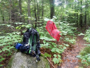
09:31 – 09:38 I walked a little bit and decided to turn back (without backpack) to collect the above-mentioned wet bandanna. The whole operation took 7 minutes. Yes. It is a little dirty and completely wet, but any cloth on the trail is almost always better than paper napkins.
~10 AM I see some trickling water spring. It is time for a water filter and refill. There are several challenges:
– for some reason I did not take my backpack off;
– I can barely keep my balance on a few rocks in a sea of mud and dirt;
– bugs are attacking vehemently face and wrists.
 |
 |
 |
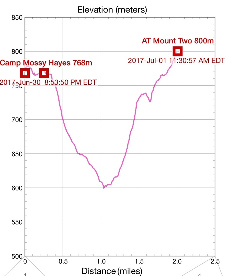
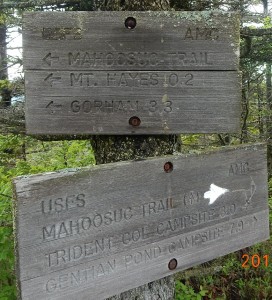
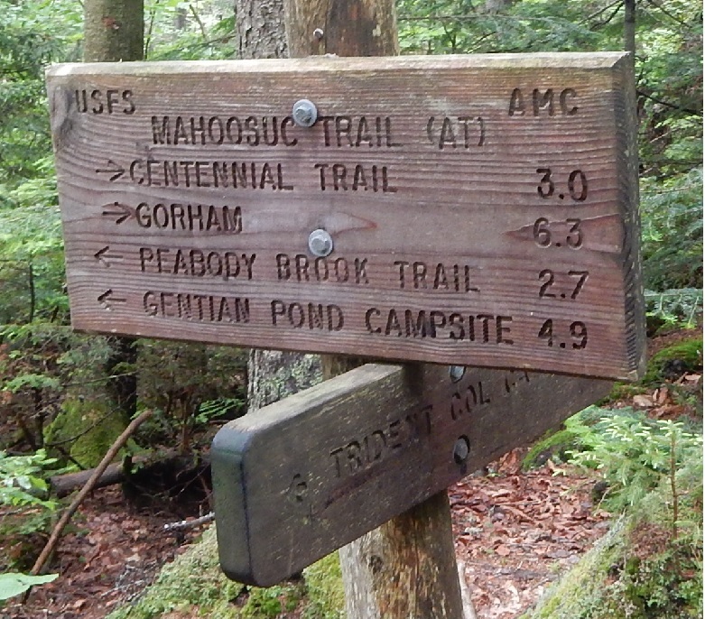
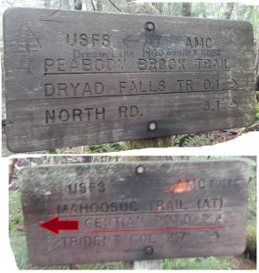
| I did not pay any attention to the sign that said 7.9 to Gentain Pond shelter. Only 7.9 miles! | For the first mile trail goes swiftly down. Backpack is almost not a factor. I took significant measures to reduce the weight, and now it doesn’t bother me anymore. | Drying up red bandanna 10:23 – I reached the bottom of the first ravine today – elevation drops from 768 m to about 600 m. Now trail turns upwards. |
 |
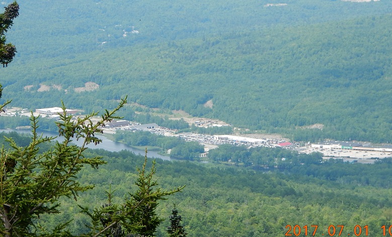 |
| 10:58 I did not pack a heavy camera stand with me. Instead, I had to use natural folds of the landscape to position the camera and shoot. | 10:55 – trail escapes clutches on the forest, and now I see views into the valley behind me. There is an industrial landscape behind me where Berlin and Success Pond Road should be. But what is river doing there? |
11:35 – entry at the notebook on the second mount – Cascade Mountain (800 m = 2631′) – Two miles in 2 hours are behind me. There is a cell signal – I can broadcast my location. I eat trail mix and drink pretty good filtered water. Weather will turn rainy after 1 PM and all the way to 10 PM.
 |
 |
| 11:23 – 12:21 Very exiting! – I am at Cascade Mt. – elevation 800 m. First rest stop, food break, vent up boots and socks. | It is dark, cloudy and rain is about to set in for several hours. But no matter, full steam ahead! |
People I’ve met today so far: two business-like men talking about “We had a great team”, one old silent type and one guy from New Zealand, who taught me a hello word – Kia ora [ki:ora].
Another leg down begins. In preparation for the approaching rain, I put on my yellow poncho, but rain hesitates, and it is too hot to walk in it. Poncho goes off. Somewhere here 2 hikers caught up with me. I am following their steps now. The guy a little bit worried that they are on a wrong trail, but I assure them that
(01) there are no other trail here and
(02) my GPS show we are firmly on AT.
On the other hand, it is true – there were no white rectangular blazes anywhere on this section of the trail. It feels like any trail USA.
 |
 |
| 13:13 together with a young hiking couple we reach the Trident Pass Campsite. I did not go to look at camp site. Sign shows the distance to Gentain Pond Shelter as 4.9 miles. | I am not even considering to go that far today. I am thinking another couple of miles and I am done for today. Young couple planning to reach the NH/ME border today. Amazing. |
I started to notice that I am much faster going down, but they are much faster on the flat terrain and going up.
They drop to have lunch at the next opening, right after seeing clear white double blaze on the tree. And I continue down. The trail is still down at this point.
 |
 |
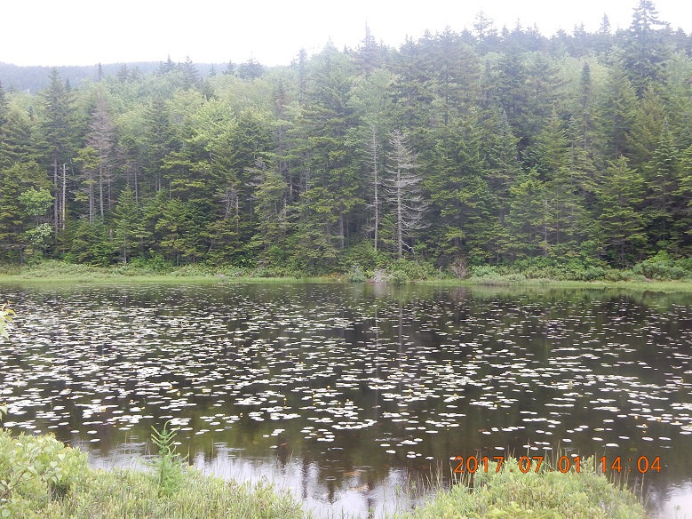
| 14:00 Page Pond. According to my paper plan in Excel this pond should have been my first camp for Friday. But it is 2 PM on Saturday and am just reaching the pond now. | Frogs are singing their songs, and for that I switch camera to video mode (the only time on the trip) and records a 2-minute video of the pond. Rain continues to develop, but it is still just a pleasant cooling down effect and nothing else. |
In a few minutes, young hikers caught up with me again, and I am ready to follow. It is a long climb now, and they quickly disappear from the view. Forever.
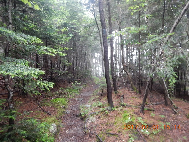
~15:00 Water level on the trail is high and some wooden planks floating instead of supporting your feet. I stepped on one of these floating wooden bridges (puncheons) suddenly submerges under my foot, and “my feet are wet” section of the trip begins. From that moment on my boots will stay wet for several days. Without fire, there is not enough hours in the night for boots to dry up.
 |
 |
| 15:15 I reached another junction. This is a trail and another beautiful pond. I learned later that it is called Dream Lake. Sign to Gentain Pond Campsite shows 2.2 miles, and now it is firmly within reach. | Dream Lake is another missed opportunity for a side trip. But under impending rain and slippery trail – it seems like a right decision even now. |
15:54 a strong powerful downpour finally starts. There is no escaping it. And because it was delayed for several hours – it comes as a surprise. Walking with poncho and rain-cover for backpack is not a problem at all, but how would you setup a camp in this rain? I remember seeing on one of the old topo maps word “Shelter” next to Gentain, but all sign here at the trail mention only Gentain Campsite. I wish there is a shelter here somewhere.
16:20 – one more pond, but this is not my pond. Trail ignores the pond and continues around the pond. Later, under a much dryer conditions, I can see that this was a small Upper Gentain Pond.
 |
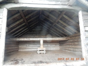 |
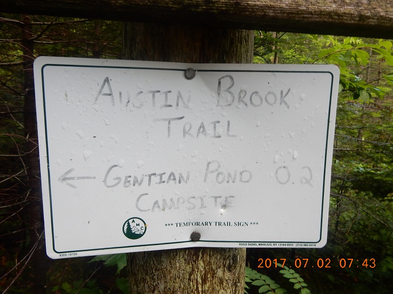
| 17:02 I am at the merge of AT with a local trail – Austin Brook Trail. And a very little nonstandard sign points to a campsite 0.2 mile away. | 17:08 – it is a shelter! Large elevated hut with 3 walls and solid roof. And there are only 4 people here, and it can comfortably accommodate 8 hikers and more if needed. I am in! This is the most exciting moment of the whole trip. It is a quick jump from quiet desperation to an unbridled enthusiasm. Now there is no doubt in my mind that I will make it. |
 |
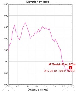 |
| 14:26 – 17:07 – segment of the track after Page pond to Gentain Pond Shelter | 14:26 – 17:07 – only now I can see that last portion of the hike (under a heavy rain) was all down. I did not notice that when I was hiking. |
17:27 – first picture at the shelter. I am safe, dry and happy. This is a very unusual 2-level shelter and I’ve got an upper bank along with the other couple. Rain storms rages outside, but it is peaceful and somber inside. Waterfall (Austin Brook) right from the pond reminds of powerful forces of nature nearby. Someone offered to venture out for water and fill everybody’s bottles. Nice!
I wonder what happened with a couple I was following earlier. They probably were in too much hurry and got stuck in the middle of nowhere somewhere.
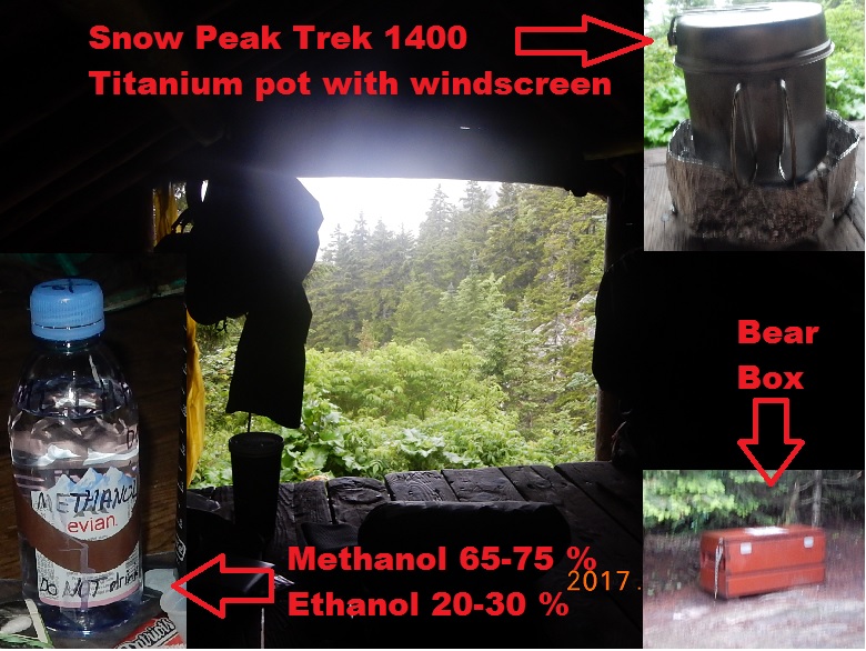
18:00 I am cooking my food on Vargo Decagon stove – very convenient and no mess. Stove can be placed right on the wooden floor of the hut. Everything is fast and efficient. Now I am getting the benefits of spending at REI earlier. And things begin to find their optimal places in the backpack – very nice!
Food at the shelter: vegetarian AlpineAire Foods Santa Fe Black Beans & Rice (640 calories) – tasteless – do not recommend. May be try adding some salt?
18:36 – entry in the notebook – I am dry at the shelter! And I eat at the shelter – hurrah!
People at the shelter: a girl from Germany, a couple and a lonely hiker. Everybody very interesting and with a story to tell.
19:49 There is even an outhouse that encourage peeing in the woods. It is only for number 2. And bag of crushes bark to facilitate the compost.
19:58 rain is almost over. It came late and going away early. I have dry clothes on, my devices are charging from RAVPower 16750mAh USB battery. TYVEK now goes on the hut floor before the sleeping mat and the sleeping bag. All things are working nicely together.
It is darker in the hut. I used my headlamp earlier to spread my things on the floor, but now it disappeared and I am using USB battery as a backup flashlight to search for missing headlight. I finally figured out how to to activate flashlight – press the button – the only button – twice. My neighbors also lent me their light for a moment. Thank you!
20:20 my headlamp was right here near me with all the other stuff that I prepared for the evening.
 |
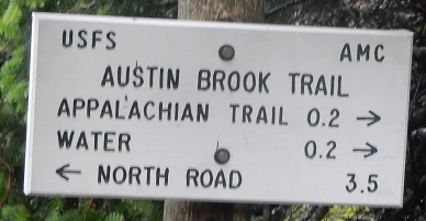 |
| Shelter is only a small part of the complex here. There is no caretaker, but there is a bear box, several tent sites, designated water access path to get pond water, well-hidden and profoundly-smelly toilet, and even tent overflow area for busy times. | This sign is visible directly from the shelter: it is 3.3 miles from North Road that goes parallel to Androscoggin River and to AT here. It is the same road where I started at 3 PM on Friday. I can’t believe it was only yesterday. I am in a different world, but there is a cell signal here! |
20:31 – official sunset. Rain is stopping. I am the last one to enjoy the quite evening. Everybody else already in virtual bed.
End of day notes:
Red Bandanna — picked up a red wet and dirty cloth that might be a bandanna;
When to stop? — the best time to make a stop in a hike is 5 PM – full 3 hours before the sunset. But you are not entirely to free to make stop /no go decision. Very often you forced to move down from high elevation, closer to water or to some designated spots.
Elevation Profile — elevation profile 3 miles yesterday all going up today up and down today. Estimate for today – 8 miles: 2 miles before noon and 6 more miles from 12 to 17. It means 11 miles down and 20 more miles to go.
The last miles — the last miles were muddling through heavy rain and grim spirit. They were totally hopeless. I would have survived in my hammock without any shelter, but it would have been a painful experience. I appreciate the nice gift of a shelter at the end of the day today.
The main difficulty and the main attraction is seeming endlessness of it all. Where else you can go for several days straight and do not cross any roads or encounter any cars?
Trail conditions — trail conditions – very wet and slippery. Mud, exposed rock, water covering entire trail – that is what I saw. But there were not a single tree blocking the path. Someone thoughtfully removed all mechanical obstacles from the way.
Plans for tomorrow – I will reach border with ME.
Birds are still singing. Water is still rumbling from the waterfall. I have dry wool socks with flip flops on and long pants. Pants mostly from mosquitoes, but how are we going to slip with one wall missing? What would stop bugs from discovering out breathing bodies?
View from the shelter – Fog beginning to roll up from lower elevation, but not quite reaching us here at the hut. Even in the dusk the view is grabbing your attention.
Summary of two days – hardest rainy part of the trip is over. Expect sunny and cloudy days ahead. Fantastic.
Number of people on the trail: today I’ve met total of 12 people plus 4 people in shelter.
20:36 – last entry on the notebook
Navigate through the List
- 2017/06/30 Friday - Who covers license plate with a Panama Hat? (2025/08/15)
- 2017/07/01 Saturday - Gift of shelter at the end (2025/08/19)
- 2017/07/02 Sunday - One of them now (2025/08/23)
- 2017/07/03 Monday - Endless Mahoosuc day with 7 miles (2025/08/27)
- 2017-07-04 Tuesday - From hike to bike, to car, to home (2025/09/01)
- Preparations for July 2017 trip to Appalachian Trail (AT) (2026/05/11)
Be the first to comment