
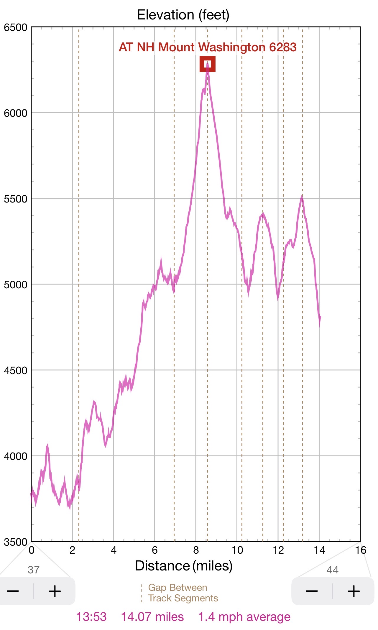
Summary: 14H and 14 miles from Mount Webster over Mount Washington and presidential Range to Madison hut
04:51 wake up alone in the forest near Mount Webster. The night was OK. Near full moon and stars in the sky. It was a quiet night with no wind. The stop for hammock was perfect. Only one wake in the night at 23:46. Morning is clear and cold, but nothing extreme. I am putting my slightly dampen equipment together and . . .
05:55 start the hike when the sun is already out.
06:43 – hiked 0.85 mi / 21.3 remains – elev. 4052′. I am on top of Mount Jackson. There is no sign. There are two hikers with a dog cooking breakfast. A first view of Mount Washington Hotel in the valley. Also, you could see the Mizpah Hut where I will go next. The hut is 1.7 mi away. The weather is warming up, and I am ready to start losing some layers. Also there is a first sighting of Mount Washington where I will be in 7 hours.
07:12 Alpine Bog – that is a flat area between the peaks where water creates a soft surface that requires a series of puncheons not to step on the wet weak surface.
07:31 So far, I only met 4 hikers in 2 groups. Apparently, all the foot traffic is ahead after the hut. There is no immediate appetite, I am taking off black jacket. My thoughts about last day with OTIS. Is it?
08:07 hiked 2.31 mi (6.1 mi total) / 19.8 mi remains – elev. 3803. I am entering Mizpah Hut. Here there is a lot of movement, energy and excitement just after the served breakfast. People are chatting, gathering things, asking questions, kids are playing games. I just need a table by the window to mix cold water with my Grape Nuts, dried fruits and nuts and have my power breakfast after completing 2.31 mi of ups and downs.
08:41 I refill water and ready to continue after breakfast. After the hut trail begins to gain elevation consistently from 3800′ to over 5000′.
 |
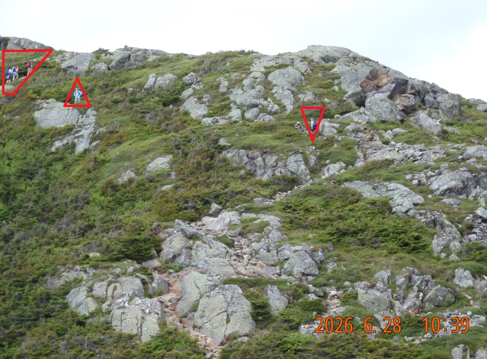 |
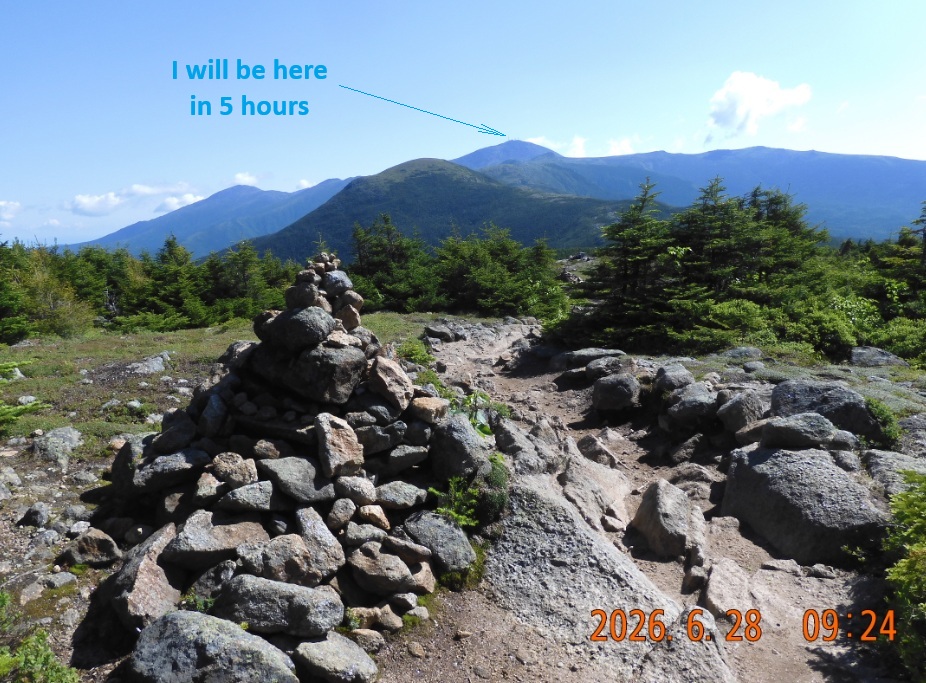
| View from Mount Monroe. B 9AM I am on already the trail for 3H. Five more hours to Mount Washington and endless more the hut. But we are doing it. | Mount Eisenhower bypass loop: some decide to climb every mount, but I am using a bypass every time it is available. |
09:24 elev. 4310 – I think I’ve reached Mount Pierce or somewhere nearby.
Unpreventably, the trees are getting shorter and are replaced by bushes and grasses. The wide views are opening and that makes this section of the AT so popular with hikers. The markings on the trees (trail blazes) are now replaced by cairns – a cone of stones along the root.
10:12 hiked 4.36 (8.2 mi total) / remains 17.7 mi – elev. 4414′. Mount Eisenhower bypass loop. AT goes around the Presidential peaks, but normally there is a loop or extension trail allowing connoisseurs to go over the top. Now you can see the target mount ahead and the peaks that you visited hours ago.
11:01 hiked 5.07 mi (total 9.1) – elev. 4657. All trees are gone. I am putting on black jacket again. Every few minutes encountering hikers now. Several hikers are bypassing me with ease, and I realize how slow I am moving forward.
11:35 hiked 9.9 mi / remains 15.9 mi – elev. 4982. Only 1 mi to the hut and 2.5 mi to Mount Washington. The clouds are accumulating and the top of Mount Washington is no longer visible.
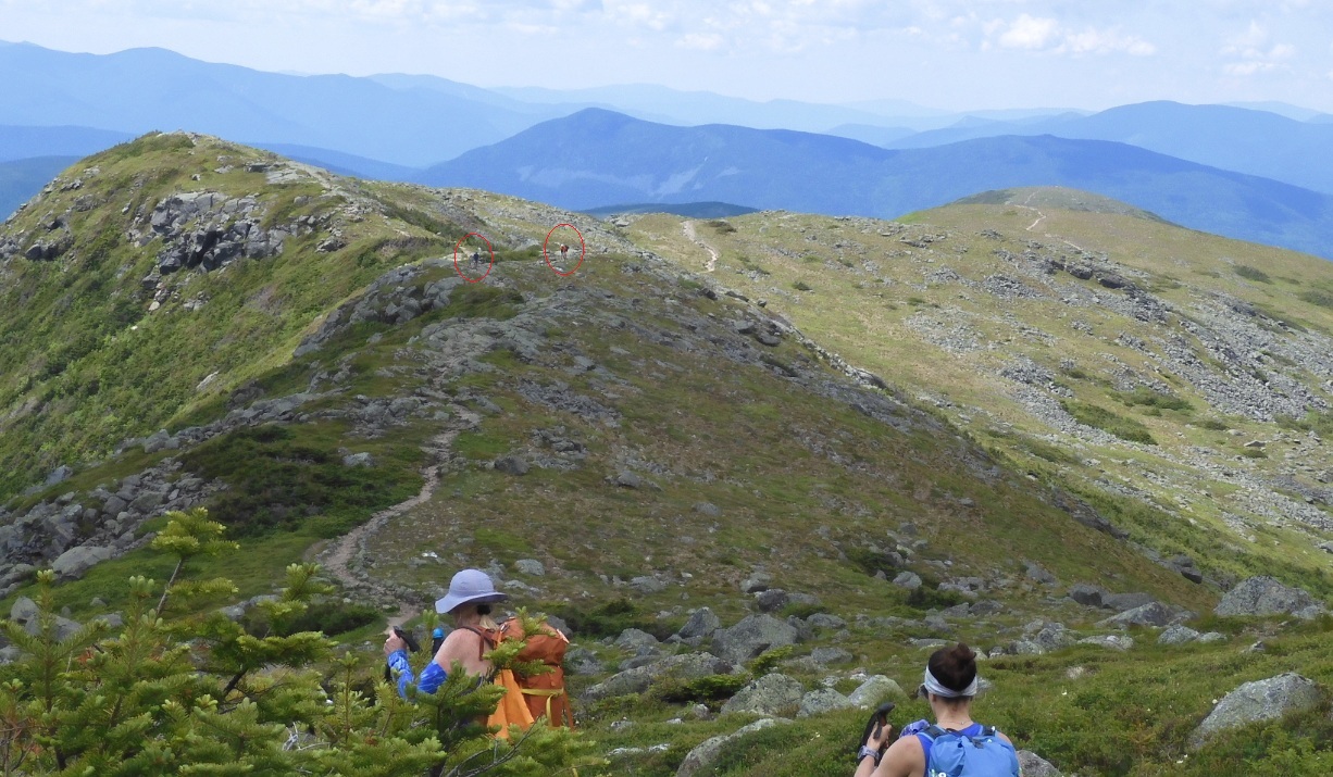
11:50 Mount Monroe loop, elevation is over 5000′. The snake of the trail is visible and is mostly visible in both directions for many miles. And clear weather is cooperating.
12:17 -12:41 I hiked 6.95 in 6H today (total 10.9 mi) / 14.9 mi remains – elev. 5031′. I am at Lakes of the Clouds Hut. There are plenty of people relaxing and ordering food. I am eating my orange. I realize that there are no garbage bins – I would need to spread my orange peels along the trail. I refill my water and I am eager to continue the hike as I need to go 7.1 mi more today to reach Madison hut. Next stop will be Mount Washington 1.5 mi up the slope. The lakes surrounding the hut are very tranquil and relaxing. Many hikers are sitting and relaxing on the banks.
How was the final climb? – Tough. Slow and long. Crowded. Windy. But all the people dressed relatively light. There are plenty of trail runners that jump up and down the boulders with no visible effort.
 |
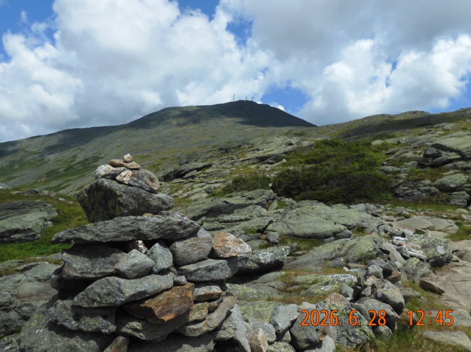 |
| The weather is superb. It is a rare treat here. You can see the snake of a trail that you just completed. Notice two more hikers at a distance. | From Lakes of the Clouds hut – two more hours to the top of Mount Washington. This is the most crowded section but you still feel alone against the nature |
13:56 I’ve reached the 0.2 mi extension trail to the top of Mount Washington. AT itself doesn’t go to the top. For today there are 5.8 mi remains to the Madisin hut.
14:00 I am dropping my sticks and backpack here And I will climb to the top having just the phone and camera.
14:09 I am at the top of Mount Washington. To the end of the trial – Mt. Katahdin are 333 mi.
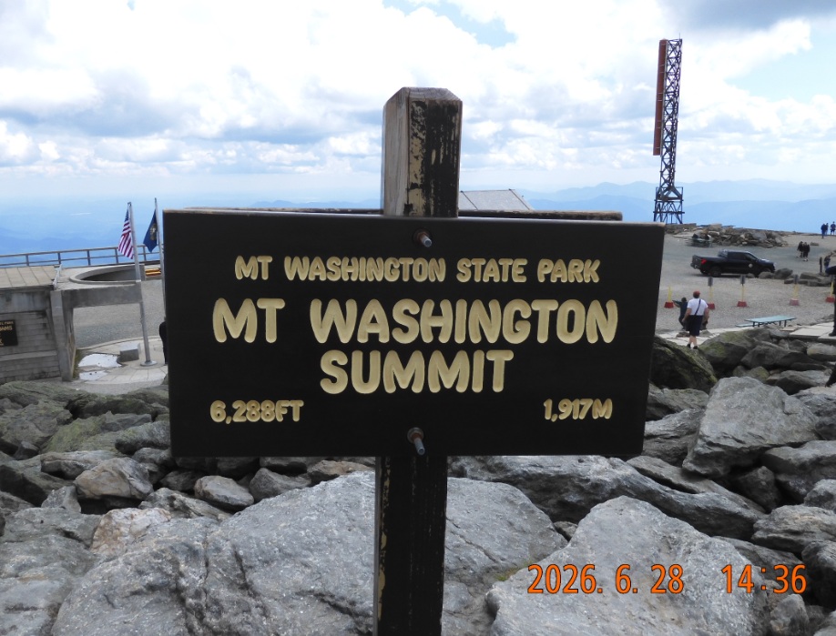
14:36 – elev. 6288′ or 1917 m. Lira discovered that there is a webcam here, and she can see me on the observation deck on the Internet. There is weak spotty signal so I can do my Duolingo.
14:51 I just crossed the cog railroad, and I am taking the stock of the situation. There is intriguing temptation to drop the current plans and take a shortcut via Great Gulf Trail that can bring me to route 16 in just 7.5 mi. But no. I will keep going on AT. I simply need to put all my energy together and keep walking from boulder to boulder for another 6 mi to the hut. I put on an extra layer of socks to protect my feet. Ok. I have 6.5 hours till sunset at 20:33. But do they have a bunk for me at the hut?
The views around me remain spectacular in all directions, but the focus of the hike prevents me from fully enjoying them. I am fully focused on moving forward. I am counting the hiker throughout the day and here I met hiker number 200 for the day.
15:24 – 9.56 mi done today, 4.7 mi to go. I am bypassing Mount Clay who was not a president (US Congressmen). I am taking a quick break right on the stones. This can be considered as near the midpoint spot of the trip as I’ve completed 13.4 mi and 12.4 mi remains to the car. The weather is great and warm. Again, I took off the black jacket and wore only the shirt.
15:43 – a sign shows 4.6 mi to the hut
16:01 -16:07 – 10.26 /4 – elev.5162. Now I will try to track my progress every hour. With 4 more miles to go I need to go over two more mounts.
16:20 – a sign shows 3.7 mi to the hut.
16:27 – I guess do not believe all the signs. At the Sphinx Tr. Junction the sign shows 3.8 (more than before) miles to the hut. There is still opportunity to cut the journey short here, but I am no longer tempted by it.
16:58 Mount Jefferson bypass loop. 3.2 mi to the hut.
17:01 11.28 / 2.9- elev. 5385. Next rest stop under the shade on Mount Jefferson. I am tired but there is still energy left to continue. As evening sets in, there are less people on the trail. All day-hikers are gone now. There are 3.5H more hours of daytime remaining.
17:45 – a sign shows 2.2 mi to the hut. Views are spectacular all around me.
 |
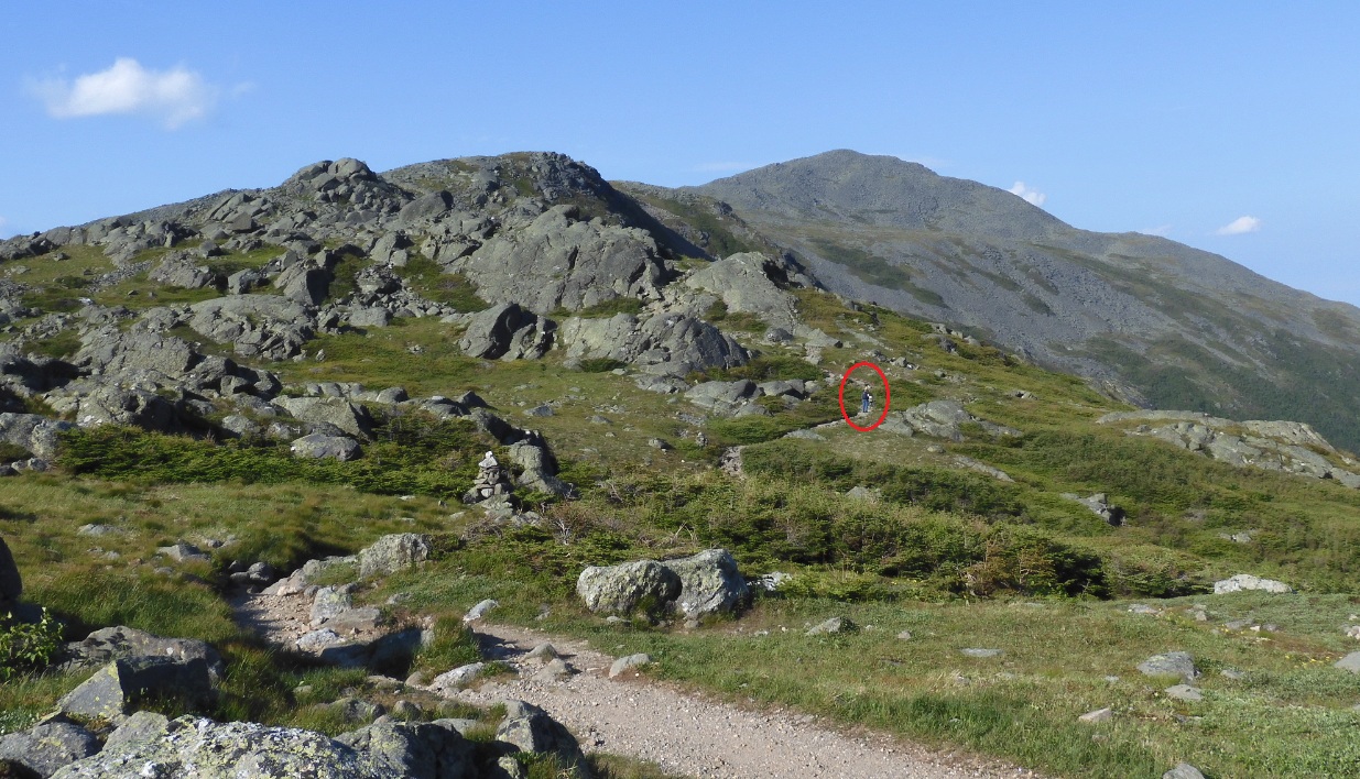 |
| After 8.5 hours of hiking I am at the top of Mount Washington. It is Sunday afternoon, so it is crowded with people arriving on Cog Railway, on their own car, on the passenger van and not the least – the day hikers. | By 5PM I am still far away from the hut and all the people have disappeared on side trails to their comfy lodges and dinners. So the sight of a lonely hikes ahed is a welcome sign. I will catch up with him in 90 minutes. |
18:01 – 18:07 – 12.27 / 1.9 mi remains – elev. 5107. My speed remains only 1 mph despite my focused efforts to go faster. In front of me there is about 1 mi climb up and 1 mi going down to the hut. I am tired and I need to use extra caution stepping on all these assorted stones and boulders. Plus there is a strong monotonous wind that what you to hide from it, but you can’t, you must go despite the wind. Way in from\n of me, there is slow seemingly disoriented man dressed in different shaded of blue, ever his backpack is blue. He wears dark glasses and he is advancing very slowly. But I can’t overtake him. He is like a mysterious man they called “Chicken John” form “A Walk in the Woods” book.
Finally, I did bypass the man. Yes. He is real, he is really tired, but he wouldn’t show it. He looks like Jack Nicholson. He lays on the sun with his dark glasses being the most prominent feature. “See you at the hut” – I say. “See you at the hut” – he replies. I would never see him again.
 |
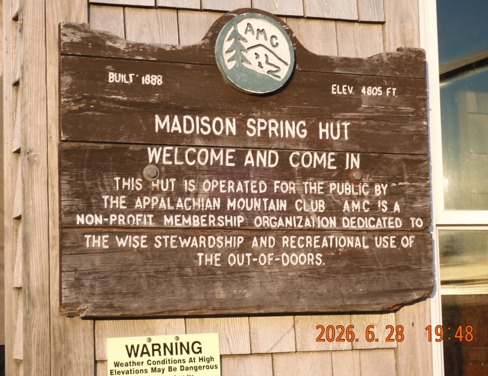 |
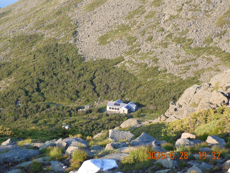
| it is 7:30 PM and I am so close. Now I can the the hut – my goal for today far below in the ravine. It would take me only 15 min to get there. | Sun is still shining brightly when I enter the hut. As if they are waiting for me – they offer me “work for stay” deal. Boy, I am happy! |
19:03 – 13.09 / 0.9 mi remains – elev. 5487′. This last climb was the most difficult and seemed endless. The trail goes up in such a way that you can predict where it will take you. Slowly you realize that the path will lead you between Mount Adams and lower Mount Sam Adams. I am putting on the black jacket again as it is getting chilly. I even remember drinking water, although focus to get to the end is overwhelming.
For the next walk down I can follow another hiker in pink shorts who looks like Fred Ebbett from TransPro – my Connecticut client from 2001.
19:30 – Airline Trail junction
19:32 Wow! I can see the hut down there between Mount Adams and Mount Madison
19:48 Ok. I am at the entrance to the hut. Today I hiked 14 miles in 14H. Elev. 4818′. There are no vacancies, but they are taking me as Stay for Work person. I would need to do some kitchen work when needed. And leftover food for dinner is also included. Universe has its ways!
 |
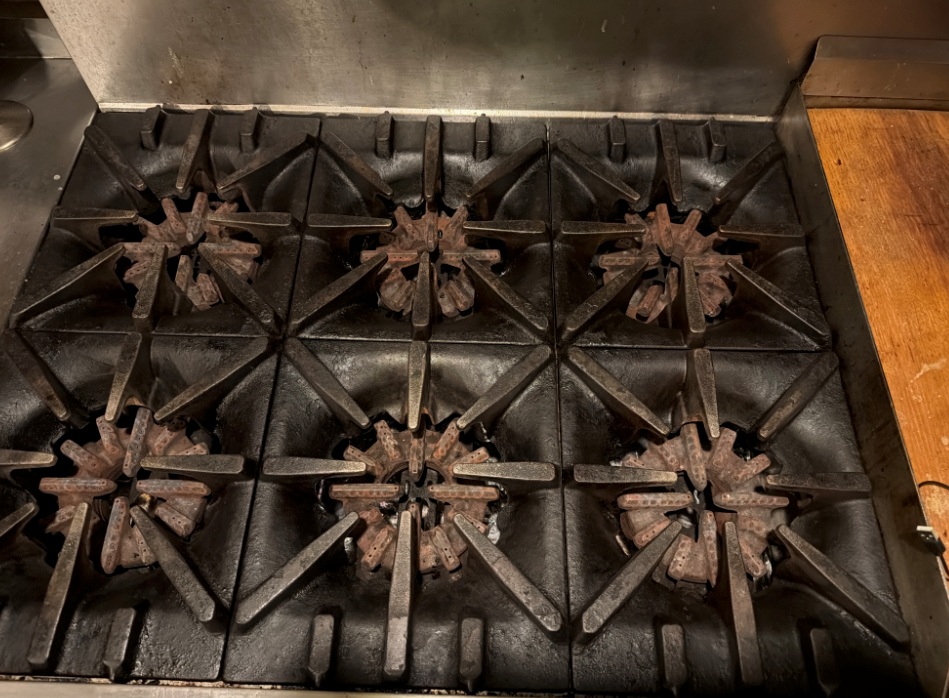 |
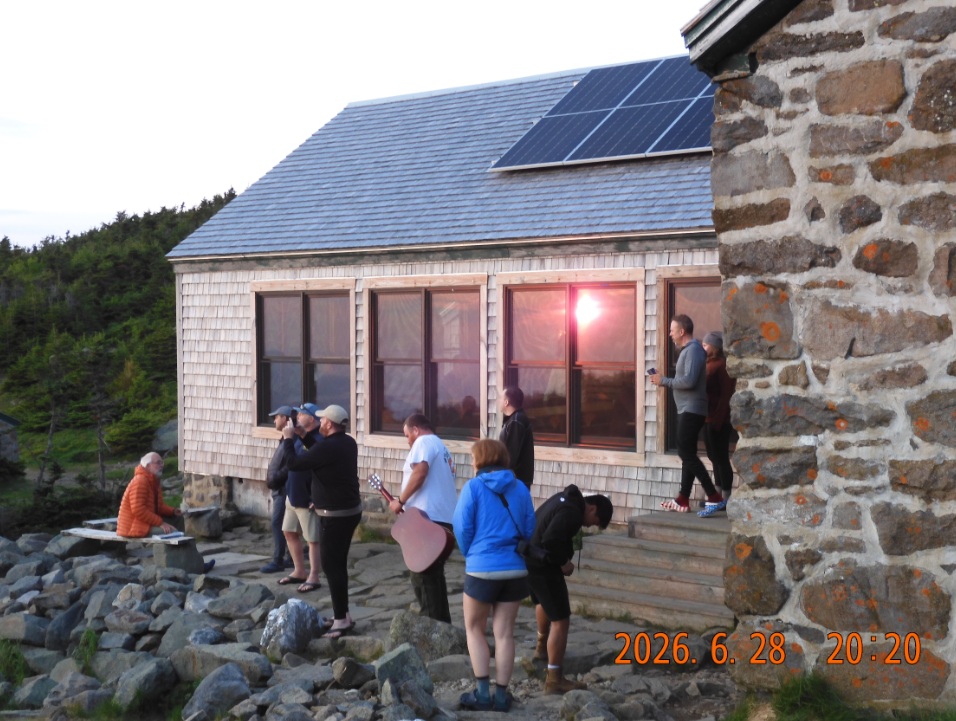
| Caching the last sun of a endless day. From beginning to end it was a glorious day and it ends in a symphony of colors. | Task to complete – wash 6 stove tops in a warm soapy water with gloves in multiple oversized kitchen sinks. That is a piece of cake after strenuous hike. Cooked dinner with salad and main course and a drink after the deed. |
20:13 – 20:20 last pictures of the sunset and surroundings. There are plenty of people here, but my people count for the day doesn’t include them. The total number of hikers I met of the trail today was 253 – 2.5 times higher than even on nearby Kinsman Ridge on June 4 (99 hikers).
21:31 Let Lita know that I am at Madison Hut and they let me in as a Work for Stay parson. She is very surprised.
22:26 last picture of the day. In the red light, I am laying on the benches with a happy face.
|
|
 |
| Endless 14 mi day with 14H of hiking – relentless and rewarding experience | All the chores are done. The universe has connected all the dots for me. I just need to follow along the Milky Way |
22:45 Last entry in the logbook for that day. They turned off the lights in my area, but there is still some last-minute activity in the kitchen. Here at the hut there is potable water, toilet paper, electricity (there must be outlets for charging, but I didn’t see them), plenty of board games and books. I did not even ask about the price for staying here.
Navigate through the List
- 01 2026-06 Preparation for a third trip (2026/06/02)
- 02 2026-06-03 WE - Private Mile Notch Rd. to Grafton Loop Trail (2026/06/03)
- 03 2026-06-04 TH - from Old Speck MTN over AT to Mahoosuc mile (2026/06/04)
- 04 2026-06-05 FR - local shortcut to Bull Branch and alternative roots (2026/06/05)
- 05 2026 06 Lessons for all three May-June trips (2026/06/06)
- 01 2026-06 Preparations for the fourth trip (2026/06/26)
- 02 2026-06-27 SA bike fast without rucksack, hike slow without gusto (2026/06/27)
- 03 2026-06-28 SU Fourteen miles in fourteen hours over Mount Washington (2026/06/28)
- 04 2026-06-29 MO - up to Mount Madison and down to the car (2026/06/29)
- 05 2026-06 Epilog - bite the bullet and do it (2026/06/30)
Be the first to comment