04:36 AM wake up in Boston without an alarm
Everything is ready, so I only had to do these things:
– print latest weather forecast. It will be mostly warm and rain will bother me only today and tomorrow!
– what gas stations are open at 5 AM? Wow! There is one: Mobil at 1335 Main St, Waltham, MA 02453 near Bear Hill Road
– load watermelon from the fridge.
 |
 |
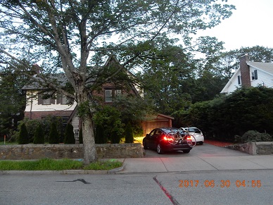
| 04:55 departure pictures with bike attached- it is almost daylight outside; 04:58 departure | 06:10 – 06:34 – 52 miles – +21°C -NH Welcome Center on I-95. Happy first steps of vacation. You already far enough from home, but everything is yet ahead. |
05:19 – 3 miles into the trip – at the gas station on Bear Hill Road in Waltham (17.104 gallons for $2.859 per gallon = $48.90) +20.5°C
While driving I am listening audio-book John Irving “Avenue of Mysteries” about a 54-years writer from Mexico
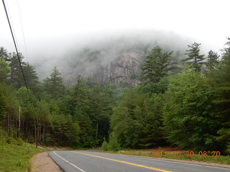 |
| 08:20 151 miles – 44.083478, -71.165153 – pictures of a formidable ledge taken directly from West Side Rd. in Bartlett, NH 03812. A sign pointing to a tiny Sartwell Ln. On Google maps this street laconically called Ledges. |
08:33 157 miles – I am passing Glen Junction without any appetite for a hearty breakfast – this is an intersection of NH 302 and route 16.
08:45 – message to Lira that I am passing Mount Washington on route 16.
08:56 177 miles – +15.5°C – Androscoggin Ranger District. Prices for parking permits have changed. There are no more weekly passes ($5), and yearly went up from $20 to $30. And they do not accept American Express – I ‘ve tried. This little sticker for your windshield covers you for one year till July 31, 2018. Ladies at the counter were very helpful trying to figure out if Success Pond Road is open for public and operational all the way to Maine route 26. Although it a simple dirt road, and it is marked as a private road on most maps. On some topo maps it is not going all the way to Maine. They think it is open all the way from Berlin, NH to Grafton Notch State Park in ME.
09:24 – 183 miles – Rattle River Trailhead on route 2 in Shelburne, NH. This is a place where AT Presidential range is finally over, and this large parking is the most recommended by guides. It means, I will not be parking here.
 |
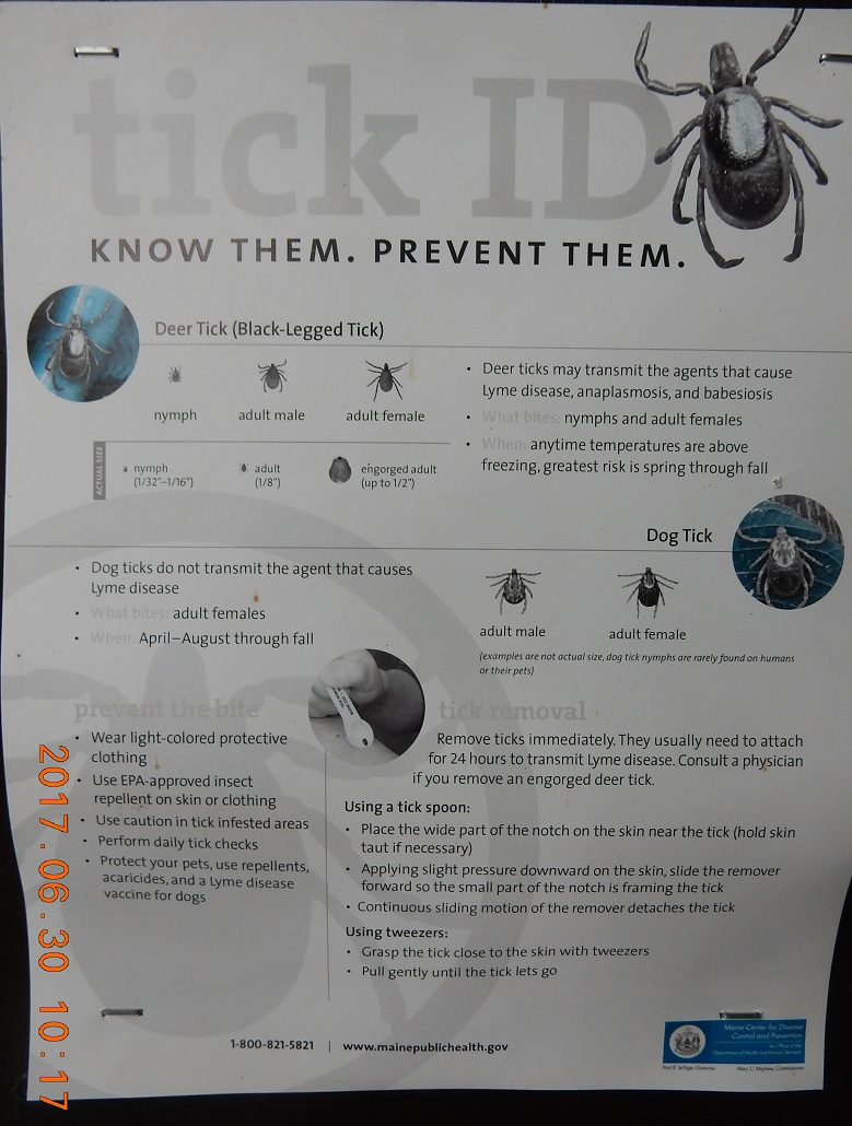 |
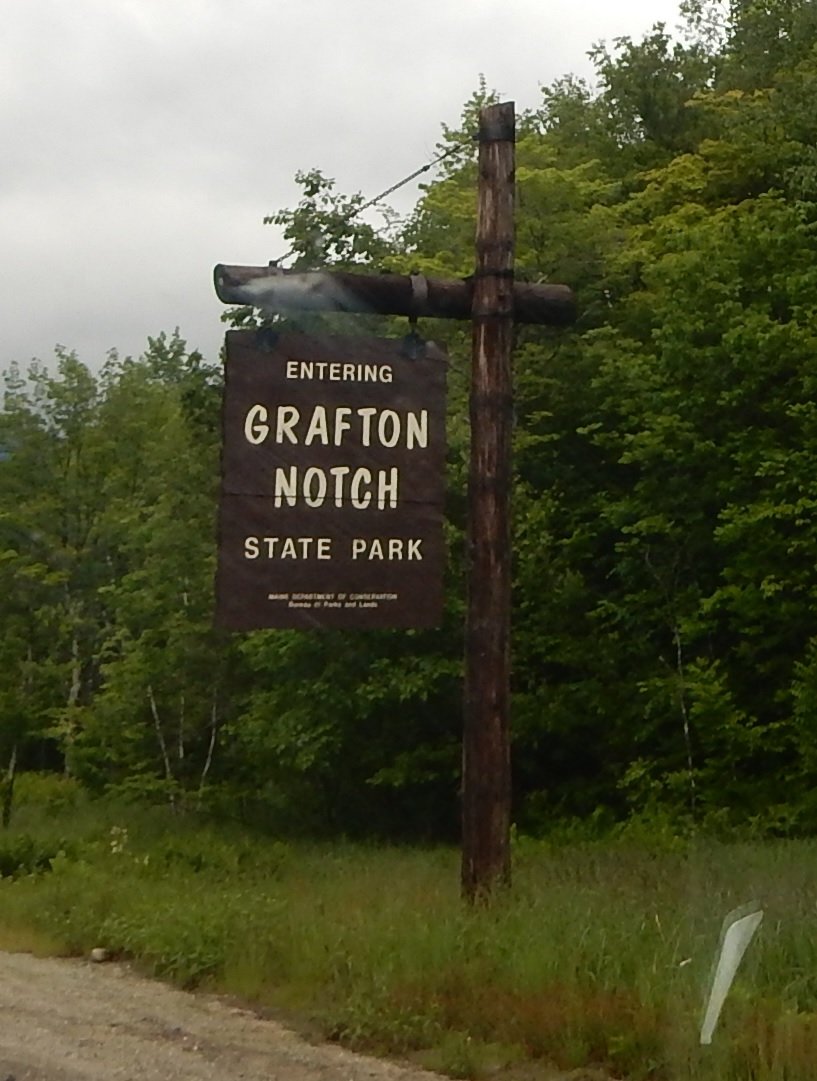
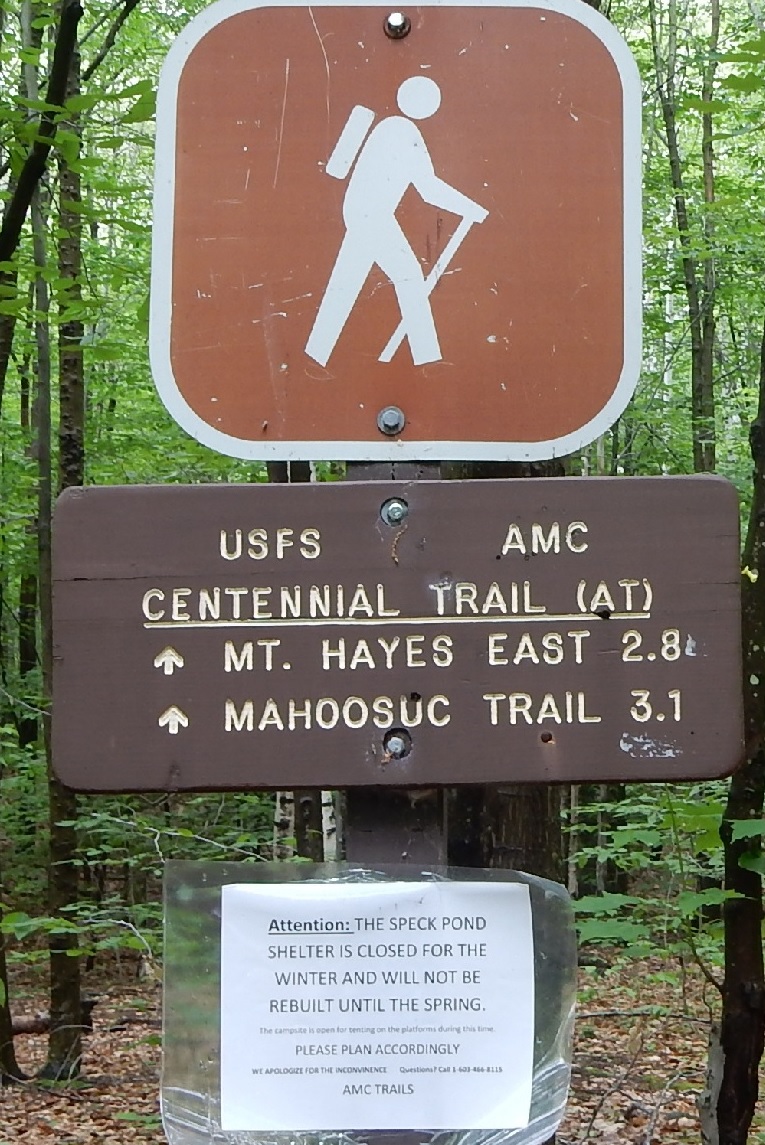
| 10:06 – mile 216.6 – +16.0°C – arrive to Appalachian Trail (AT) at Grafton Notch State Park. I noticed that distance from Rattle River Trail-head is 216.6 – 183.0 = 33.6 miles. That is an approximate distance that would have to ride bike back to the car. | There is plenty of information posted here. There is ticks warning. Volunteer Adult Park admission fee is $4 in English and French. There are some maps. There is a old sign that Speck Shelter is closed. There is no cell signal at all anywhere on the parking lot. I can’t believe it! |
 |
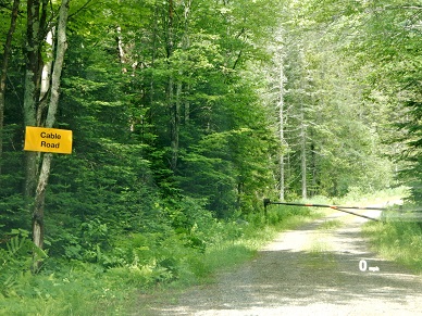 |
| 10:37 – hide bike in the woods. Bugs are brutal. To keep things dry I place saddle and frontal bag into a large plastic bag and put them in a separate location under the rocks | 10:50 – depart to search York Pond Road. Instead I found a gravel road called Cable Road. This Cable Road is closed by a gate. Here I sit with my back to the car and eat my mini-watermelon cutting it with folding knife. What a pleasure! |
11:25 – depart back to NH to the starting point of the hike.
 |
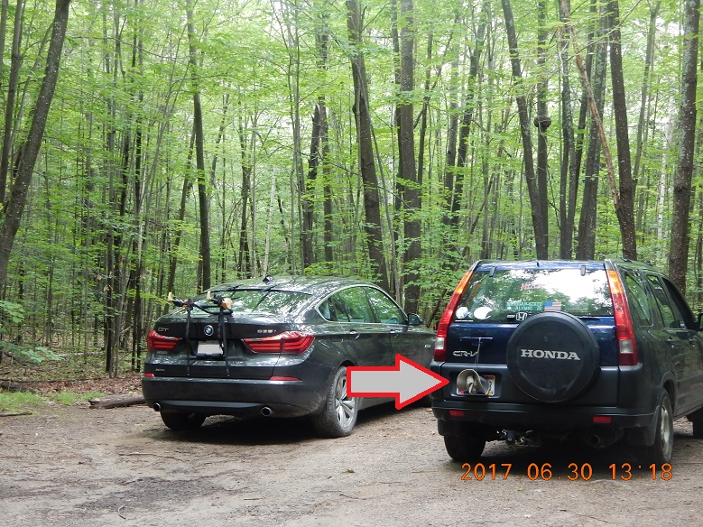 |
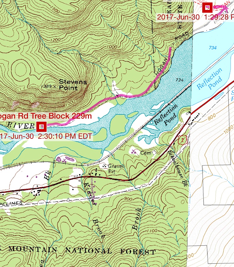
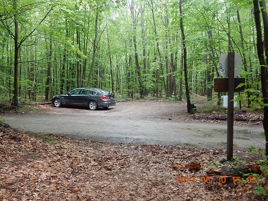
| 12:13 – odometer shows ~ 257 miles – arrive at a small parking lot on Hogan Road in Shelburne, NH. Here also there is note that Speck Pond Shelter is closed. I am the only car here. | 13:18 – first attempt to leave for a hike. I am ready to leave, but I am nervous. The car that returned – Honda CR-V – have its license plate blocked by a panama hat. Maybe they just waiting for me to leave and start doing things to my car? |
I am at a small parking lot on Hogan Road in Shelburne. There is a lonely hiker waiting for his ride. His partner went to get the car from Rattle River parking lot on route 2. His ride arrives, we talked about their hike and my plans for the next several days. They leave in a few minutes.
I continue to amend the pack, cover myself with bug spray, put on thick, decide to take only one Nalgene bottle and one soft SmartWater bottle with a convenient nozzle and flip cup. I remove several items of warm clothes – long sleeves, jacket, long underpants. Everything is painfully slow, as there is no dry surface to put thing on.
Car with hikers returns and they can’t really explain the reason for their return. The driver mumbles something about that they forget their buddy. What? I am afraid that they thought that I will be gone by now, and my presence at the parking lot is totally unexpected for them. And their license plate covered by panama hat!? (see image above)
13:23 – I depart, but with a very uneasy feeling.
 |
 |
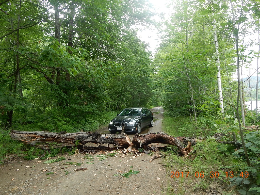 |
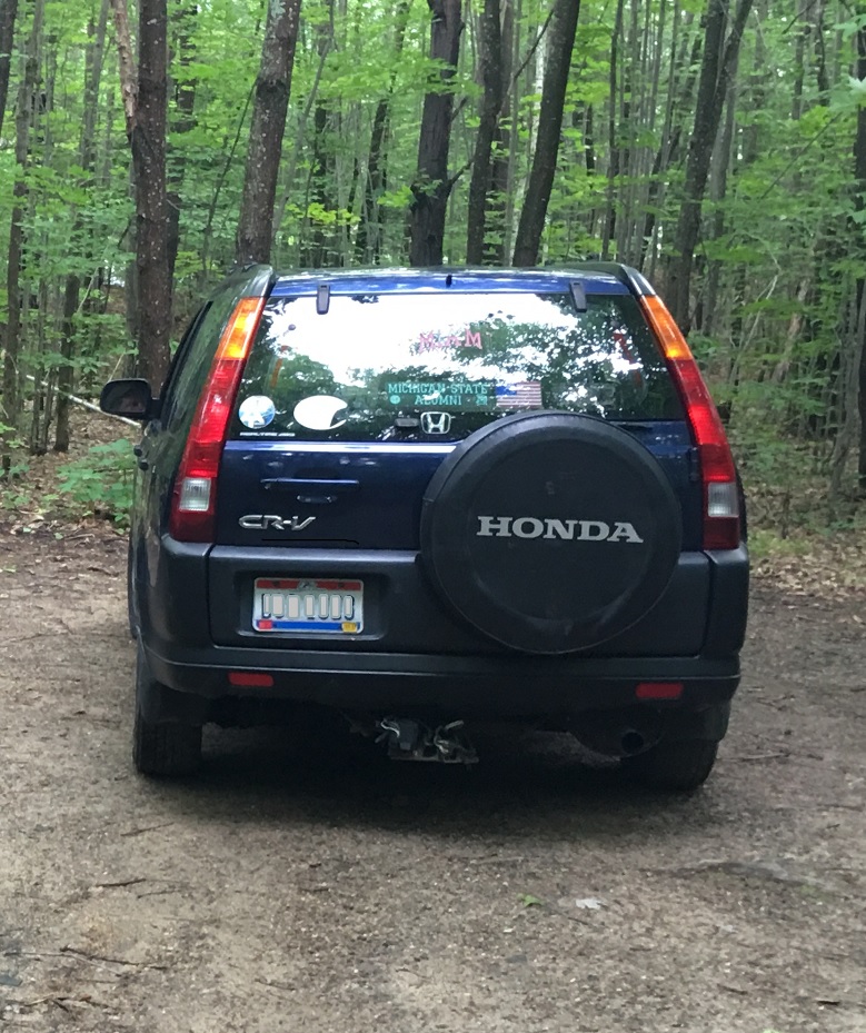
| 13:38 – I returned and took a picture of both cars from behind. This time -20 minutes later – the license plate is open, and this is a car from Michigan, but the license plate looks totally fake. | I drop my backpack into the car and drive away deeper into the woods on Hogan Road. | 13:49 – odometer 259.1 +22.5°C – road is blocked by a fallen tree. I have all the tools to remote the tree, and start doing so, but rain stops me |
 |
 |
| 14:34 – It was an interesting challenge to make a U-turn on a narrow dirt road with no defined boundaries under a powerful rain | 14:39 – 14:51 – swim at the mighty Androscoggin river to cool off. |
15:00 – almost immediately I found a cover for my bug spray bottle that I was looking in vain 2 hours ago – this is a good sign
 |
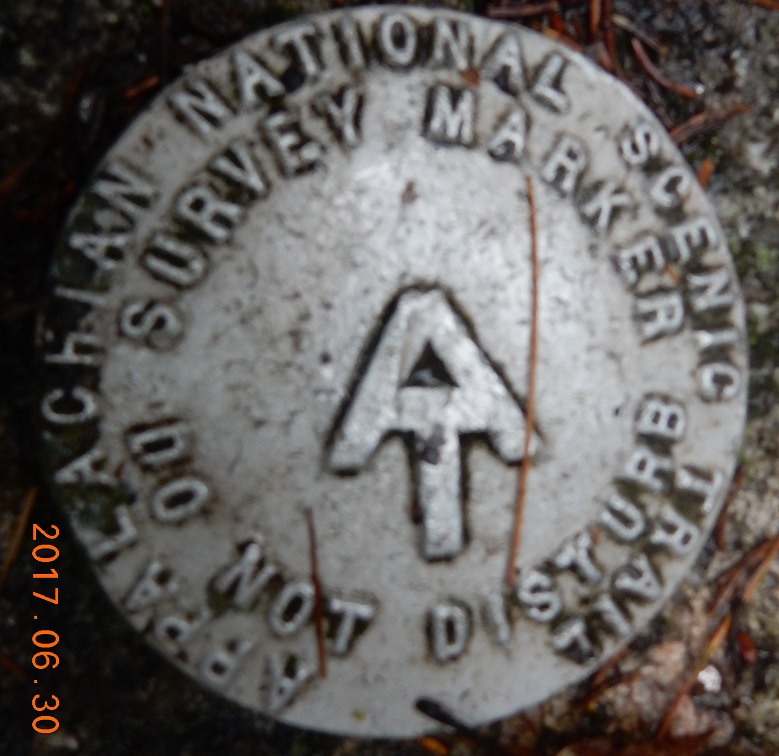 |
| I return to a small parking lot that I abandoned in fear, and the car with fake Michigan plates is gone. I park car parallel to the road, so that parking lot can accommodate more cars. Now, I am ready to go. | 16:00 – elevation 532 m – found first AT trail marker embedded into the rock. My first mile of the hike is complete. |
.
15:03 – elevation 251m – second and final departure for my hike. First steps a refreshing and final. My big (probably biggest) hike starts right now.
Found a walking Stick. I usually use a fallen tree or a branch as a natural walking stick. This one is from a very sturdy branch. This walking stick will travel with me all 31 miles, then 33 more miles on the bike, to be loaded into the car and ride another 200 miles back home.
 |
 |
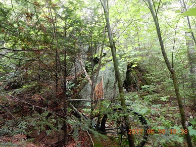
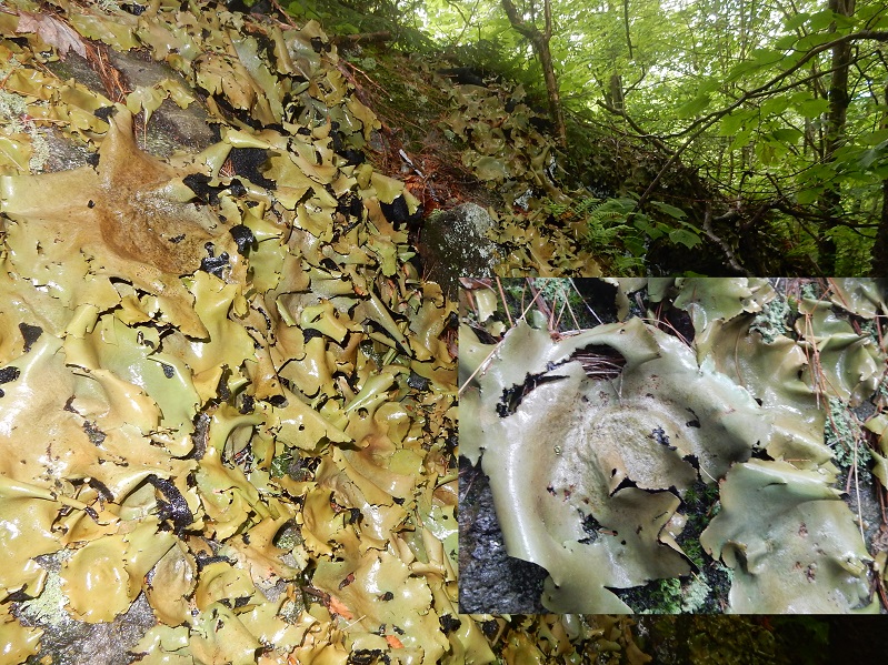
| 16:22 – ran into a giant wet stone covered with greenish leaves or moss – interesting formation | 17:14 – 17:21 I conquered first local hill. There are views and nice dry bald spots to rest on. So far, I encountered only 2 solitary hikers. |
 |
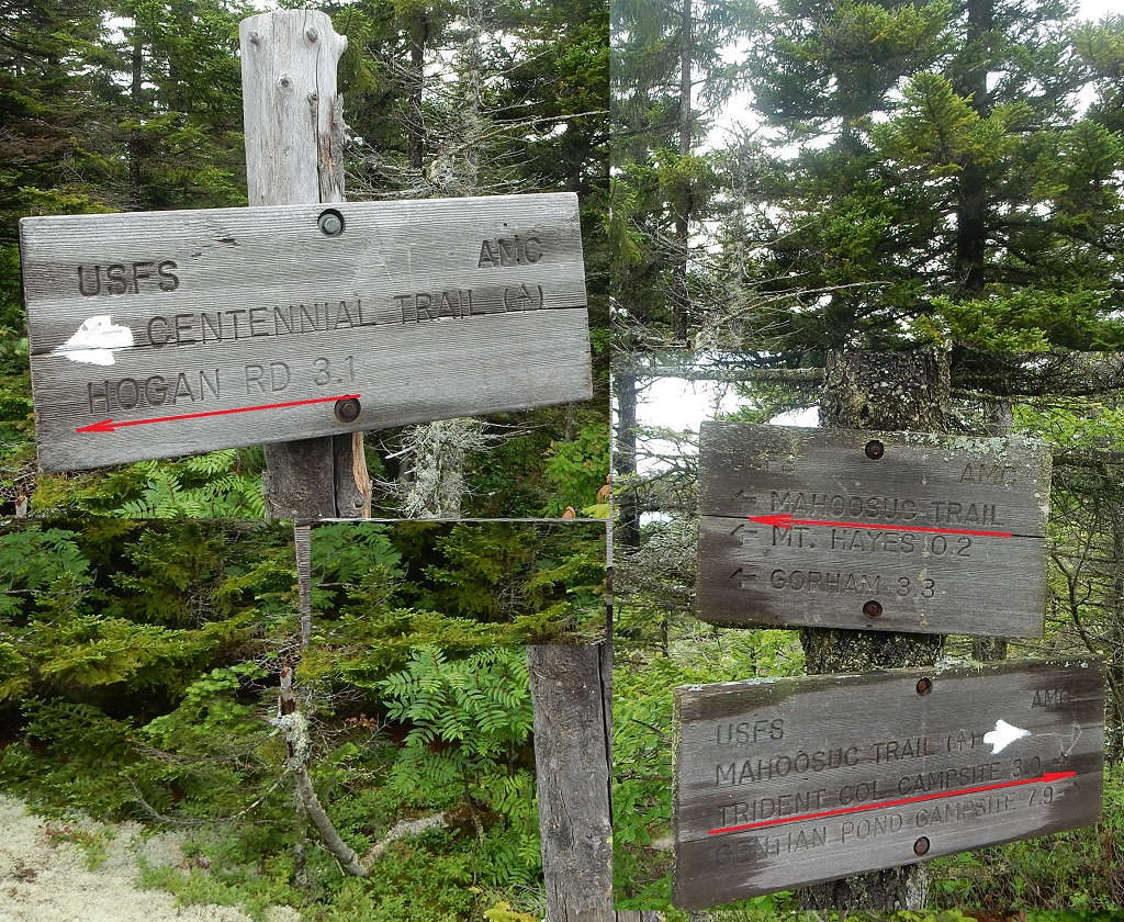 |
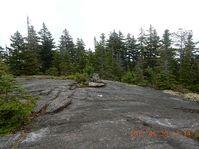
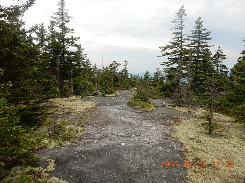
| 17:38 – elevation 768 m – AT junction with Mahoosuc trail – this is 2.8 miles away from parking lot. I found a very good spot to camp over seemingly dry rock. There are some moss growing over the stone. | 17:39 – first 3 miles out of 31 are complete. It is time to camp just .02 off the top of a flattened summit (2,555′) |
Rain starts just when I am setting the hammock.
 |
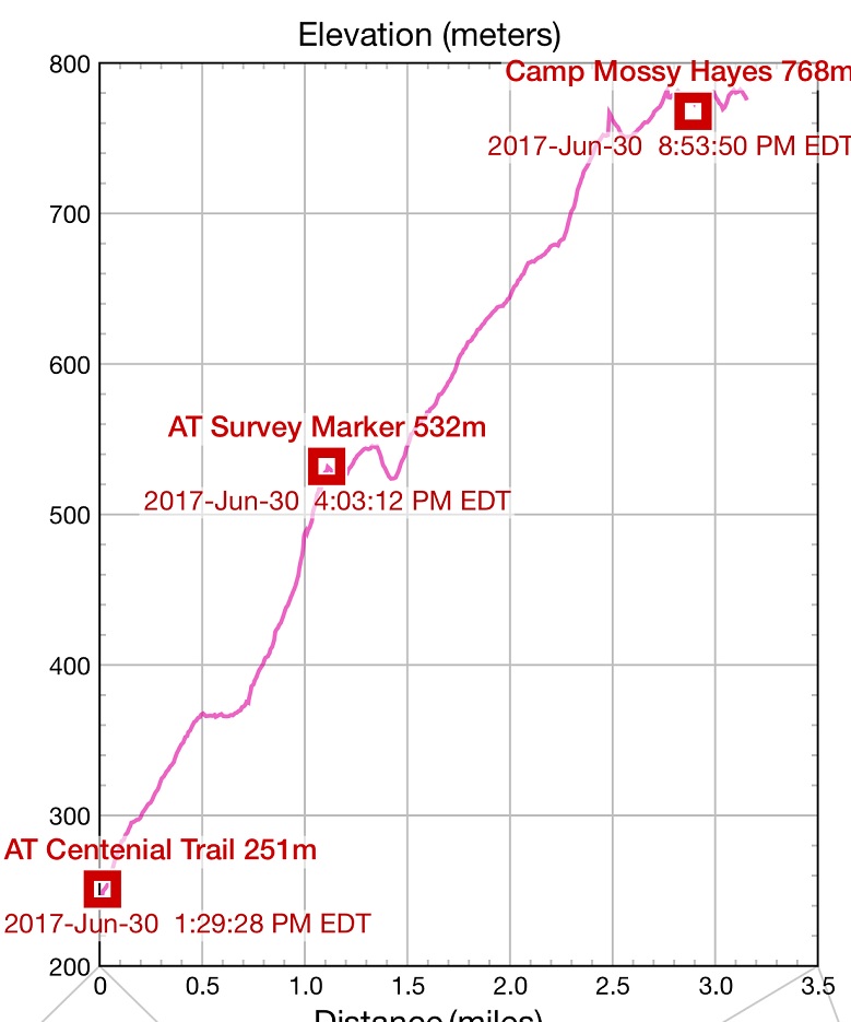 |
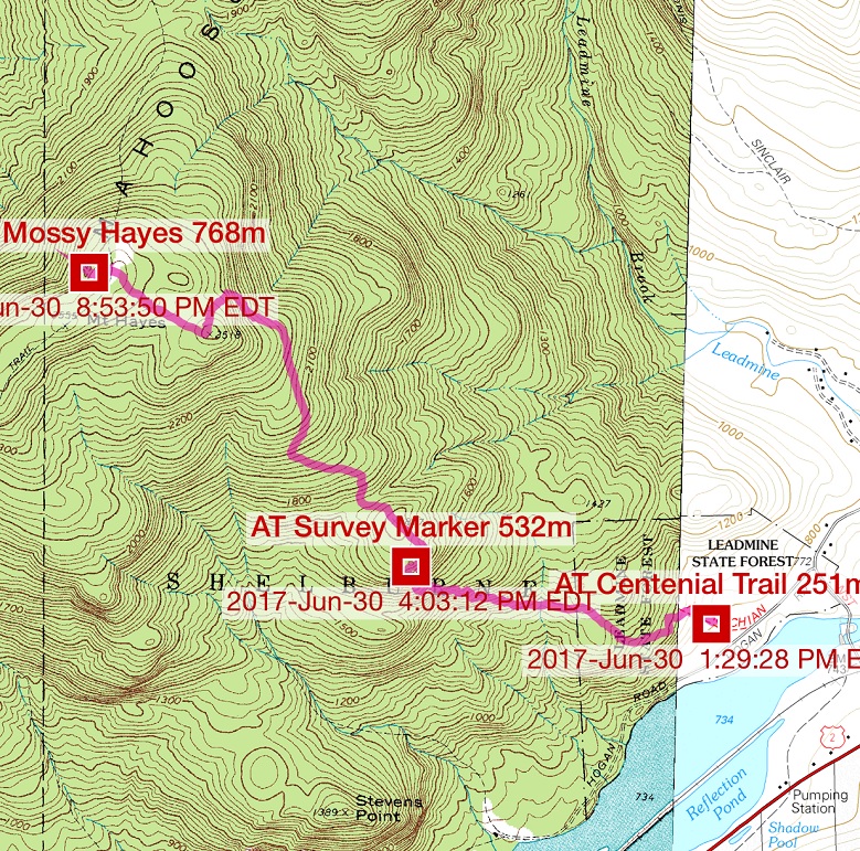
| Topo map of Centennial Trail | Centennial Trail – elevation graph |
Night 1 – Mossy Hayes Camp
 |
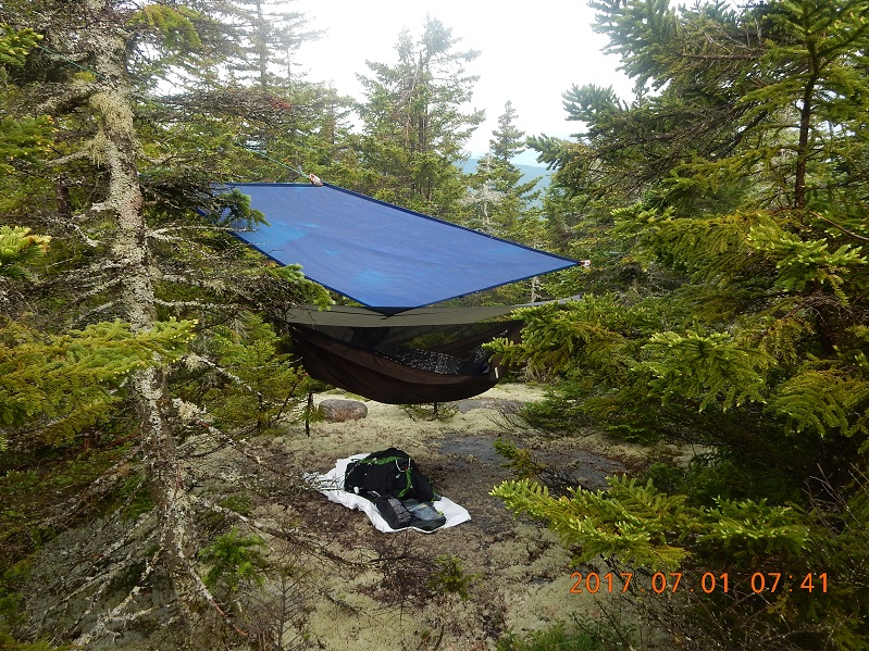 |
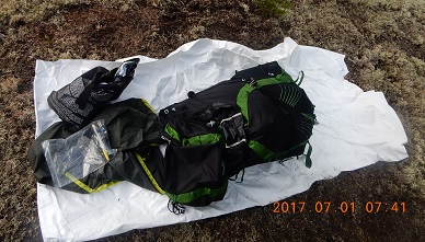
| First use of TYVEK sheet. To gain some space to place my stuff, I cover slimy dirt under the tarps with folded TYVEK, and now I have a surface for backpack, shoes, bottle. But I am on the slope, so I must be careful not to let things roll and slide. | It took me long time to adjust hammock tarp and regular tarp. I need to get better with this. With first rain drops, moss under my feet started to slide exposing slippery dirt and making the whole camp uncomfortable. Tarps covered wrong stops. Even hammock gets a bit wet. Big struggle to keep my stuff dry begins. |
19:30 I am not cooking this evening. I only had some water left from the start, and never bothered to refill. Everything is wet and it is raining hard, I do not have water to cook. Even better – I will skip a meal today. I limit myself to nuts and dried fruits.
21:23 – last picture of the day. I was trying to photograph my back where I can’t see to check for ticks.
21:00 – 21:57 – started a new empty notebook that is smaller and lighter than the regular one. My log this time is very abbreviated and to the point. To write this article I used 3 sources: -01- notebook, -02- photos and -03- iHikeGPS Track records, maps and elevation charts.
There is cell signal here on the hill. It will continue to rain for the next several hours, but it will stop by the morning.
Total number of people met on the trail in 2.5 hours – 3 lonely guys.
Thus ends this long first day of 22 – 5 = 17 hours.
Navigate through the List
- 2017/06/30 Friday - Who covers license plate with a Panama Hat? (2025/08/15)
- 2017/07/01 Saturday - Gift of shelter at the end (2025/08/19)
- 2017/07/02 Sunday - One of them now (2025/08/23)
- 2017/07/03 Monday - Endless Mahoosuc day with 7 miles (2025/08/27)
- 2017-07-04 Tuesday - From hike to bike, to car, to home (2025/09/01)
- Preparations for July 2017 trip to Appalachian Trail (AT) (2026/05/11)
Be the first to comment