Summary: Hike 18 mi – 5 mi on AT and another 13 mi over Black Pond motorized trail back to the bike and some serious rain by the afternoon.
The night felt a bit colder because I didn’t spread the under quilt, I just used a sleeping bag. I woke up 2 times – at 21:30 and 23:38. I didn’t see the stars, but owls made quite a production with their echoing dramatic cries in the stillness of the dark.
04:23 wake up in the hammock in the half-darkness. It is time to get up and start the day early, maybe even before the bugs?
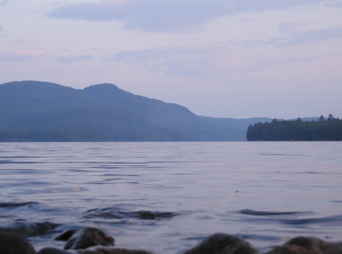
04:34 the first pictures of the lake are somber and still. The water looks silvery blue. But there is plenty of noise from waking up birds.
 |
 |
| 04:34 Exceptionally warm night is replaced by a calm mild morning | 05:48 early morning view on Nahmakanta Lake from AT. Nesuntabunt Mtn is visible ahead |
05:31 a perfect start to the day hike. Quiet, efficient, thoughtful.
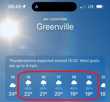
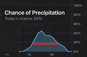
06:39 -06:48 I climbed on a local knob at 850′. I am sitting right on the trail facing Nahmakanta Lake. I am contemplating an almost familiar hike down to the shelter. Sleepy tents are popping up on both sides of the trail. People group together and camp in solo fashion. But the only hiker I see is a guy from yesterday who arrived about 7:30PM yesterday and already passing me by in a push to finish his 100-mile section maybe even today. The forecast shows rain today from 12 to 21.
07:08 At the hut there are 4 people in 2 groups. I am doing just a quick Hi as the shelter is right on the trail but promptly continue the journey.
07:49 I’ve completed 3.6 mi today. I am making nice progress and going very carefully being afraid of an injury. There are 0.8 mi remain till the top of the mountain and 2.1 till the road.
08:25 I was going fast and without looking at the GPS. Finally, when I sat down and looked – there is only 0.1 mi to the top. I would still need to climb from 1339′ to 1522, but that is nothing.
 |
 |
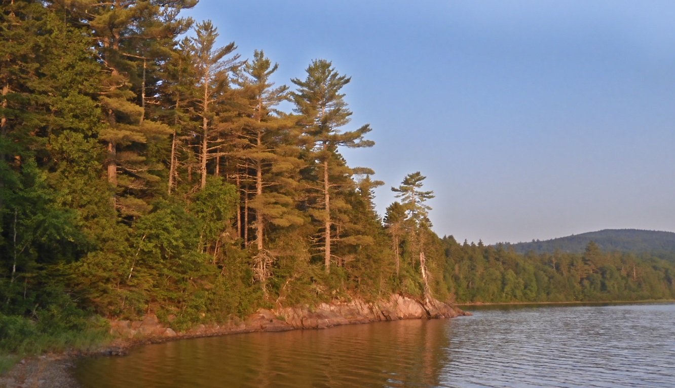
| 07:08 Familiar to me Wadliegh Stream shelter – I am passing here for the third time. Four hikers are getting ready for the day ahead. | 07:32 on the way to the mountain. You are goings along the lake, but rarely see it. |
08:36 – 10:12 I am luxuriating at a super-extended stop at Nesuntabunt Mountain (1522′). Here I take pictures, re-check the rain forecast, do my Duolingo and have a well-deserved breakfast. Three more hikes stop and go while I am here.
10:50 I am on the road – the AT section of the trip is over for me. Now I will continue over the gravel and forest roads and ATV trails.
11:27 – 7.3 mi completed at this point. I am making a sharp right turn from the main Jo Mary Rd. onto side Wadleigh Outlet Rd. Everything is going surprisingly well and according to the plan. From this point I will be investigating an approach to Nahmakanta Lands from the East.
11:50 -12:40 I am at the bridge between Wadleigh and Pollywog Ponds. For me this is the bridge into unknown. This site is easily reachable by paying an entrance fee to the Maine Northern woods. On the other side laying the roads less taken. Normal cars can’t pass the bridge – only ATV, bike or a snowmobile. Here I would cool off on a shallow stream, filter 2 full bottles plus I would drink 65 gulps to store some water in me. I do not see any good sources of water for the next 9 miles ahead and there is now water immediately around the bike if I reach that far. So, I want to be ready to camp anywhere along the route with a full load of water. The promised rain and thunderstorms are moving in, and I will go forward with an umbrella and only one walking stick.
|
|
 |
| It is going to rain all afternoon. I see it but I think I am prepared for it. | 11:51 Welcome to a very special bridge. Only ATV can pass here. But if there is a bridge, it means it leads to somewhere. |
12:39 the heavy rain has started, and I am hiding from it, protecting the backpack and planning the route ahead all at the same time.
12:46 – I see that there is green slightly overgrown road branching out a desired direction where there is nothing on Goole satellite image. That is very good! From the profundity of news even the rain has stopped for a bit a sun shone through.
12:58 – Now I’ve reached a stable section of the road visible from Google. I believe I made it through the most unpredictable portion of the track.
Even under the rain mosquitoes smartly dive under umbrellas, getting comfortable and then attacking from there. It’s a very clever tactic. The only way to free myself from mosquitoes is by turning the umbrella upside down.
13:56 – 14:35 I am hiding in the forest from a stronger spout of rain. Surprisingly there are very dry spots in the underbrush where water can’t easily reach. I am sitting on the ground, eating my clementines, and somehow remain dry. When I depart, I glance at my walking stick leaning against the tree and carefully navigate umbrella from under the branches. While walking down the road I constantly making stops to pick wild strawberries on both sides of the road and in about 10 minutes I realized that I forgot the walking stick. So, I dropped the backpack and returned to the spot. The whole detour cost me 0.3 x2 = 0.6 mi. A small price to pay.
14:56 I see a wide-open gate that potentially can be closed? Strange, this spot is not near any property borders or any regulation signs. It could be a leftover from some previous forest owners
 |
 |
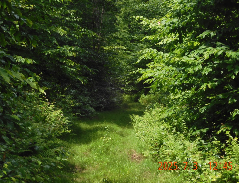
| 12:45 Yes. The trail is green, but it is there. I do not see anything on Google satellite images, but now it clear why. Even sun came out for a second. | More and more wild strawberries right along the road. They are tempting, tasty and clearly visible. But there is not one here. Not a single person for the whole afternoon hike. |
16:26 A tough endless walk mile after mile. I climbed to 1500′ height almost as high as Nesuntabunt Mountain, only this is an open road.
16:40 in a dramatic turn of events a super charged spout of rain caches me off guard. I decided to jump off the road into the forest through the wet grass. No matter. It is better. Under a tree I can at least hang the umbrella and free my hands to cover and protect the backpack.
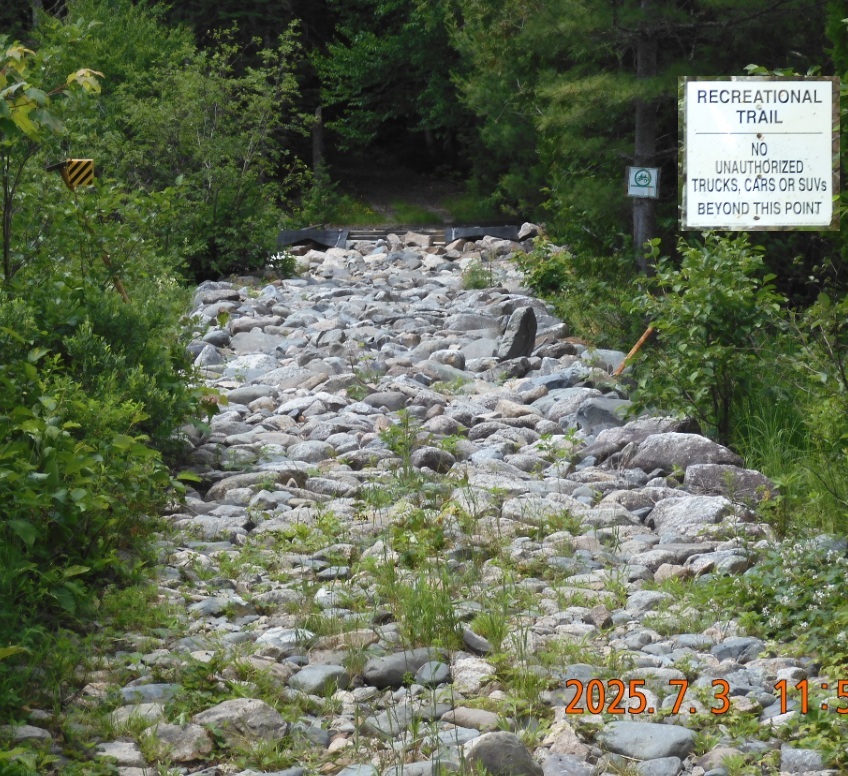
17:02 -17:06 the end of Nahmakanta Land. Two roads merge here into one and a new owner welcomes you to a Kokadjo Roach Riders Trail System.
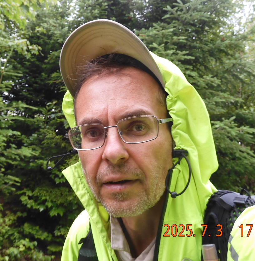
There are only a few miles left to the bike, but rain begins to go steady, and it is not a joke. I am comfortable under the umbrella and determined to keep going. My feet are completely wet from all the oversized pools of water on the ground, but it is not cold. Seriously! It is a glorious warm summer rain that also checks the bugs. Things are looking up.
I am watching closely not to miss my mark on the ground from branches and a stone signifying the spot where bike is hiding. The anticipation is overwhelming. The GPS also helps, as I created a waypoint when dropping the bike.
 |
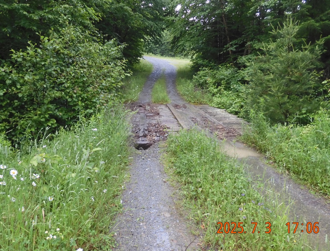 |
| A quick gap between continuous rains shows that I am adamant to keep going | This bridge is connecting Nahmakanta Lands with the main land. The bridge is passable, but dying. |
17:49 – Finally, I am at my bike after 18.5 mi of hiking today. The rain is going strong. Here at the bike in a bag I have an extra bottle of water, 3 clementines and a little bottle of coconut water. Great!
 I have an unusual task of setting up a camp in the rain. First, I need to find a stable place for the umbrella on the adjoining branches. Then I place my backpack under umbrella and get the tarp out. I can attach the tarp to the branches observing the incline so that the water will roll off in one direction. After several attempts the tarp is finally spread across creating a space where I can operate.
Slowly and deliberately, I pick the spot for the hammock. It is not an easy task in a dense forest, but surprisingly there are several good areas free of underbrush. Every move through the branches causes water to drip profusely down on my yellow jacket, but again – it is not very cold. I extract the rainfly for the hammock and hang it high and tight at a different spot about 5-7 yard away from the bike and from the tarp.
Closer to 7PM I begin to cook under the tarp and spill already boiling water – a minor setback, but I must watch my water consumption. My camp here is without a water source – just the water that I have with me. Anyway, I am cooking Nomad Nutrition Indian Red Lentil Stew. As a seat I am using a bike seat inserted into the ground – that way I am not sitting on the wet ground. There is no signal here anywhere.
19:09 after I’ve done all the hanging and preparations in the rain, the sun suddenly pops out. Amazing. The rain is still going from all the leaves and all the branches, but weather as per forecast decisively turning positive.
 |
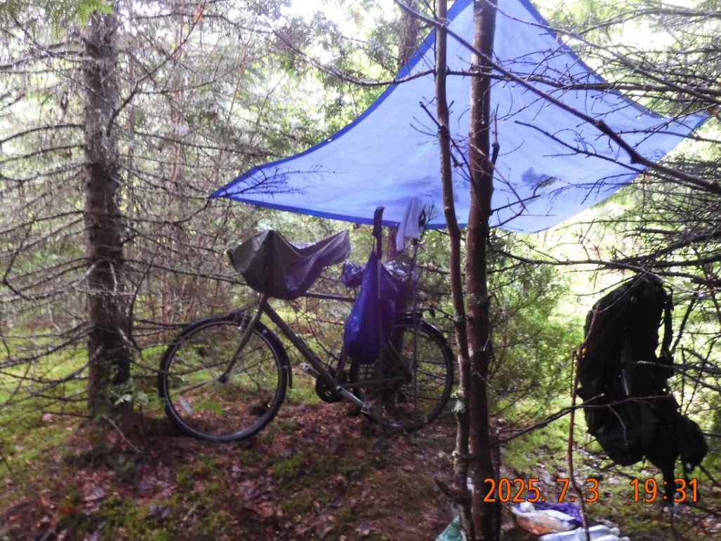 |
| Sleeping quarters are set under a strong rain. It is a small miracle to find a clearance for a hammock in a thick brush | Kitchen quarters are set first to create a space to reset and regroup. |
19:32 last pictures of the day. I am already dressed in dry clothes and dry socks. I will take my stew and tea into the dry hammock. This is the high moment of the trip. The hiking portion is complete. The bike is waiting for me. Tomorrow the road will be nicely wet and passing cars will not leave a wail of dust in the air. Perfect.
20:58 – 21:09 – last notes for today. The day was long. The hiking took most of the day – almost 12H or 10H net. But I took a lot of breaks and anticipated the incoming sections. I was carrying the water and that played out well.
Tomorrow, I have over 30 miles of biking to that car. I might be home by tomorrow evening.
Navigate through the List
- 01 2025-07 AT trip preparation (2025/06/30)
- 02 2025-07-01 TU from Boston to ME Northern Woods (2025/07/01)
- 03 2025-07-02 WE - Green snowmobile trails from Debsconeag to Nahmakanta (2025/07/02)
- 04 2025-07-03 TH from Nahmakanta to Black Pond motorized trail (2025/07/03)
- 05 2025-07-04 FR - down the Sias Hill Rd. on Golden Rd. to Abol Bridge (2025/07/04)
- 06 2025-07 Lessons and fixes (2025/07/06)
Be the first to comment