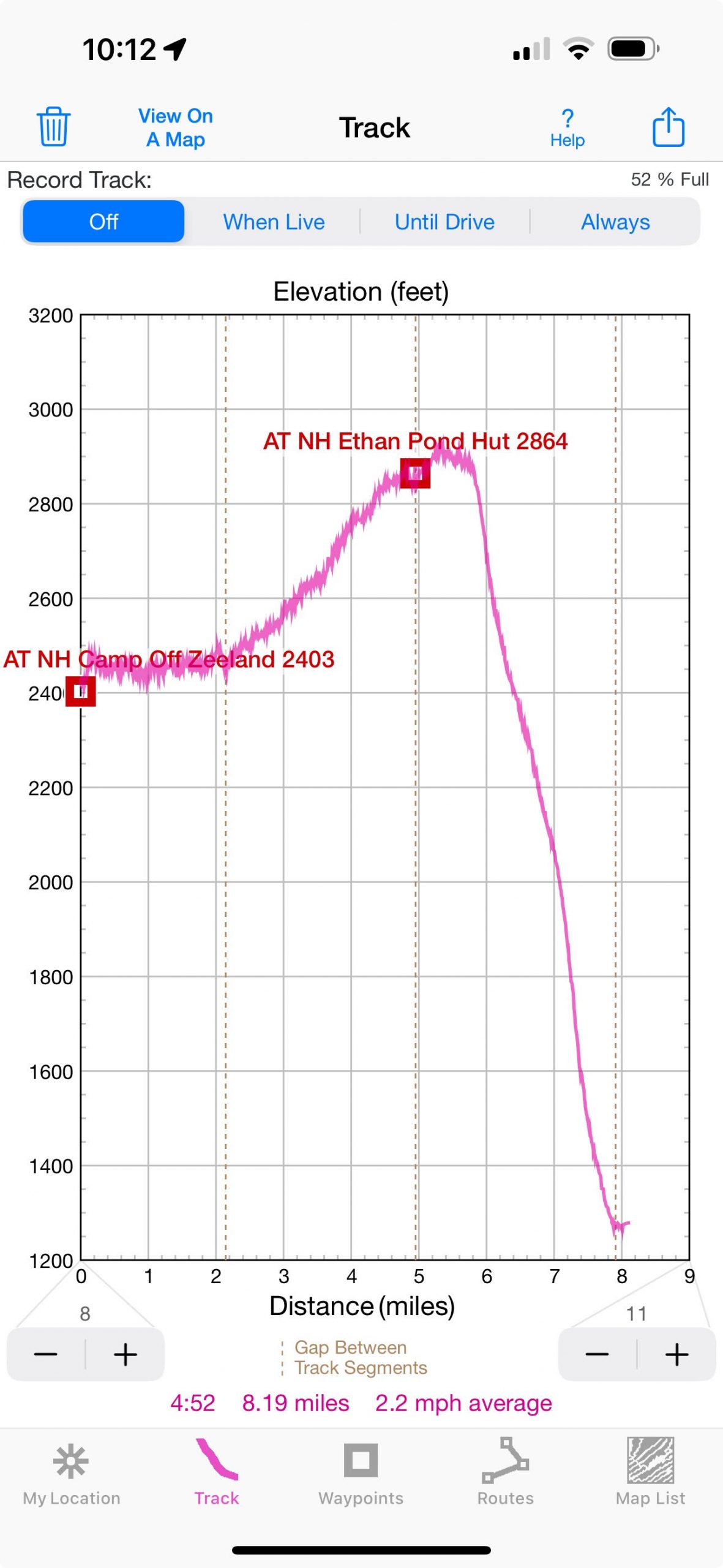
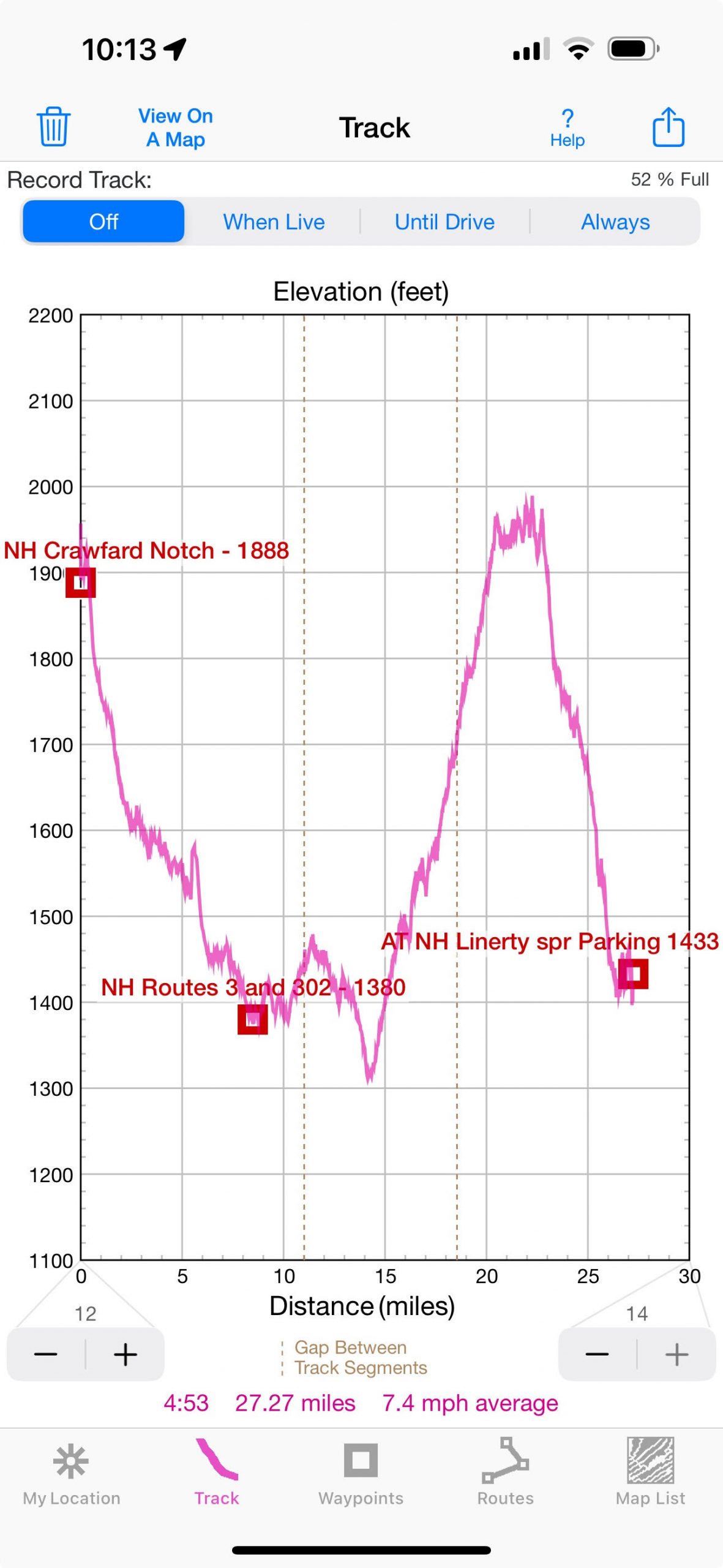
Day 04 summary: relatively flat hike to Ethan Pond and then route 302 and the final desperate bike dash to the car to finish the trip on that day
 |
 |
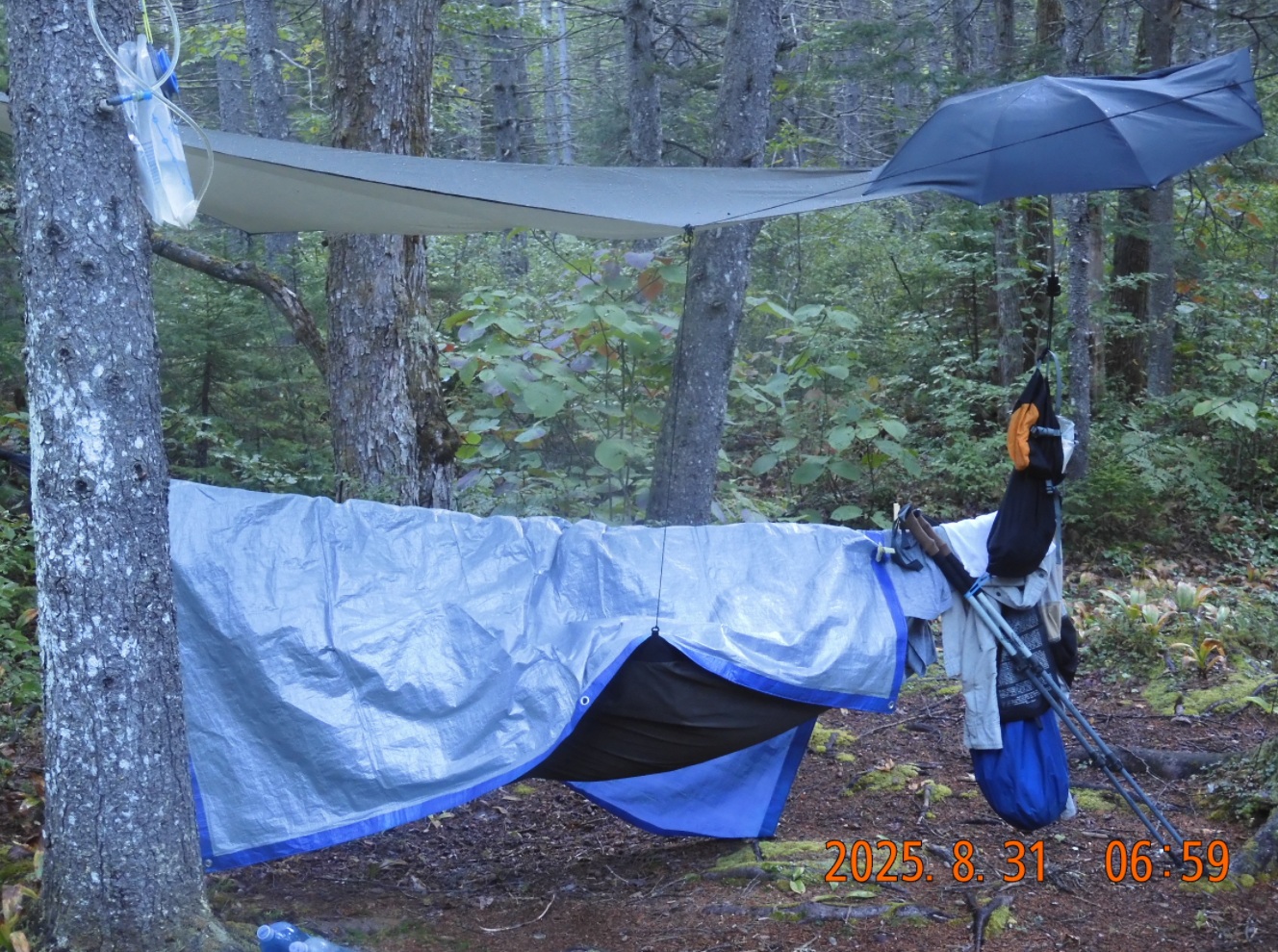
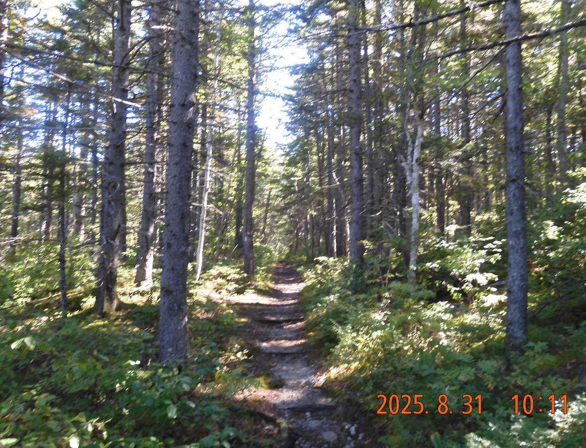
| Waking after a comfortable night of rain – everything is good and dry | Very flat Ethan Pond trail goes along the edge – a big difference from yesterday |
06:49 – It is cold but sunny morning. I climbed out of the hammock 4 times during the night. Rain stopped around midnight, but rain drops continued to pound the rainfly and the tarp. Around 4AM I was getting cold and put on all the clothes. The cold came from somewhere inside, so it was hard to warm up.
Bearing the camp this morning is slow because everything is wet or damp. I do not want anything to touch the wet ground, so everything must be done on top of the tarp in a strict sequence of steps.
08:37 – start the hike in good spirits. I will finish the hike mid-day today and I will have time to bike considerably closer to the car.
 |
|
| Why the light is always shimmering? | Exiting onto Thoreau Falls a bit off AT. There are sun, water, and a few more miles ahead – good progress. |
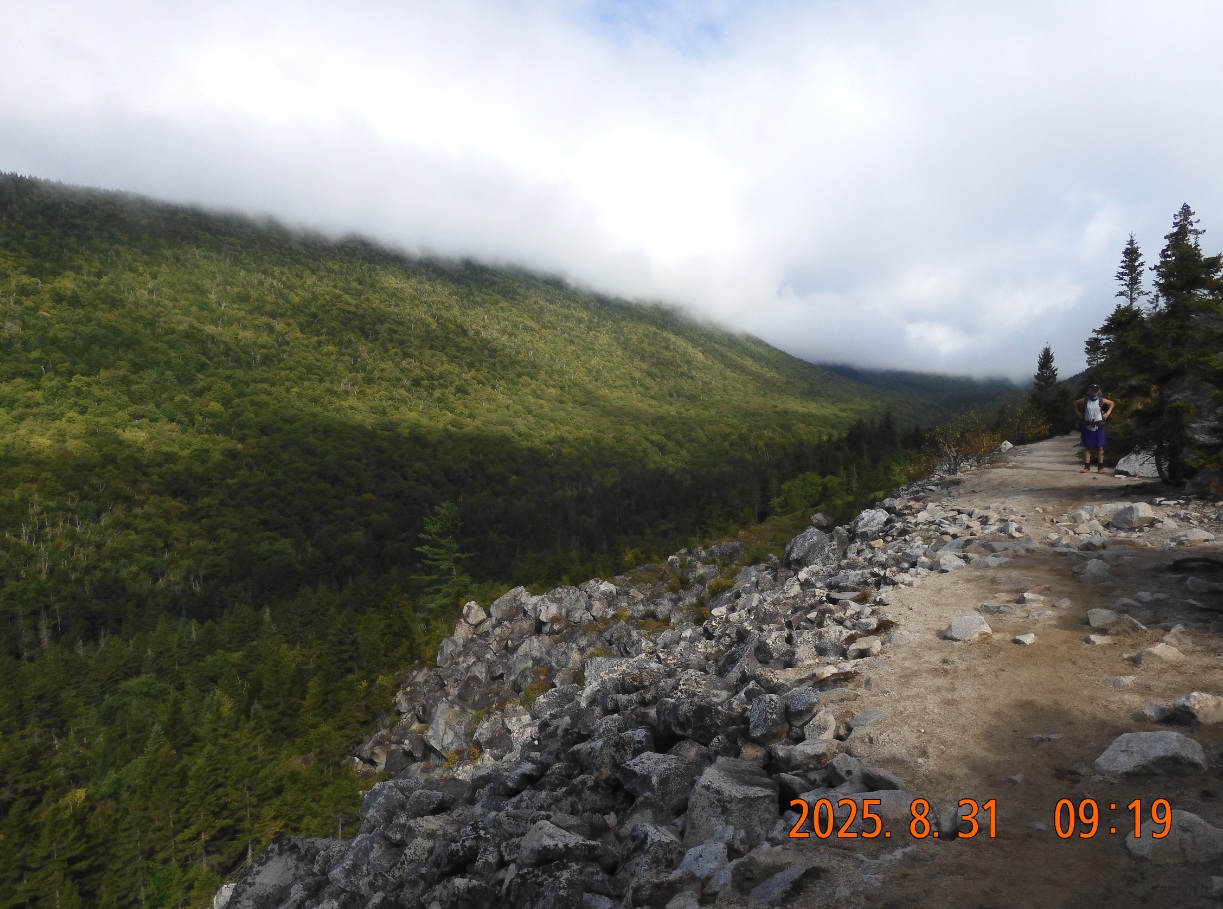
09:13 I am at Zeacliff Trail deviation. The trail enters a valley about 200-300 yards wide with outcrops of naked boulders on the slopes. The trail itself is a wide flat almost road forming an edge surface on a gentle slope. Here I briefly overtake the strange hiker in a purple Scottish Kilt that I met at the very beginning of the trip on Thursday.
09:29 pictures show a gorgeous day in a forest – full of sun and transparency. The path is clear and easy. Everything is so much better than in cold rain.
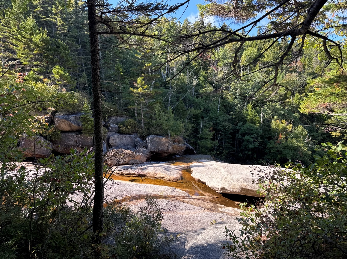
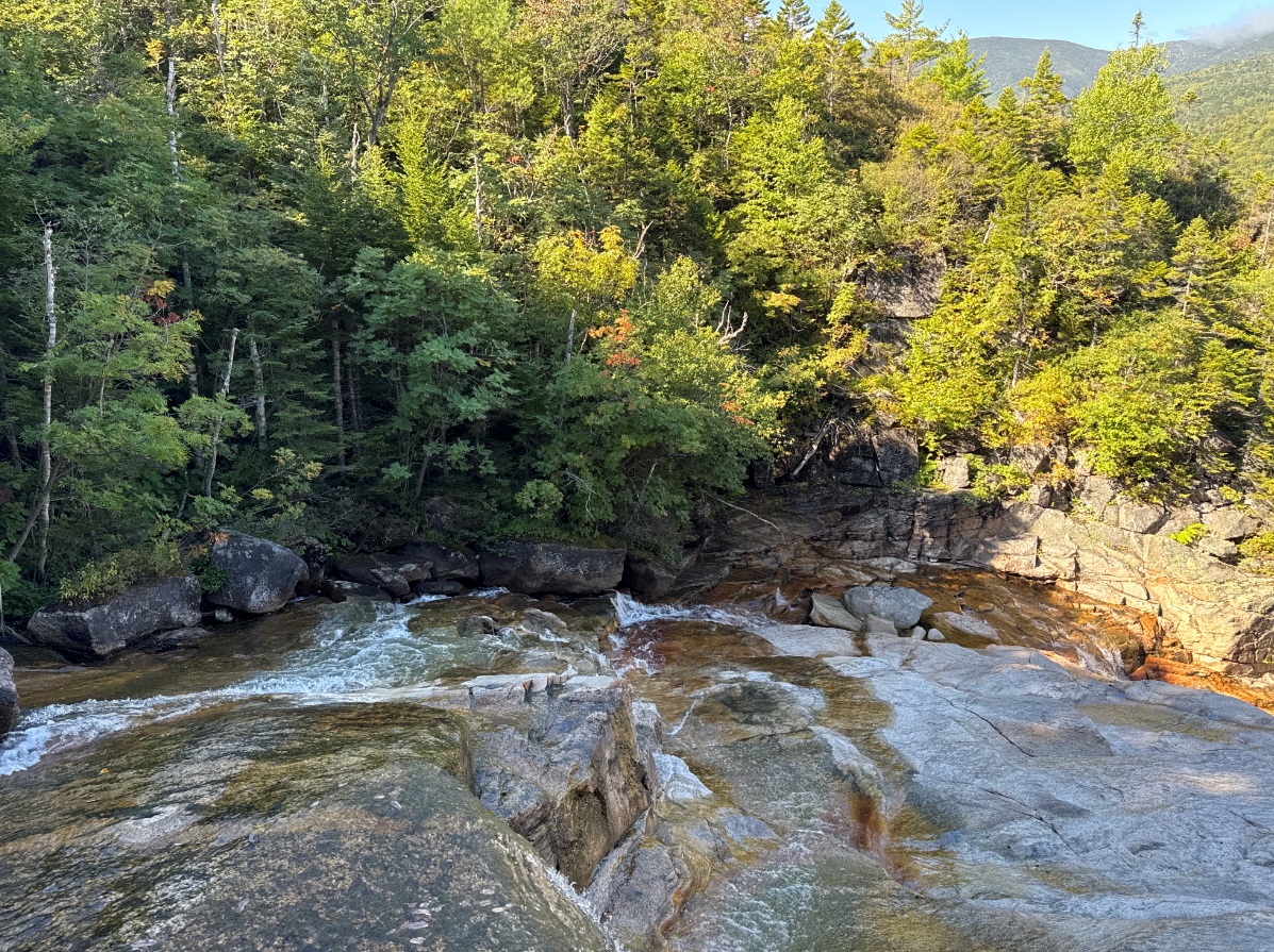
09:32 – 09:57 – I am at Thoreau Falls after 2 mi of hiking. This is another entrance to Pemigewasset Wilderness. I hiked here 9-10 years ago trying to cross from route 302 to route 112 (Kancamagus Highway).
 |
 |
| Thoreau Falls are hard to photograph. One can see along the water down the slope. | AT is gently imperceptibly sloping up to the Ethan Pond. Fantastic! |
10:09 While continuing the hike mostly East, I cross the river that forms the falls over a nice wooden bridge. There are already day hikers going in. Some even going with their dogs.
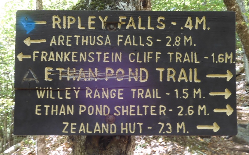
10:17 – entrance to Shoal Pond Trail – all nice wild and familiar places. The sign shows 2 more miles to Ethan Pond shelter
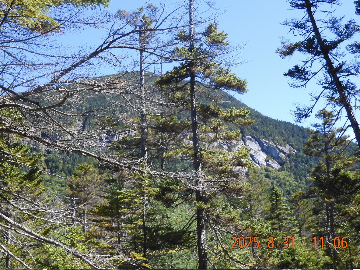
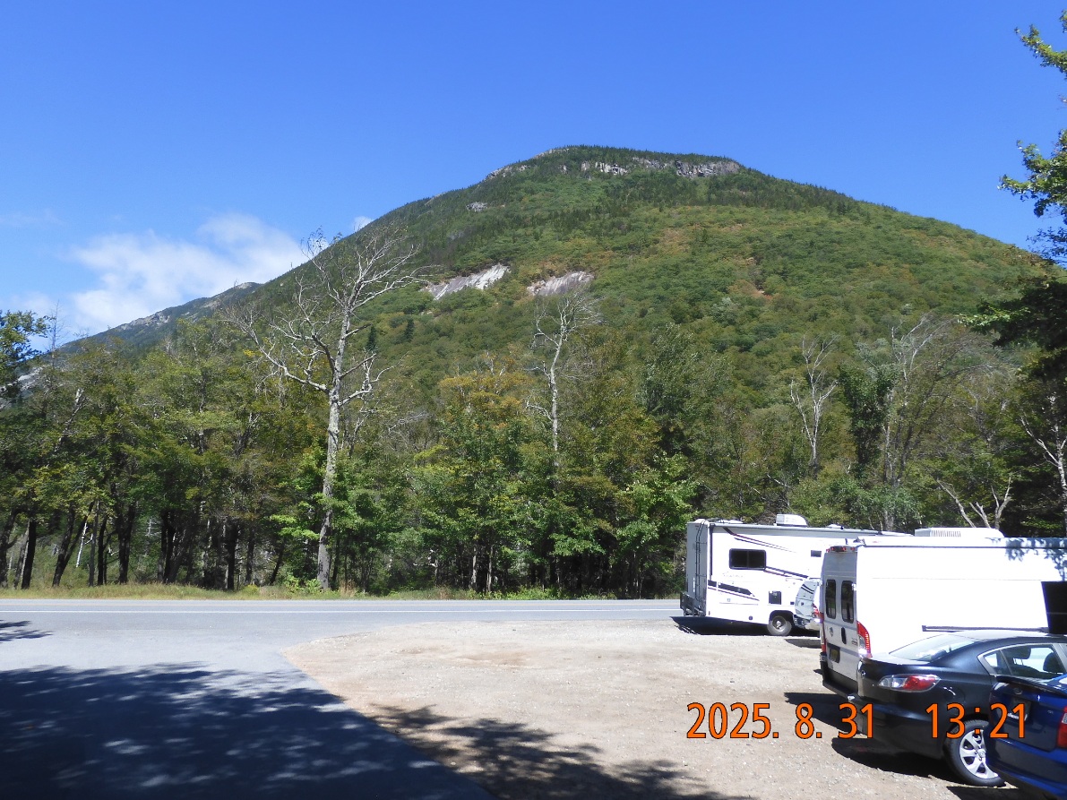
11:06 – 11:54 I see a beautiful view of Mount Willey that is about 4000′ high. It looks like it is hanging directly over the pond, but you will not see that while at the shelter.
 |
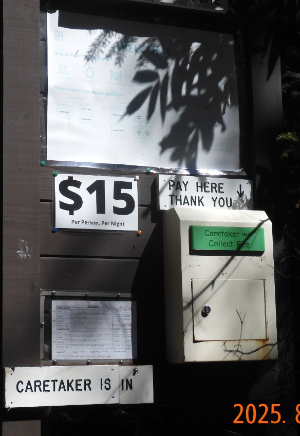 |
| Approaching Ethan Pond shelter. An impressing view on Mt. Willey from AT. | Pay to play. Pay to stay. This is one negative about White Mountains section |
12:27 – first trail deviation to Willey Range. I am already 1 mile away from the shelter. And 2 more miles to the road. Before the trail was gently descending, but now the big final drop is starting from 2900′ to under 1300′
12:38 – another shortcut – Kedron Flume – goes out directly to 302, but I must keep going on AT.
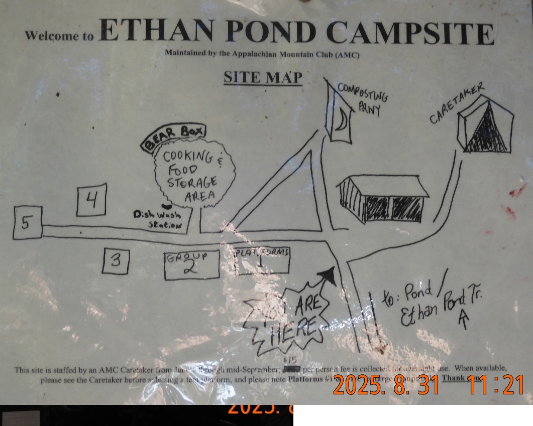 |
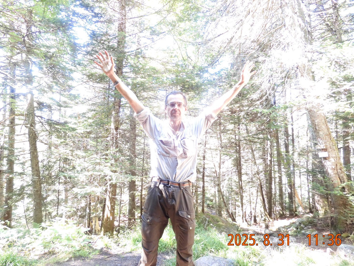 |
| Cooking and food storage is strictly separated from living quarters | It is still summer outhere. Everything is good. Feet are dry. Legs are moving. Eyes are seeing. |
13:07 – I am rapidly approaching civilization with increased day-hikers with kids and dogs.
13:12 crossing the railroad tracks
13:13 I am at the parking lot that is a fee area – $5 per day or $30 per year. Here my parking pass would work.
13:22 I am on route 302 – at Ripley Falls entrance via Wiley House Station Rd.
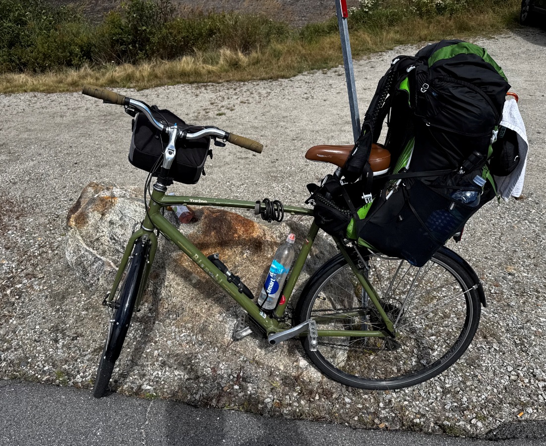
The bike is up the road
Almost immediately I was able to catch a ride on Subaru with father and son with an open hatch door. They forgot to close the hatch, so I put my backpack in the trunk and closed their hatch door. The ride is about 3.5 mi long and amazingly by 13:32 I am already at Webster Cliff Trailhead by my bike.
13:53 – start the bike ride back to car way earlier than I expected. Now it feels like I can finish the trip today.
 |
 |
| Hiking is close to an end. Ripley falls is the landmark | Exiting on route 302. I still need to go up to my bike 3-4 miles away. |
14:14 I am passing Mount Washington Hotel making pictures while riding
14:44 ride on route 3 is complete and I am turning right to route 302.
There is a temptation to stop by at the restaurant, relax and eat, but I continue to ride.
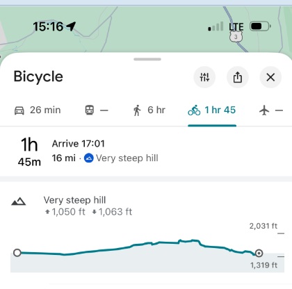
15:04 – 15:41 a first stop after 11 miles of riding down at a random convenient and all green turnout 15 min after the turn. Here I dive about 50 yards into the forest to find a flat trunk of a fallen tree where I can spread my things, relax, drink water and estimate the remaining leg of the trip – 16 mi. Google warns that there is a “Very steep Hill” ahead. I would have to climb to 2000′ and then drop precipitously to about 1300′.
 |
 |
| Bike is loaded and ready to go. 28 mi to go. | 11 easy miles completed. 16 more difficult miles to go. Very steep hill ahead ? |
 15:41 I am departing from a random stop on the side of the road (route 302) and I need to go up in the next 10 mi from 1300′ to 1700′ elevation.
16:48 – 17:02 Totally intact and in good spirits I am arriving at Skookumchuck Trailhead near routes 3 and 93 merging and taking my rest on the ground after yet another 11 mi of riding. From here to Lafayette Mountain is exactly 5 mi. Now only 9 more mi remains to the car. Seems doable.
 |
 |
| Only 15 more minutes of riding and I can’t go forward anymore. I still have 9 more miles to go, but no more energy. | A view from Pemi Trail at the merge of routes 3 and 93 to Cannon Mountain. |
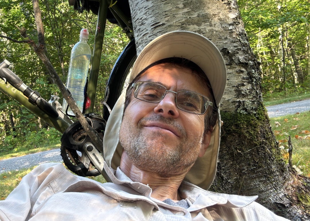
17:15 – 17:28 I am so tired that I had to stop again and fall on the ground with my back to the tree. I do not think I can move forwards anymore.
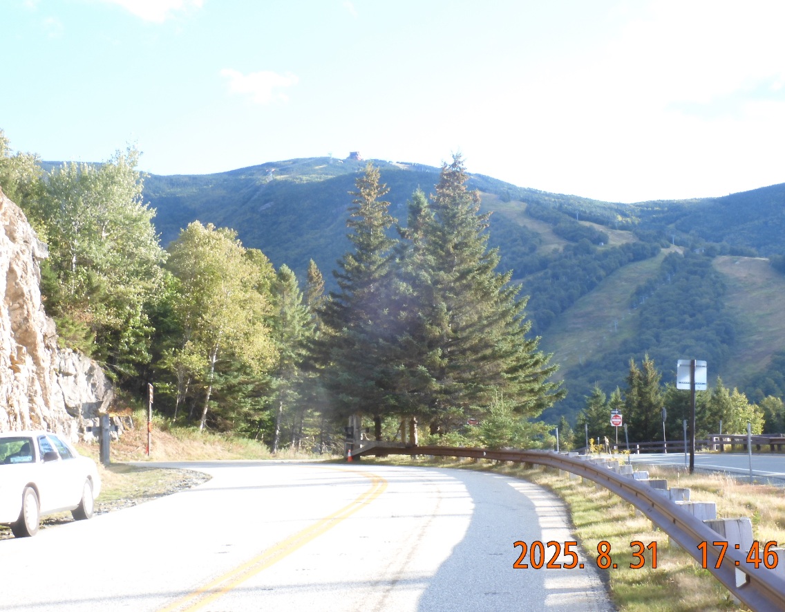
17:28 – 17:46 I continue climbing up from 1700′ to almost 2000′.
17:46 I’ve reached a local pick with a clear view at Canton Mountain. I took some pictures.
Here bike path interrupted, and I need to check the map to see how to get back to the path after crossing route 93 over the bridge.
The path continues to go up and down for a bit longer, I can’t pedal up and walk the bike even the slighted hill, but soon road begins to drop sharply, and final miles begin to fly out of my back end.
 |
 |
| Ok. That was tough. Hiking plus biking from 8:00 till 19:00 was a perfect happy end. | Two more hours of driving (140 mi) and I am home. All went according to plans. |
18:48 – 19:00 ODO 193.6 – +18.0° – everything is in its place – I am ready to drive home.
21:12 ODO 334.3 – +17.5° – I have arrived home. Everything went according to plan. It was very little traffic. Nothing was lost; many things were found. NH still is a very interesting please to explore despite the crowds of hikers and visitors.
Navigate through the List
- 01 Preparations for AT NH trip of September 2025 (2025/08/27)
- 02 08-28 TH - Climb to Liberty Springs (2025/08/28)
- 03 08-29 FR - Franconia Ridge in the rain and wind (2025/08/29)
- 04 08-30 SA - From Garfield Range darkening sky to Zealand hut (2025/08/30)
- 05 08-31 SU - Casual Zealand hike and lucky return to the car (2025/08/31)
- 06 Summary of three 2025 AT trips (2025/09/01)


Be the first to comment