Summary: drive 300 miles from MA to Maine Northern Woods, drop the bike at the end of the hike and drive another 35 mi to the beginning of the trail. Hike to Ice Caves and start wild hike on snowmobile route 86 that is not used in Summer and overgrown with green grass.
02:47 I wake up without an alarm clock and decide that it is time to do some hiking. That is the earliest unforced wake up among all the previous AT trips. The weather forecast in Millinocket, ME is warm with some rain today, on Thursday and Friday.
03:37 depart into the warm summer night from Boston to Maine (ME).
04:46 – 05:39 – ODO 71.6 – almost an hour gas and Duolingo stop at Kittery, ME. I am surprised that many gas stations are open at that AM hour.
07:36 – 08:26 – ODO 213.7 – another stop at Danforth’s supermarket in Pittsfield, ME. I bought and washed blueberries, cherries, strawberries and mandarins ($18). Now there are 82 mi or 2H remains till my first stop where I would drop the bike.
 |
 |
| Exploring a new route to Greenville, ME via exit 150 off route 93. Visiting Danforth’s Down Home Supermarket to get berries and fruits for the hike. | It is not 8AM yet, but I’ve done Duolingo, visited a gas station, completed 213.6 mi of driving and only about 100 miles remains to the destination. |
09:26 ODO 261.4 – flying through AT parking lot where 100-mile wilderness begins
10:05 ODO 290.8 – the asphalt is over. It will be the dirt roads going forward. +21.5°C. Everything is very quiet and nice. I just passed the Lily Bay Township where a year ago I took an overnight kayak trip to Sugar Island. 6.3 more mi to go.
10:26 – 10:40 – ODO 296.0 – I stepped on the same rake again – the next 100 yards of the road are covered by overflowing water. I take off the socks and go in my sandals to test how deep the water is, I mark with branches oversized underwater boulders and I need to make sure there are no hidden holes or other underwater dangers. Can the car pass through this? – Yes!
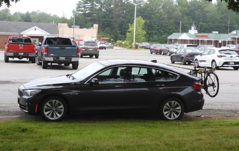
10:46 – 11:16 – ODO – 296.7 – This time I remember to attach a water bottle to the bike, put some fruits and coconut water into the bike bag so that I have something good when I hike back to the bike. I ride the bike 0.1 mi on the side road and quickly find a spot when I can veer off the road and hide the bike. I mark the spot with branches and stones, and I create a Waypoint on the map. Mosquitoes immediately make themselves known to my skin.
|
|
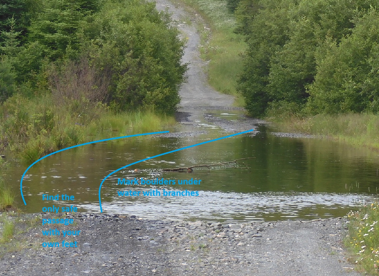 |
| 10:30 Intimidating – a wet road ahead. What to do? | This is a road under water. There is a safe passage, but you have to walk it, find it and avoid underwater boulders. |
11:25 – ODO 297.3 – I am back on a main Sias Hill Rd., although the road naming here is very vague.
11:59 – ODO 305 – I am at the unnamed road that I was originally planning to take. This road doesn’t connect to Nahmakanta Lands and would have required some 2500 feet of bushwalking.
12:17 – ODO 308.4 – now I am passing the road that leads to Rainbow Lake and AT. I took this road last year (May 2024) and that is another way to connect to AT. You can drive 2.5 mi and then walk another 2-3 mi on a disappearing and wet road. Rain is starting and stopping but I am taking my umbrella with me.
12:29 – ODO 312.5 – I am at a viewpoint at Ripogenus Gorge on the other side of Branch Penobscot River that is wide here due to a dam. There is a small parking area for 1-2 cars right on the Golden Rd. It is a stony embankment with a steep downhill from the road to the water. Keep reminding myself to relax staring from the back. I left my umbrella hanging on the branches and remembered to return for it after 2 miles of driving.
 |
 |
| A large parking lot at Abol Bridge is to open and not very inviting. However the signage is clear and you can go there for free. Like most things in ME. | The road after Ice Caves parking is blocked and the trail after that is green, a bit overgrown, but totally passable. |
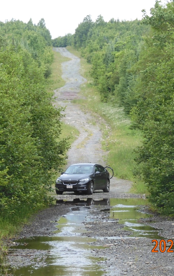
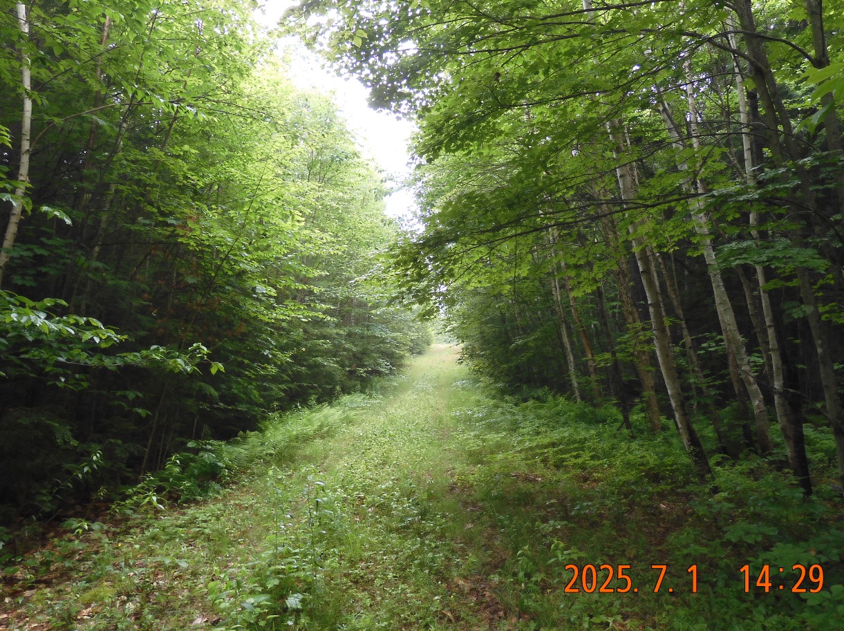
13:20 – ODO 328.4 – I am at Abol Bridge. I did the final 26 mi section of 100-mile wilderness from here 4 years ago in July 2021. A perfectly good road that goes for another 3 miles leads to the Ice Caves parking lot. I decided to drive there and cut 3 mi of today’s hike. It means 3 more miles of riding the bike before my return in a few days.
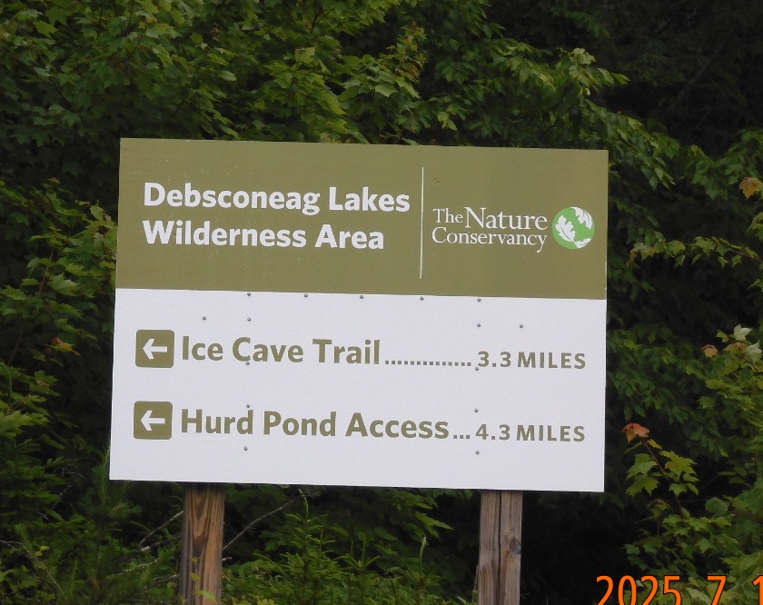
13:53 – 14:22 -ODO 332.2 – Ok. Finally, that is my starting point – Ice Caves parking. Finally, there is some cell signal here – I notify Lira that everything is OK, gather my things and start the hike. There is a plentiful main car park plus an overflow car park, but there are only one or two cars parked here anyway. Beyond parking, the road is blocked by the gate and the road turns into green pasture. It appears it is used only in winter for snowmobiles. I drop my backpack in the woods and go to Ice caves attraction on mostly flat 1 mi trail towards First Debsconeag Lake.
I start the hike, and the sign announces just over one mile distance to Ice Caves. The trail is flat and uneventful. Several parties are returning, but there are only two cars at the parking lot. With me I have one walking stick and a gun.
|
|
 |
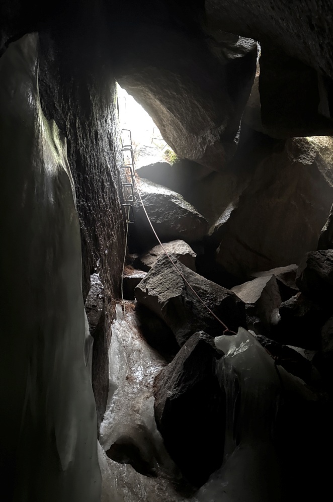
| iPhone camera works well, even in a very contrast environment – like in caves. | Entrance to the Ice Cave with ropes and metal staples is intimidating. |
15:01 I am at the scenic overlook onto First Debsconeag Lake at an elevation of about 800′. The strange acoustics make every word said at the caves audible here at the overlook. There is a family there that started at the same time as me.
 |
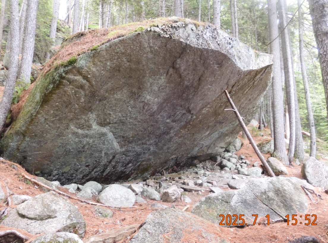 |
| Climbing down to the lake is somber and this dead-end is rarely visited. | Natural stone shelter and nothing can grow with no water |
15:26 -15:36 I am climbing down into the ice caves. It would be better called Ice cavity or ice box. There are no corridors or a chance to get lost here. But the danger to slip and fall is clear and real. So, to help with the descend, they provided 2 ropes with some loops for easier grab. One rope is frozen deep into the ice, so they added another one. The ice box is very cold, and my camera and glasses fog up when I return to the surface.
Descending even further down to about 500′ I am reaching the banks of the First Debsconeag Lake. All my senses are on a high alert, as I am still easing into the wild. This side trip seems to keep me from covering the real miles and moving towards the real goals for today.
Hike back is completely quiet, completely alone. The remaining clouds seem to be clearing out and I would have a dry and warm night.
16:30 finally I am back at the parking lot and picking up my backpack. Let’s see if the road is real and I can find a connection with a bridge built in 2013.
At first the grass covered snowmobile trail goes up but at about 5PM I’ve reached the top and trail begin to descent down to the river.
 |
 |
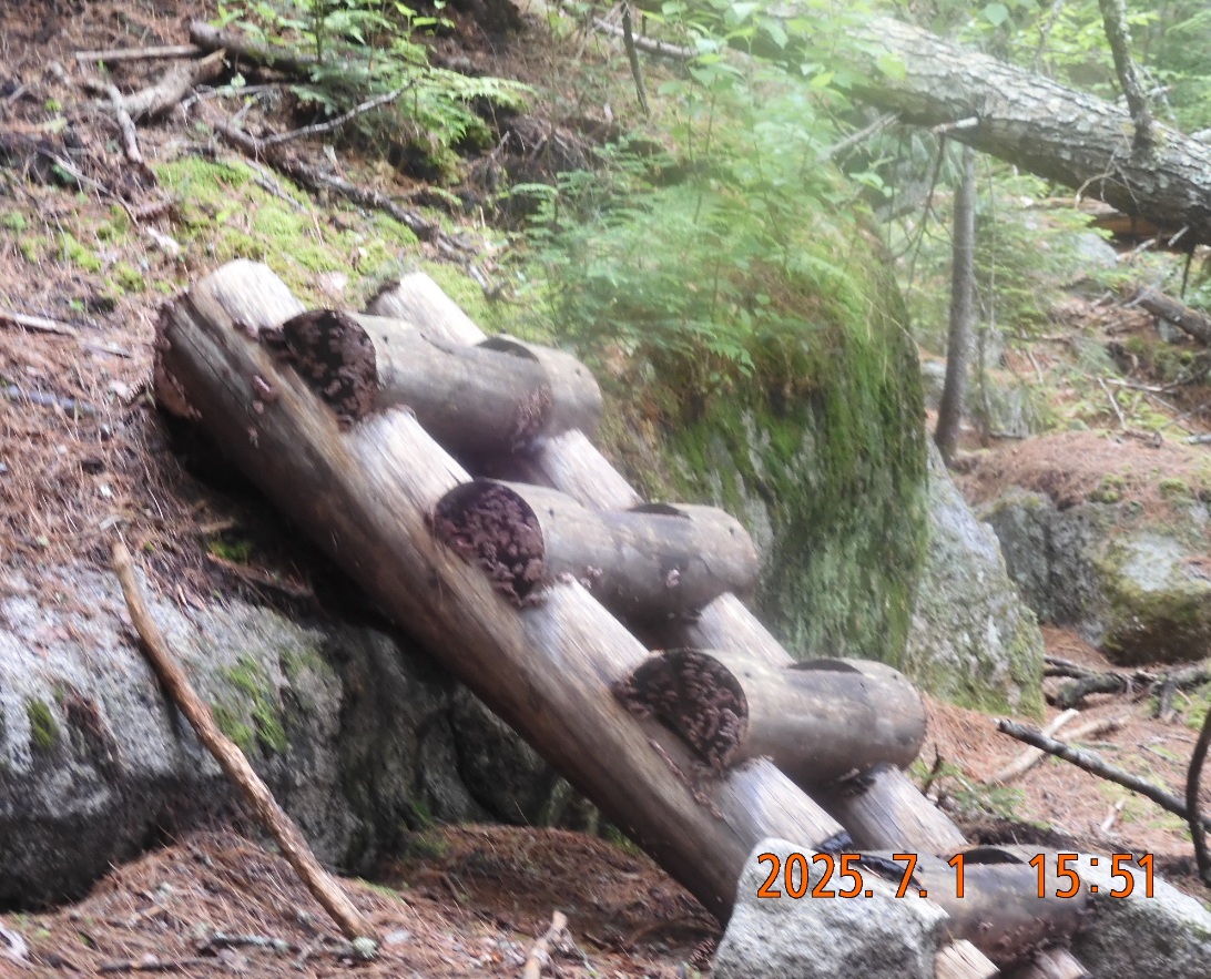
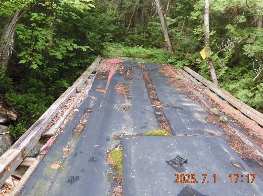
| Hurray! The snowmobile bridge is still there. It means that someone uses it. And for me it means that I will not have to bushwalk. | A key moment on the first day – and all goes as planned. Bug are plentiful, but there is no one here and it is glorious. |
17:17 – 17:37 Yes! The road didn’t end, and now I can see the bridge. The plan was to camp around here, but bugs push me forward – anywhere away from here. I am just taking all the celebratory pictures, looking up towards the invisible Google satellite that made this possible and collecting water in 3-liter bladder. There are plenty of bear dung right on the trail.
 |
 |
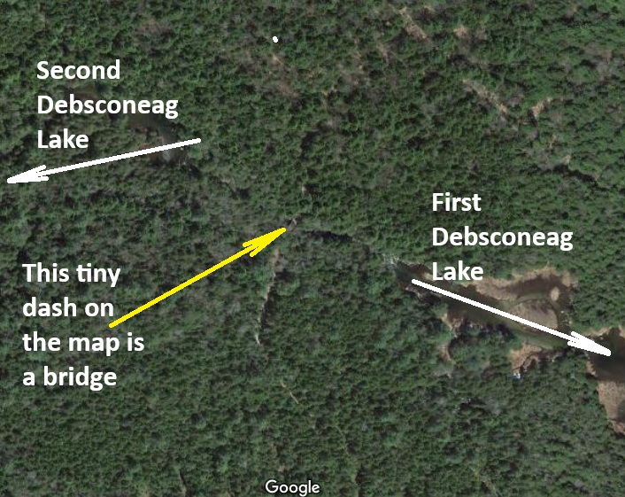
| Just look at the tiny object that is the bridge that I crossed today. It was re-built in 2013 by snowmobile enthusiasts and still going strong 12 years later | Hiking elevation profile for the day – mostly flat |
With a 3-liter water bladder in one hand and a walking stick in the other I quickly reached what I thought would be a main road, but it was pretty much the same green grass winter road, but this one is clearly visible on Google satellite map, so the doubtful portion of the track is now behind me. No one except large animals travel this road in Summer, but the main win is that the road is here, and it will guide me where I need to go.
I quickly found a clearing on the side of the road – a good spot for my hammock. This little clearing could have served as a turnaround point or a winter camp spot, but it is as convenient now in Summer.
19:27 – 19:37 last notes from inside the hammock. A swarm of mosquitos is trying to penetrate inside. It is very warm in the forest. Unusually warm – I am just in a T-shirt. From my hide out I can see a sun-lit road. There is no wind. For supper I eat half of my home porridge – it is normal that there is no appetite the first night. Water bottles are just outside. All my clothes are drying out on the strings. iPhone is at 70% charge, and I would need charge it only tomorrow. In today’s hike I covered only 5 miles but was packed with emotions and doubts. I am totally ready to go to sleep as I woke up before 3AM today.
Navigate through the List
- 01 2025-07 AT trip preparation (2025/06/30)
- 02 2025-07-01 TU from Boston to ME Northern Woods (2025/07/01)
- 03 2025-07-02 WE - Green snowmobile trails from Debsconeag to Nahmakanta (2025/07/02)
- 04 2025-07-03 TH from Nahmakanta to Black Pond motorized trail (2025/07/03)
- 05 2025-07-04 FR - down the Sias Hill Rd. on Golden Rd. to Abol Bridge (2025/07/04)
- 06 2025-07 Lessons and fixes (2025/07/06)
Be the first to comment