 Crossing a huge body of wilderness often involves a question of returning back to your car. This itinerary suggests such a crossing, if you have one car, one bike and 3 nights to spend in the woods. At no point you are required to carry your tent and your sleeping bag on your back. Instead, you will stay two nights in a campground and one night in the hut, where they have beds and blankets.
New Hampshire White Mountains are only 2 hours from Boston (140 miles to Lincoln, NH). They are close enough and large enough to explore several times a year.
Here is a bird-eye view of your itinerary:
Arrival Day – Buy a parking pass, stock up on provisions, deposit your bike deep into the woods (to save walking time tomorrow), come back and stay at a local campground ($20).
First Day – Wake up in a Campground, drive to a trail-head on the other site of the wilderness, hike to the hut ($40 – $110) and enjoy the rest of the day.
Second Day – Wake up in the hut, hike across the wilderness till you reach your bike, emerge from the woods and stay at the campground.
Third Day – Wake up in campground and bike back to your car around the wilderness (25 miles).
This particular itinerary describes staying at Hancock Campground on Kancamagus (Route 112), starting next day from US Route 3 on Gale River Trail, staying over at Galehead Hut, continuing next day on Twin Brook Trail and Franconia Brook Trail back to Hancock Campground, and returning next day on a bike along 93 north.
For a similar trip through a Zealand Falls Hut see a story here.
Each step offers a wide variety of choices and potential difficulties to overcome. Here is what could happened.
Arrival Day
 Leave Boston around 13:00.
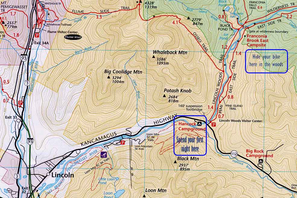
In 2 two hours you arrive to Lincoln (exit 32 of 93) and buy a parking pass for a week ($5) at the visitor center (go straight at the ramp light) . This is a very good deal, because each individual parking costs $3. This pass works everywhere on White Mountains territory even as far as exit 28 of 93 in Waterville Valley.
Next, you go to a Price Chopper (this supermarket works 24 hours) and buy your provisions for 2-3 days and nights. This is where you first struggle with choices begins. Consider water, OJ, healthy sliced bread, cheese and smoked salmon, large strong container of yogurt, bananas and oranges, mixed nuts and dry fruits.
Everything you buy should be universal, indifferent to refrigeration and resistant to squishing. Also buy something fresh for an immediate consumption: hot soup, sandwich or salad. Any food that you are not taking with you on the hike tomorrow should be able to survive 2 night in the trunk of your car.
Remember to relax and not think too much about the logistics. 3 nights in the wild is a nice span, and remind yourself to enjoy every moment of it.
Drive to to Lincoln Woods Visitor Center and park here (around 16:15). This is the first time your parking pass begins to work for you.
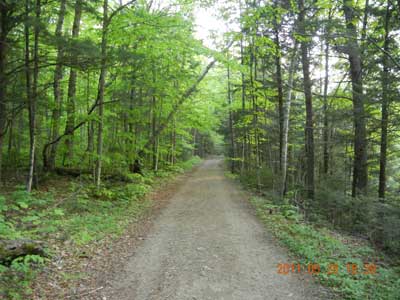
Ride your bike deep into the woods using East Side Trail. You are allowed to ride your bike 3 miles on a dirt road “upstream” until you reach “The Gates of the Wilderness”. Here there are some free tens sites, but we are skipping all that. Note that there is no bridge across the river, so if you have time for Franconia Falls, you would have to cross with your own feet.
 Deposit your bike 30-40 feet away from the road. Mark the location well with sticks and stones. Look around for a good landmark. Take a picture as a reminder. Save a location on your GPS even if you do not have topographic maps loaded on it.
If your bike ride into woods was about 20 minutes, expect to spend over an hour to return back on foot. That is the time your will save on your way back from the other side of the wilderness.
Campgrounds inside White Mountains park operate on a First Come, First Served basis. Drive through the entire expanse of the campground and pick unoccupied spot. In Hancock Campground there is very little mosquitoes and favorite spots are along the river. But river itself has very sharp banks and is good 100-200 feet away from the campground. Erect your tent before the darkness sets in. On your way out to the restaurant drop off payment in a provided envelope. It is $20 per night per spot. It covers up to 2 cars and 4 adults.
Food places are closing around 20:45. After that just finger food at the bars. Do not make an emphasis on the food. Just try to go to bed as early as humanly possible. Leave all the discoveries till tomorrow morning.
When sleeping in public place always always remember to bring ear-plugs. The world could gone mad around you, but you need your sleep no matter what. In a complete ensuing darkness appreciate the value of a simple flash light. Tuck away everything from animals and from rain. Close the car. Close your eyes. Hope for a quick release of sleep.
First Day
You wake up in your own tent in a campground. When you return here tomorrow you will not have your car. It means you need to leave all your sleeping gadgets (tent, mattress, sleeping bag, pillow, flashlight, tools and stuff for your bike) here with the campground host. Usually it is easy to arrange, because you not just a customer, you are a returning customer.
After folding all your sleeping arrangements into a bag you are off for your first Pancakes and Omelet breakfast. Try to get at a breakfast place in Lincoln before 9AM. Or you would have to wait in line. It is very interesting, but even breakfast places are differ in their recipes, and people somehow gravitate toward “better batter”.
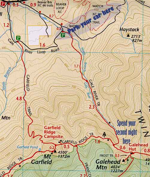 Gale River Trail parking is located 3 miles into the woods on a gravel road off route 3, right across from Trudeau Rd. Around 12 noon you reach your destination parking lot. Your car will remain here for 2 nights and almost 3 days. Search for a shady spot. Pack 2 bottles of water per person. You would be able to replenish at the hut. Cover yourself with bug spray – those tiny black flies are not going to kill themselves. Sun cream is not very essential – you will be in the shadows of the forest most of the time.
Gale River Brook Trail will climb up evenly in the beginning and it will cross the river twice. Use those opportunities to swim, to take pictures, to rest and not get your boots wet. After second river crossing trail begins to climb sharper up.
There is nothing special to report about the trail. You hear the river a lot. You try to avoid puddles and muddy spots. On the last mile you begin to hope that this very clearance in the trees is your destination. Eyes are searching for any sing of clearance in the thick of the woods. But it is hopeless, and you are wrong every time.
Meet and talk to the strangers. They will tell your about the hut, about the winds, temperature and conditions.
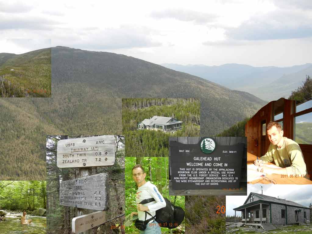 Finally, when you least expected, you reach the junction with Twinway and you are now only few sort away from the hut. Around 15:30 (after 4.6 miles behind you) you reach the Galehead Hut. There is no one to see. You are alone. Just grab your bank bed and drink your tea. There is a gas stove with a whistle-kettle. Water is potable, and place is nice and clean.
Those first minutes at the hut are especially precious. You are alone in a large kitchen hall. It is so large and well-lit, it could have been a ceremony hall. Sun is all over on wooden tables, benches and floor. You wet clothes are now drying outside on the sun. Your first leg of the trip is complete, and there is absolutely nothing to worry about till tomorrow morning.
Your host will appear around 17:30. You could pay $38 with no service (just lodging when off season) and $111 with food and drink per person, per night. To my surprise I discovered that a weak AT&T signal exists at the hut, and one other person was making several lengthy calls from here with Verizon account. Hikers are advised to make their calls outside to preserve idyllic somber mood here.
Walk a quarter of the mile on Frost Trail. You will find an convenient outlook to the hut and to the valley. That is a good spot for pictures especially if you have a good zoom on your camera. I was planning to visit Galehead mountain (4024′), but several fits of hale and rain made me turn back. I needed to keep my clothes and my boots dry for tomorrow. Later in a guide I read that Mount Galehead offers no views due to a thick overgrowth.
Hut has 38 bunk beds, but it was only 6 of us and the host. Each “family” got their own bedroom. Very graciously our host offered to cook the dinner for everyone, and it was great, because I had only “nuts and bolts’ supper in my backpack. To express my gratitude I stuffed a $10 bill into a tips box.
Try to finish all you earthly affairs before the dark. Mainly, make you bed before the dark. If you do not have a flash light here and uncomfortable to ask for it from other guests, it is nearly impossible to fight with blankets and pillows in a complete darkness. And have your ear-plugs ready. Every child in the house is a potential noise maker. And you need your beauty sleep for tomorrow.
Second Day
 You wake up in a hut. Do not feel obligated to wait for an official breakfast. You goal is to be on “the road” not later than 8AM. Do not forget to pick your stuff from guest’s refrigerator.
Twin Brook Trail is not your “poster child”. You’ll find very little details about this route on the Internet. This 2.7 path is your link on a long journey back down to the valley. It is completely plain, view-less, almost monotonous, and it reminds you of a ladder to an old attic: so many fine looking cobwebs you have to break to get through.
There is so little details about Twin Brook Trail on the Internet, that this is a perfect staging place for a thriller story. Were I’ve met my final destiny… Were ghosts gather to roost… Dark alleys of Twin Brook… It is all quiet on Twin Brook Trail… All those titles ate at your fingertips, when you walk here.
The path is descending into the valley between boulders and mud puddles. You are surrounded by usual jungle of small trees fighting for light and soil. White rotting birches are scattered everywhere. If your “Made in Austria” walking stick from LL Bean breaks suddenly, you have plenty of options to replace it with light, strong, straight stick just waiting for you on the side.
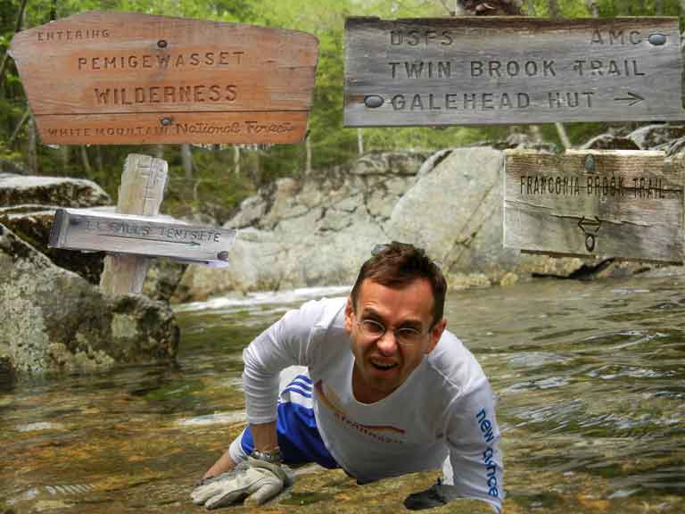 In 2 hours you can reach a junction of several trails and a 13 Falls Tentsite. I’ve reached this junction at 10:50. Here is a good place to drop your stuff and explore a little. Find you favorite boulder on the river and have some refreshments under accompaniment of a water currents. Do not place anything round or circular on the surface – it will roll off into the river. I had to launch an all out “fishing” expedition for a rolled off orange. I can’t say that that it wasn’t exiting, although dangerous.
Here is especially important to remind yourself that this is it. This remote wild area is the purpose of your journey. Experience the wild through sight and sounds. Just remind yourself that any paved road or vehicle is a good 5-6 hours away from here. Any shop or hotel even further away. Only few more hours in a grip of a wild, and before you know it, the magic will be gone.
You path continues on Franconia Brook Trail, although you rarely see it. You now have to cross several brooks rushing to meet Franconia Brook. And for 2 of 3 of these crossings you would need a sturdy stick and to take off your shoes. Respect the current. Do not get your socks and your shoes wet. Look at each crossing as an opportunity to make a brief stop, take pictures, search up and down for an absolutely the best place to cross.
After you done with brooks, you are entering a crooked beaver county. Beavers create rather ugly pools of still water, and level of mosquitoes goes up. But it is very interesting spectacle. If you are well covered in bug spray, spend a few minutes to examine, how they do it. Compare the notes. How would you do it without tools and opposing thumb.
They are building a future living quarters as a kind of dome of sticks and branches. Next they flood the area by a series of dams, and now entrances to their dry dome home is under water. That is what we called security.
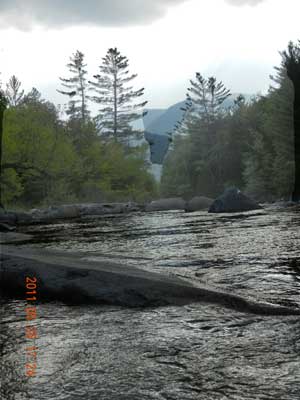
Finally you emerge from the wood (around 15:15) to see the juncture of East Branch Pemigewasset and Franconia Brook rivers. According to the map you’ve marched today for 7.7 miles from the hut. But there is no bridge to across Pemigewasset and your bike is on the other side.
 It is Spring – Labor day weekend, and river is still swollen from the melting. It is really dangerous and unpleasant to cross it on foot. I walked and walked on a high river bank with no path to spot from above any convenient spot. I was searching for a wide section, where water current is not so violent, and there is plenty of rocks to step on. finally at one stop I decided to start the crossing. I put on my boots with no socks, I armed myself with 2 sticks – one in each hand and begin to advance toward opposite bank.
On the deepest and most violent section – when you submerged waist-deep – I almost lost the balance and let go of the one stick. I saw it floating away. I did jump to a nearby rock, but now I am sitting on the rock surrounded by rushing water, and it is deep all around. There is no way forward. There is no way back. And all my stuff is still dry and hanging on my back.
I thought that if I just rush forward and get all wet, and all my equipment to get wet, the whole trip would be tainted. So I decided to think, to look around. The cold was not a real factor. As soon as you out of the water, you get the warmth quickly. I looked around and decided to go back and look for another spot to cross.
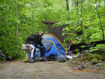 Somehow I did it (16:40 – 16:55). I crossed Pemigewasset East Branch in one piece, and the only casualty were my completely wet boots that I had to wear for safety. The whole operation took me just under 2 hours. More if you take into account the drying up measures I had to take on the other side. I found the bike in the woods, finished my provisions (17:24), and rode remaining 3 miles to the Lincoln Woods Visitor Center.
Hancock Campground was full, but the host placed me in a conspicuous area next to a storage shed. I quickly set my tent, and I decided to hitchhike to Lincoln to get dinner. The very first car stopped, and I had a comfortable ride with a fellow hiker. I ate at Gordi’s Fish & Steak (free unlimited salad bar with any entry), made my phone calls (“I am still alive”), talk to people.
It was getting dark on the way back. It is harder to see a hitchhiker in the dark. I couldn’t stop a car. I walked all 3.7 miles back to the campground.
Third Day
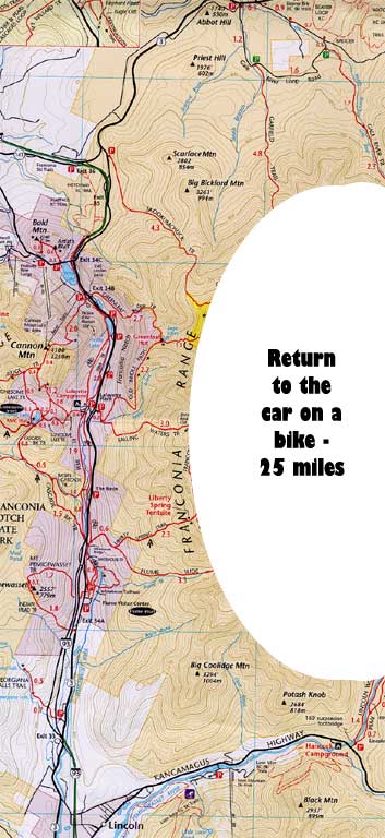 You wake up in a campground once again. All you need to do is to fold all you sleeping implements and deposit them once again with the host. You will return to pick them up later today, when you have your car.
You think that all you troubles are behind you and you expect to have a nice relaxing 25-mile ride on a bike back to your car. Not so fast. The heavy rain is in the forecast and as soon as you packed and ready to go, you realize that you back tire on the bike is flat. And it is 8AM on Sunday morning. Be prepared for everything.
Your first task is to find a bike supply place that is open on Sunday and prey they have your size in stock. If a good pancake parlor is on the way – do not miss it. Go right for it. Starting from 9:15 all breakfast places are packed and you have to wait in a line. What could be more appropriate for a sizable appetite as Western omelet and hot tea with lemon.
Riding on a bike with a flat tire is not only inconvenient. It is down-right dangerous. You loosing traction, straining your wheel, and your bike can skid underneath you right into the gutter. So walk your bike or pump every half-mile, if you tire holds air for a few minutes.
Weather is always a factor when you are outside. So you have to plan for the worst. Not only you will be wen, but all your stuff that you carry with you. Pancho and large plastic bags to cover you backpack are important things to have when you explore.
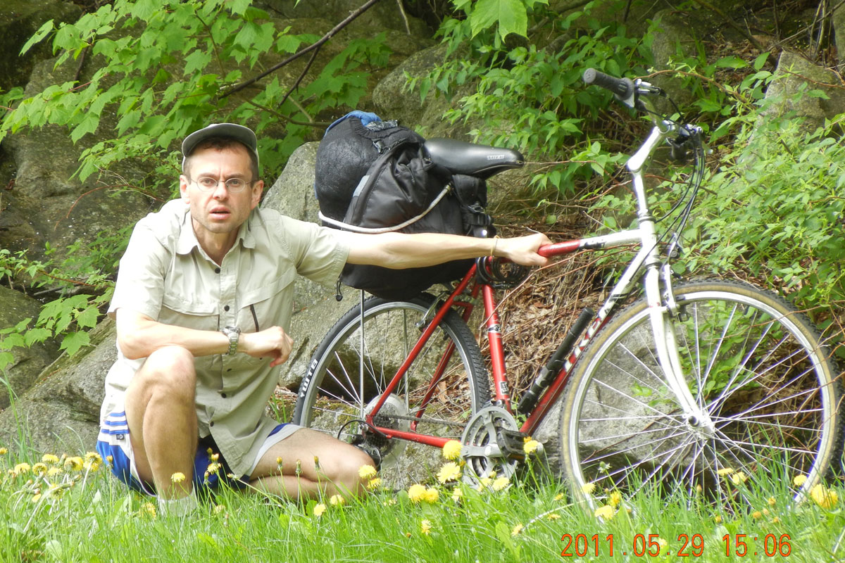
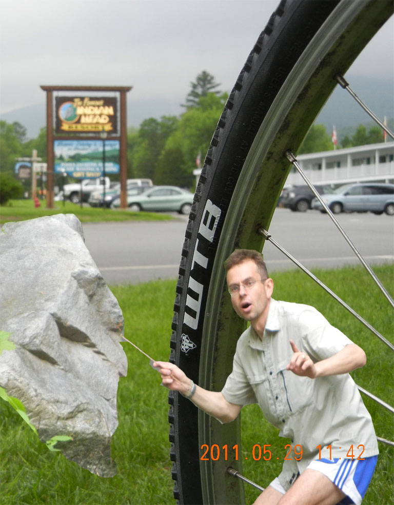 If however, you tires are humming and pavement is dry, you have pretty enjoyable day ahead of you. Let’s say you have 25 miles to ride back to your car. You are planning to stop to swim, to take pictures, to eat ice cream, to replenish your water at every opportunity you have. These 25 miles can easily take 8 hours to complete.
Consult your topo map to see, which sections are primarily uphill and which are mostly downhill. That will help you distribute energy throughout the day. If you have a GPS unit, save your current location about every hour. Name each new location with date, time and elevation. Later you would be able to review your progress throughout the day. To make each location more memorable, take couple of pictures (always always include yourself in the frame), and make notes in your journal. Write down all the interesting discoveries that you made on the last leg of your ride, your muscle condition, weather, money spend, people met.
The biggest mistake is to rush, to make a good time, to ignore the surroundings. Instead, search for perfect spot for siesta, interesting points to explore, to wonder, to ask questions, to participate. Going north on a bike path parallel to 93 is great because you are constantly reaching new interesting points and vistas. There are plenty of swimming opportunities, plenty of slow moving hikers and fast rolling bikers. Excellent mid-stopping point is Lafayette campground store, where they have food, potable artesian water, bathrooms with hot water and hot air hand dryers perfect to dry your drenched clothes.
Do not miss a nice swimming opportunity at Echo Lake. You will find an entrance to a parking lot off route 18 (Profile Road) This is exit 34C off 93. It is not very crowded here and there is a nice view at Crawford Notch.
Conclusion – Why New Hampshire?
 NH White Mountains are only 2 hours from Boston.
Entire tourist industry, all shops and restaurants are open and waiting for you.
Sales tax is Zero.
You always can find some accommodations even on the busiest nights.
Inexhaustible variety of nooks and crannies changing with seasons. It is never boring to visit the same spot several times through out the years. And yes. Reach you favorite spot from different approach routes.
Territory is vast enough to get lost, to run away from the crowds, to explore on your own.
It is still a wild country, and it is so close to civilization. Virgin forest was removed once (for lumber) and now it is a mixture of plans and trees fighting for light and soil, but think of it as a picture of earth 50 or 100 years after humans are gone.



Be the first to comment