
Summary: Hike another 16 mi on what seems to be a rather flat section of AT from Crystal Mountain Camp to October Mountain Shelter.
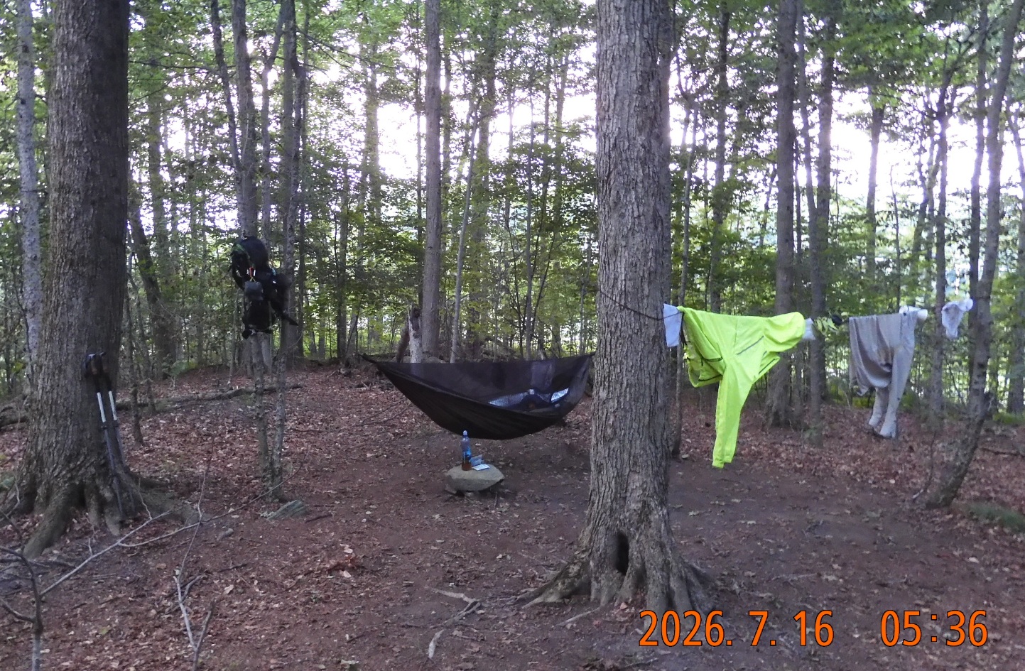 05:25 wake up in an open hammock – no rain and no morning dew – a dream weather condition. The birds are singing loudly – nice. Durning the night I woke up three times but never looked at the watch.
06:51 all packed and ready to go.
06:57 back at the trail – I am starting the southbound hike. Immediately crossing under power lines.
08:17 – 08:23 AT first goes parallel to Gulf Rd. and then quickly merges onto the road itself to start the city section of the hike. Here there are sizable parking lots on both sides of the road, kiosk with information, and there is even one car parked at this hour. Here I encountered first two hikers today.
08:45 – crossing both route 9 and route 8 via busy intersection.
08:50 – I see a dumb – here AT make a turn towards Depot St.
08:55 – 09:21 – hiked 4.64 mi/ 11.5 mi remains. Total remain 18.5 mi. I am stopping by on a porch of Tom Levardi’s with four other NOBO(s) right on the AT on Depot St. In Dalton, MA. There are electric outlets to charge your power banks, water in bottles, plastic chairs for 7 or 8 people – it is magic.
09:28 – crossing the railroad track to continue the grueling green corridor hike. It is not glamourous – just up and up to regain 2000′ elevation from Dalton’s 1050′.
Trail is soft rolling up and down. There is plenty of light around – the forest is open for light, but you still cannot see your progress beyond a few dozen yards.
10:36 crossing improved divided Grange Hall Rd. Sign shows 9.1 mi to my destination today.
10:52 – 11:47 – elev. 1765′ – hiked 7.41 today / 16.3 mi remains to the end. I am at Kay Wood Shelter. This shelter is 0.17 mi off the trail. You approach the shelter in a twisted semiarch. This marks a halfway point for today. There is no one here and there is no signal here as well. I am eating my breakfast here. The heat is not bothering me today. Mosquitoes are here but it is easy to shoo them away. Total number of hikers met – only 7 today.
I have time to relax and unwind. I am allowing myself to breathe. I am here; I am already here. It will all go away so soon. After visiting composting toilet, I noticed and took off a large dog tick right from my groin area. Before taking on nine more miles, I am putting on 2 pairs of socks – one thin pair and one wool pair for better feet protection. It is important to react if your feet are trying to tell you something.
It is a race to the end. I am actively watching my progress towards the shelter over this next section:
At 12PM there is 8.6 mi to the shelter.
At 1PM 6.2 mi to the shelter.
13:14 I am passing Warner Hill – 2050′. Not interested. Keep going.
13:32 – Finally, a change of scenery: I cross Blotz Rd., where magic trail awaits. There are two one-gallon jugs of Arizona Green Tea. I just kept going. The trail continues along an endless line of single-file wooden planks, or as they properly call it -puncheons.
14:00 – 14:25 – 3.9 mi to shelter – trail is an endless near flat windings around 2000′.
This stop was very interesting as I was sitting on the ground with my back to a fallen tree. I am keeping a very respectable speed of 2.3 mph. It means that I can reach the destination in a descent hour and have time to relax, to enjoy, to cook and to wind down before going to sleep. I keep encountering NOBO hikers -10 so far, but there is no time to chat or ask questions. I can see that many are just day-hikers with no particular purpose in mind. For me, it is 11.2 more mi to go to the bike. As I am getting ready to leave, a hike number 11 passes me rapidly.
At 3PM there 2.6 mi remain. It means that in just over 30 min I covered 1.3 mi – nice.
15:14 one more hour and I am at Pittsfield Rd. – a big intersection with a parking, a kiosk with a map, and the trail continues on one of the side forest roads.
15:39 I struck my head on a leaning tree with a sharp twig sticking out. I think it might be a serious cut on my sculp. It is very painful. I can feel the blood oozing through the hair. But I just continue to go forward. All of a sudden, inquisitive flies begin to land on the wound as they expect a feast. The old proposition is still correct – keep vigilant, do not relax on the trail, if it could happened, it will happened.
15:50 I am crossing the last road before the shelter – West Branch Rd. This is an unpaved, but well-maintained road, where I take a picture of 2 cars of people who will be my neighbors in the shelter.
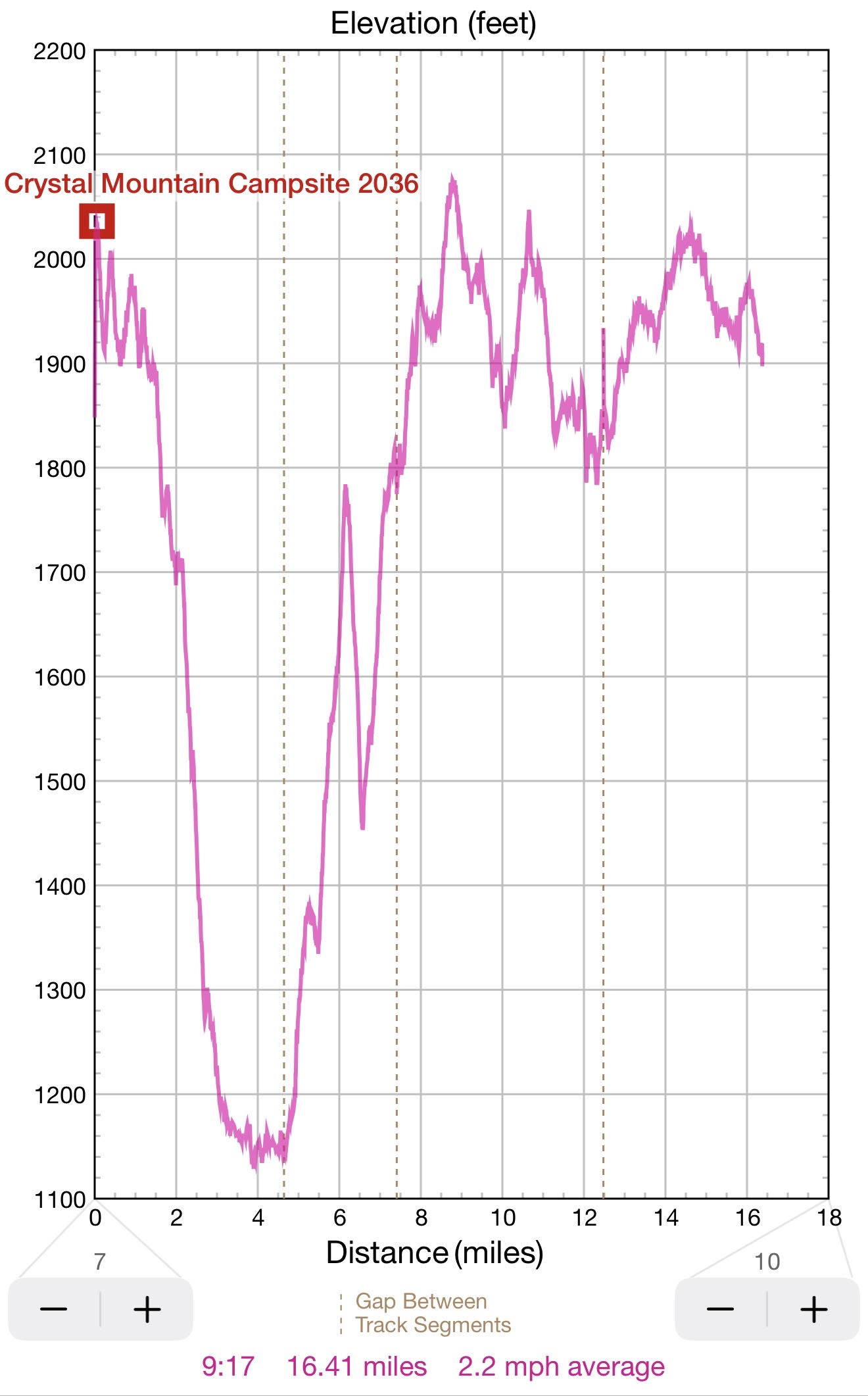
16:06 – Ok. I am seeing a bear box and a minute later the shelter itself – October Mountain Shelter. There is no one here at the moment. I hiked 16.38 mi in 7.5 hours with average speed 2.2 mph.
16:17 the first order of business is to examine the water situation here. There is a trickling brook crossing the trail. The water is running, but slowly and it is a bit yellowish. But it is OK. A scoop water into my three liter bladder for today and tomorrow. After hanging on a branch for a few minutes, the hook breaks again and the whole contraption falls on the ground. Luckly – no rupture. I would need to repair the hook securely at home. Mosquito situation is bearable, I Would need to sleep in a mask tonight. Also, I can hear some distant voices, and I can’t understand if people are coming or going.
 |
 |
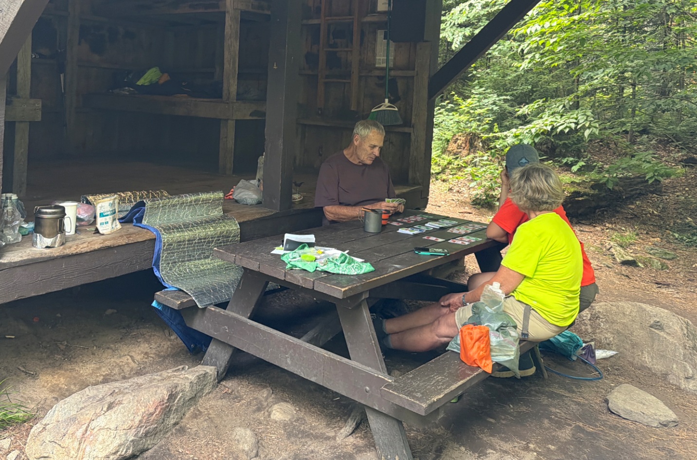
| My neighbors introducing their granddaughter to a world of hiking and camping. They offered to drive me back to my car tomorrow. That changes everything. | Another 16 mi day, but who is counting? |
My new neighbors turned out to be Diamond Dave, his girlfriend April Showers and her granddaughter. They will stay in a tent nearby, but we would spend 2 or 3 hours together in front of the shelter at a picnic table cooking food and chatting. Today I am cooking Nomad Nutrition Caribbean Curry.
I can see one bar cell signal on the phone, but it is not connecting to anything. However a phone call from a friend comes through.
19:14 after I am done with food, I took the phone and went up and down the trail to search for a better cell signal. Going south the signal eventually disappeared completely but returning and going north I was able to connect and do an extended session on Duolingo despite having the same one bar of a signal. Today is the streak day number 2417.
20:17 I am very content, I returned to the shelter to get ready for sleep. The weather will remain dry till Saturday morning. My camp neighbors offered to drive me with my bike back to North Adams tomorrow as both of their cars have the bike racks.
The plan could be for them to wait for me to complete over 7 mi south to route 20. I could be there on a parking lot at around 11AM. This will completely change my day tomorrow.
20:35 Today I’ve hiked from Crystal Mountain Camp sharply down to Dalton, MA and then back up on a relatively monotonous green corridor trail. So far, I’ve hiked 34.3 mi from North Adams.
To make my back and head comfortable this time I placed the entire backpack under my head and using it for support as a headboard. There is an element of convenience here – a king of shelves all around the walls where one can safely place all the immediate needed things. The light on my forehead attracts warrior mosquitoes – not too many, just a steady stream of strugglers. It means I would have to sleep in a mask and gloves. I asked April to take a picture of my head wound – it is just a cut – not too scarry. The night is very warm again. I feel too hot in 2 layers of clothing – long sleeves t-shirt and a green Patagonia jumper.
20:48 Ok. All done. Turning the light off. Today for the whole day I’ve met under 20 hikers.
Navigate through the List
- 01 2026-07 Re-route work and appointments to free up time for 5th trip (2026/07/13)
- 02 2026-07-14 TU sudden start of the trip to Western MA (2026/07/14)
- 03 2026-07-15 WE - southbound over Mount Greylock to Cheshire and beyond (2026/07/15)
- 04 2026-07-16 TH - almost flat map section around Dalton, MA (2026/07/16)
- 05 2026-07-17 FR - finish one of the last AT sections in CT, MA, VT, NH and ME (2026/07/17)
- 06 2026-07 Fifth AT trip in two months (2026/09/18)
Be the first to comment