
Summary: Today (on Tuesday) I decided to go on hike immediately as rain-free-window will end on Saturday. Drive to Western Massachusetts to start the hike across the state from North to South.
09:49 – Ok. After a series of phone calls to Newton Police and was able to move my LTC renewal appointment to a later date. Now, I can depart immediately.
12:14 – I am ready to depart. Lira helped me with food and water for the trip. It is a sweltering day to leave for a hike.
12:38 – ODO 0.0 + 28°C – I depart the house. New power bank battery just arrived from Amazon, but I am leaving this new battery home – it would take hours to charge it from 0%. Instead I am adding a bulky old battery bought in 2017 that still should be good for 1-2 full iPhone charges.
I am anxious but I am in an elevated mood. Gathering of things went well and together we went through the entire travel list item-by-item very thoroughly.
12:47 – 12:56 – ODO 5.2 – I am at my club. I picked NIKON camera (for 30x digital zoom) and additional ice for the cooler. The preparation steps here include to format the memory card and disable touch screen on the camera.
Start driving on Mass Pike west to Lee, MA
Passing Mass Pike highest point at 1724′.
Passing under a bridge where AT is crossing Mass Pike.
14:25 gas station at Blanford, MA on Mass Pike – $4.629 x 16.533 = $76.53 AmEx.
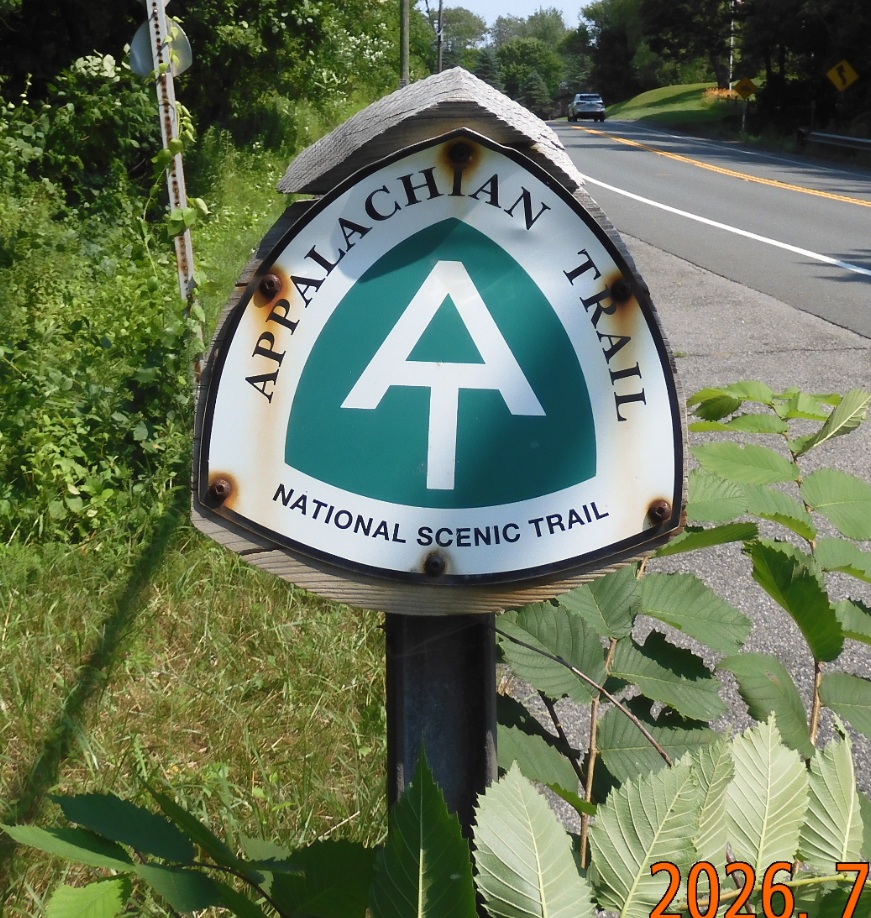 14:51 – 15:21 ODO 124.8 – arrive at a large parking lot on route 20 just on the border of Lee and Becket, MA. Hide the bike in the forest. Check the list of things I wound need to ride 40 mi back to the car without a backpack: car keys, water, rain jacket, small bag to put all the things in.
16:26 – ODO 163.7 – +29°C – elev. 1014′. After about an hour of driving I arrived at 381 Pattison Rd. in North Adams. I am at a small parking lot for Appalachian Trail. Only one more car is here. As I am about to depart, a granddaughter and grandmother are just emerging from the wood to complete their 11-mile day trip to Mount Greylock and back. They are telling me to use bug spray and that it was a tough section. It took them all day to complete this 11-mile trip.
The parking lot is situated just next to a water treatment facility, so there is a stable unusual odor in the air.
16:42 I am beginning the hike. The sign indicates 2.4 mi to Wilbur Clearing Shelter (my goal for today) and further 5.6 mi to the top of Mount Greylock.
As I climb up, I am sweating profusely. The sweat is dripping from my chin, and I must swipe it with the backs of my hands while holding the trekking poles. These are the hottest conditions in which I have ever climbed.
17:46 – hiked 1.5 mi. – elev. 2115′ – after 1H hike I completed 1.5 mi up the slopes. It is hot, but I am progressing nicely. The trail incline is nice, steady, and not technically hard.
18:08 – elev. 2497′ – I am at the viewpoint at the split to Mt. Prospect Trail. The view down the valley toward Williamstown is nice, but I am too focused on reaching the shelter.
18:19 – I hiked 2.28 mi. Elev. 2273′. I am at a trail split. I need to take Money Brook Tr. to go to shelter.
18:28 – I reached Wilbur Clearing Shelter after hiking 2.53 mi in 1:47, averaging 1.6 mph. I see two or three backpacks and gear, but no people. While collecting murky water that is barely deep enough to scoop, I hear voices. Minutes later, a group of four (two men and two women) returns to the shelter after walking 0.7 mi to nearby falls for vistas and clear water. Five people would make the shelter too crowded for comfort, so I will consider other options. All of the tent platforms are available, so I can pick any to my liking.
19:09 – with a help of satellite messages I was able to notify Lira about my progress, and I learnt that France lost to Spain and they are out of the tournament on a Bastille Day.
19:16 I need to hang all my clothes on a cloth line – it is completely wet from the sweat.
19:34 – Hammock is hanging. My mood is improving. Suddenly, my water bladder broke, and it fell heavily on the ground. Luckily, it did not rapture. Tomorrow I will temporarily repair the hanger with duct tape.
19:42 – I charged iPhone up to 92%. I already finished the porridge from home, and now I am continuing with dried fruits and nuts. To complete this hike I need to go forty more miles in 3 days before rain starts on Saturday. Tent platform is very convenient and allows to spread my things easily and comfortably. Pictures taken are clear and descriptive.
20:06 – more NOBO through hikers keep arriving and settling on remaining platforms.
20:17 I found a convenient position to write on a tent platform using it as a standup desk. The surface here is so uneven that on one side platform is high in the air. It allows me to use the platform as a convenient table. There are about eight people here at the camp (including me), so there is enough space remaining for more guests. I can hear loud voices of excited hikers discussing their daily affairs. The group of four at the shelter even have energy to start the fire. Good. One of them is a NOBO through hiker and three others are just companions for a couple of nights. It is getting darker, but I still can write without a light. There are little mosquitos, and the air is still very warm.
20:28 I climbed into my hammock. All the affairs of the day are completed. I must concentrate on resting my body for tomorrow. It will be 3.3 mi to climb to Mount Greylock tomorrow and over 15 mi total to the next camp beyond Cheshire. It is so warm that I want to take off all the layers. What is unusual this time, I did not even install a rainfly above the hammock. No need. It will be a dry and hot night. I don’t even need my sleeping bag for now.
20:34 The flashlight is already on. I am winding down, but it is hard to do on such a warm night. All the voices around the camp are calming down. All must wake up early tomorrow. The campfire in 80 to 100 yards from me is no longer smellable. I will try to stretch and fall asleep.
Be the first to comment