Night in camp Cold Sun – elevation 942 m.
05:56 – record-early wake up. That is what usually happens – on the last morning in the wild you always wake up very early. And yes, this morning I am looking forwards for a change of scenery.
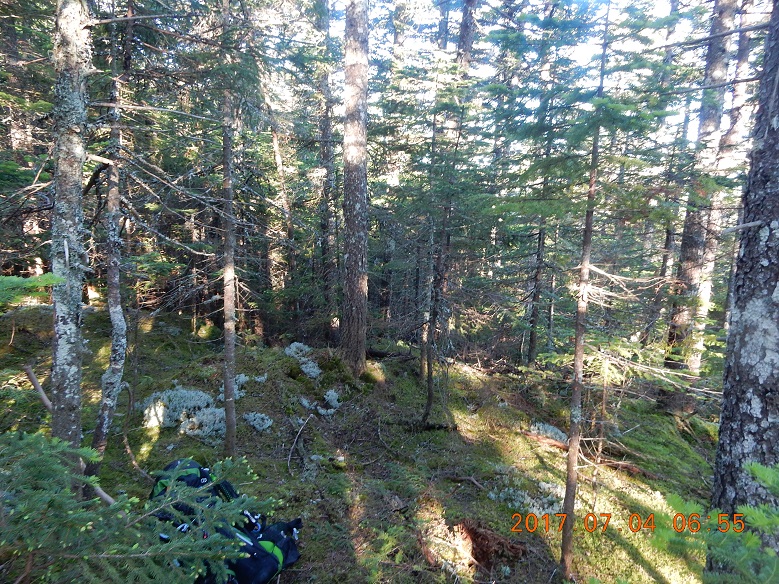
This was a very good camp. Secluded, covered by the tree canopy, but bright both in the evening and in the morning. Yesterday, sun was setting just over the edge of an invisible cliff, and now, a few hours later, sun raises again not a 90° to the right. It will be a long day. This spot is far enough from the trail as not to be observed, but close enough to almost hear hiker’s conversations.
 |
 |
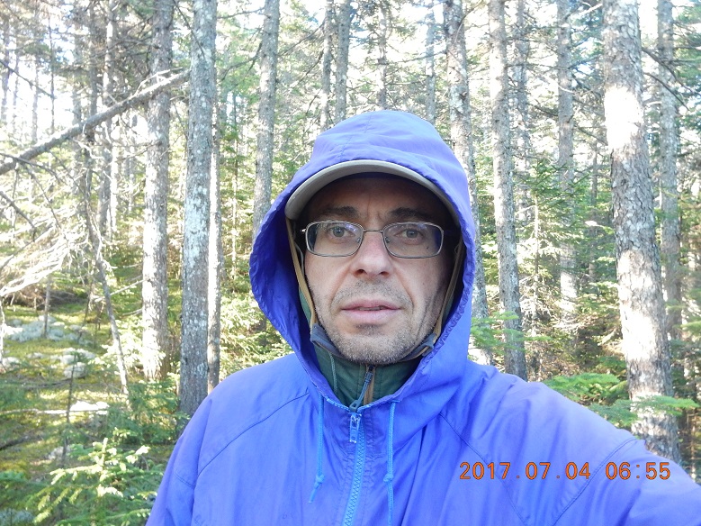
| 06:55 – this night was a cold night in July and now it is a chilly morning. So, I woke us and stayed in all my warm sleeping clothes. I quickly gathered and folded all my things. I would need to get water soon. | 06:58 – start walking. All is fresh, sunny, beautiful. |
 |
 |
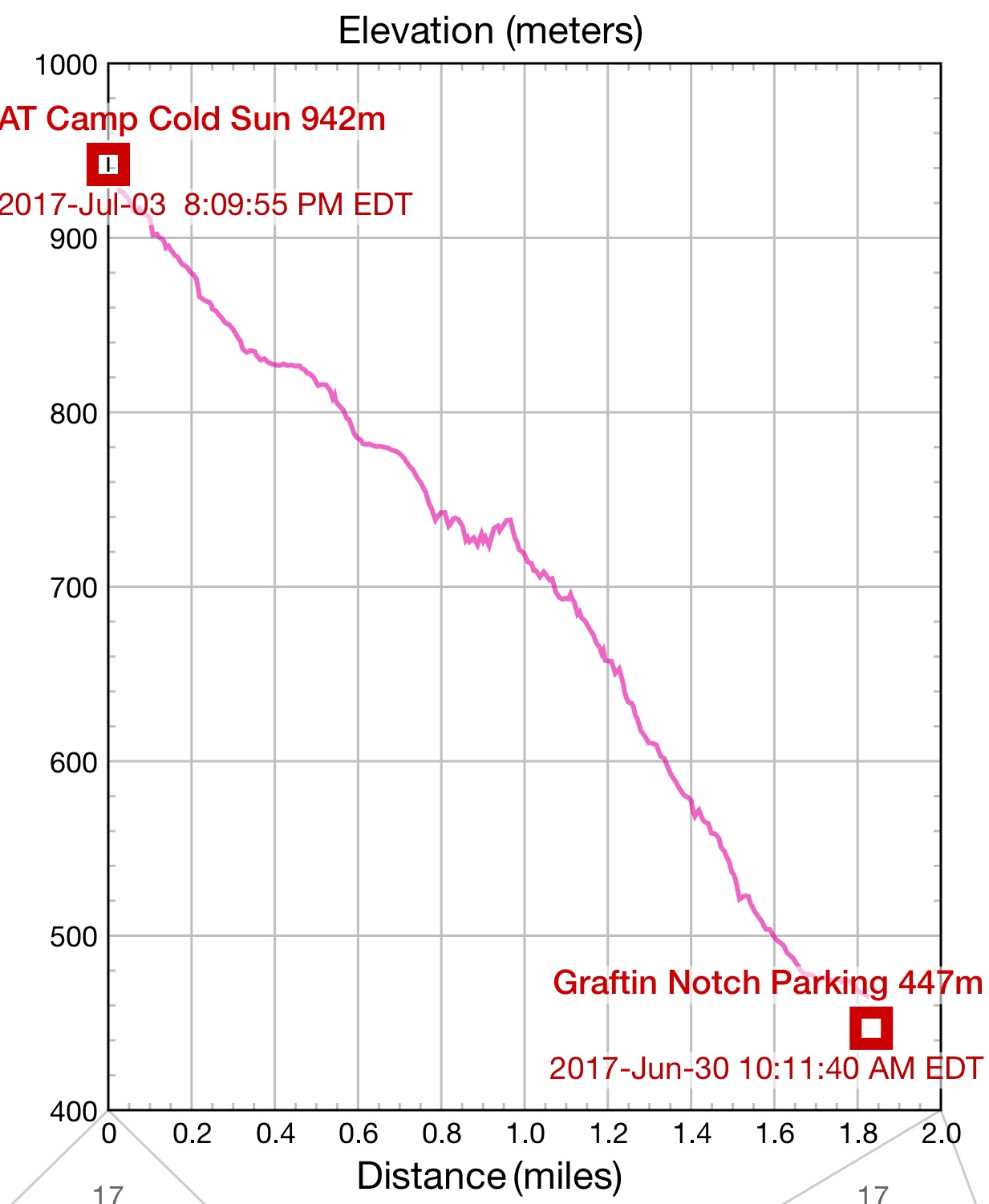 |
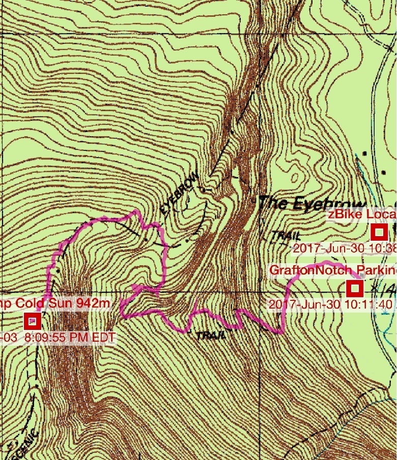
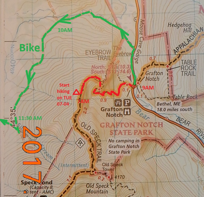
| First step is to reach parking lot and complete hiking section of the trip. | The same hiking section (marked in red) and continuation on bike (marked in green) | Today hiking was a steady down from elevation 942 m to 447 m over 1.8 miles |
The bright sun was already providing enough warmth. I took off all my clean night clothes and put on normal daily clothes. Finally, boots were dry enough to change the socks for a new dry pair. This is monumental event from my feet prospective.
 |
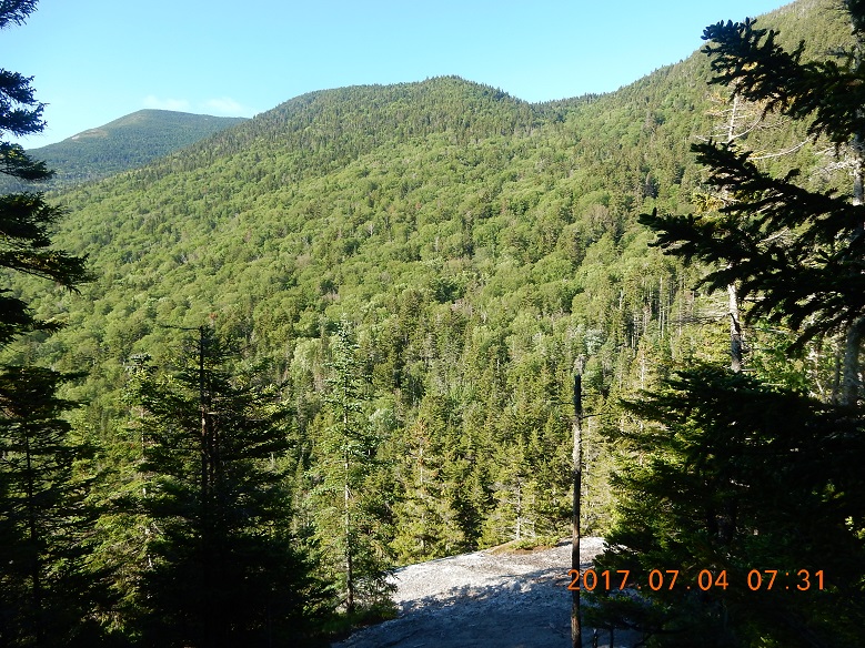 |
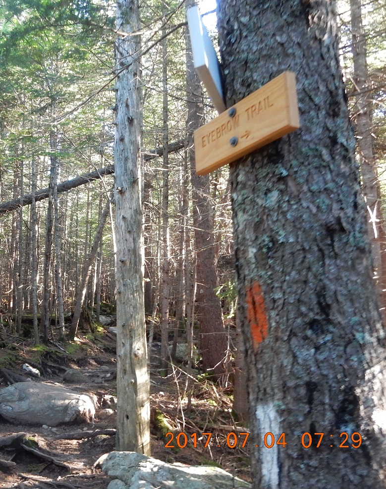
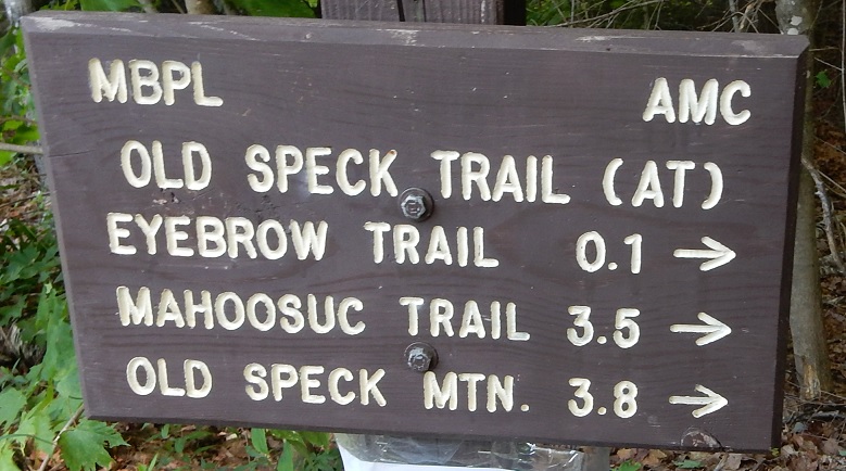
| 07:29 – Eyebrow Trail meets with AT. This trail is another round way to a parking lot on route 26. | 07:30 Reach an opening with large rock “table top”. You can see a ravine that starts somewhere nearby and goes down to a highway. View is very interesting, because you can’t immediately see where the trail will take you next. |
 |
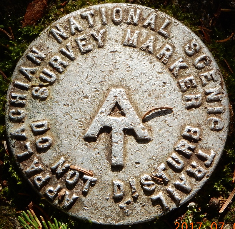 |
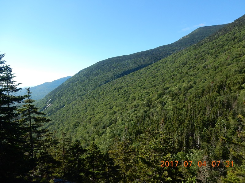
| 07:31 I can see the road from here and hope that trail will simply go down on the other side of the slope. No more SUMMITS, please! | 07:59 – during 31 miles track from NH to ME I saw several markers like this. They all look the same |
 |
 |
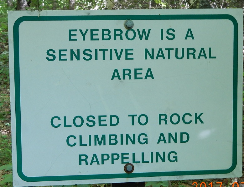 |
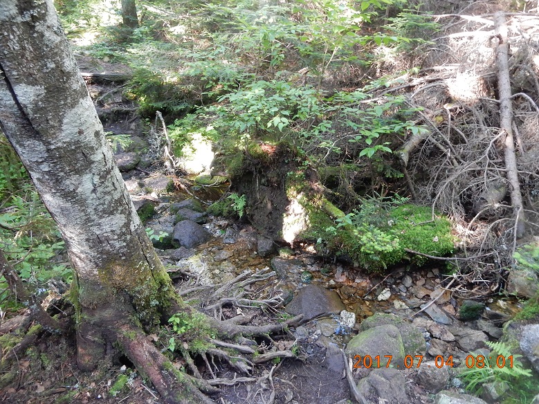
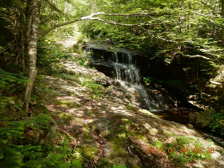
| 08:00 – first running water encountered. Fill in both plastic bottles and 32 oz. Sawyer squeeze bottle. Still, water is a little yellowish. | 08:38 it is strange that I even noticed these falls. There are a series of falls of different sizes and these are not the biggest ones. | 09:03 – Eyebrow Trail meets with AT again. This sign tells me that this trail is definitely will be a candidate for my next exploration trip. |
I first hear and then see a group of four boys/teens going up with paper cups and no gear. They are load and pretend to be obnoxious. This is the first sing of fast approaching civilization.
Also, on the way down, I meet a couple of day hikers that are going up. I’ve already met them 2 days ago around Mount Success. Back then I thought the guy is a little boorish, and now he is a bit sweeter, but still manages to insult White House inhabitants with typical unfounded expletives. But the chance meeting seems interesting and improbable. Day hikers meet through hiker twice in 3 days.
 |
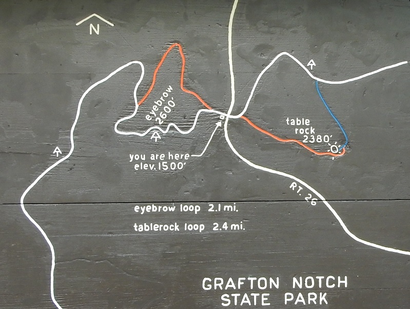 |
| 09:05 – Exiting and dignified moment – I am on a parking lot off route 26 in Grafton Notch State Park (elevation 447 m). I hiked 1.8 miles from Camp Cold Sun. | 09:06 – Wooden map on Grafton Notch paring lot |
 |
 |
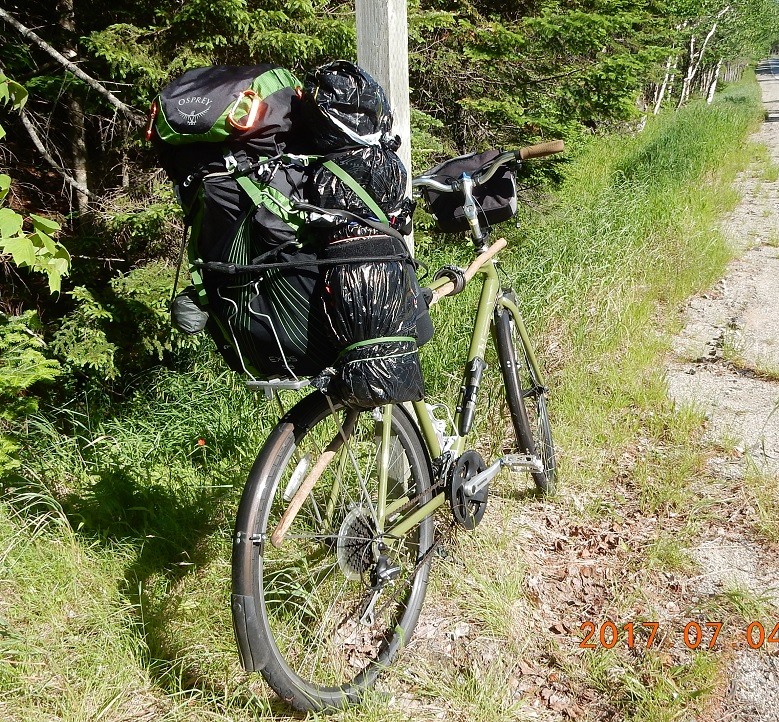 |
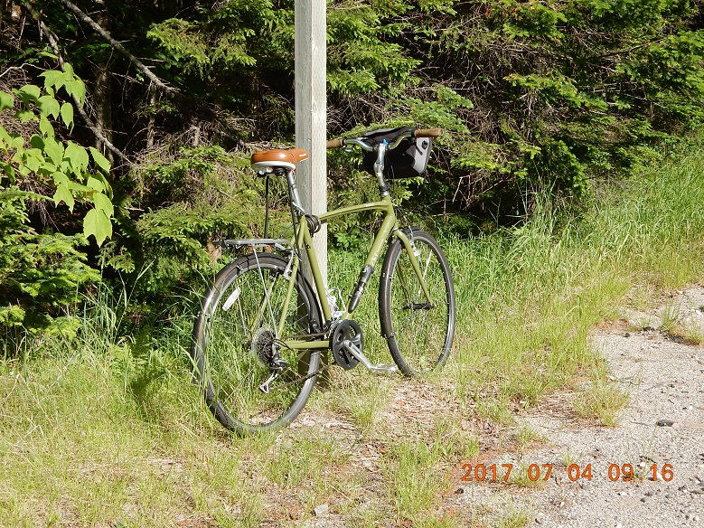
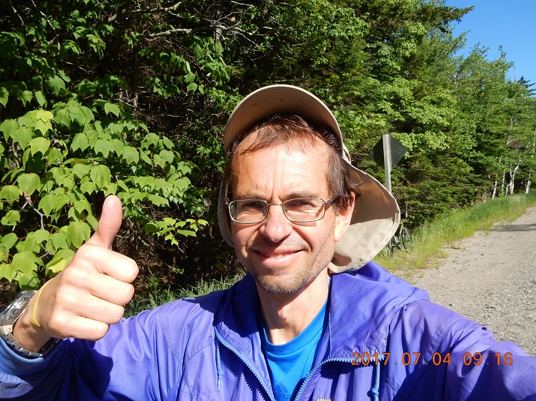
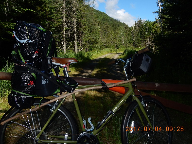
| 09:16 – bike and all accessories extracted from the forest. Bike is fully assembled and it sits on the side of the road leaning against a road sing | 09:16 – everything will be OK! I can’t believe I’ve reached a smooth warm road surface after days of wet and rough trails | 09:22 – backpack securely attached to the bike with bungee cords. |
 |
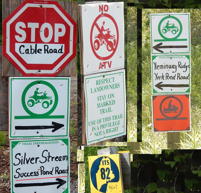 |
| 09:28 – 0.65 miles from Grafton Notch State Park parking lot) – I’ve reached Cable Road. This road is blocked by a gate and used mostly for ATV(s). This is a good news: there are no people and no cars here. But where does this road goes to? There is no such road on my topo map. I will find out soon. | 09:55-10:24 – first 1.5 miles on the bike – I’ve reached intersection with a connecting ATV trail to York Pond Road. First explicit sing pointing to Success Pond Road. Yes! At this point I know for sure that this road will not suddenly die down, and I would have to turn back. Dirt road is still in excellent condition. |
10:25-11:34 – next bike segment (approximately 2.3 miles) over the worst (for bikes) portion of the road – from ATV junction to good well established dirt road.
10:45 road goes up steep enough that I had to walk the bike up the hill. I am only glad. I can see and observe more while I am walking with my bike.
11:05 at the very top of the hill (elevation just under 700 m) road turns truly 4WD. Deep puddles of water that is very hard to bypass without getting wet and dirty. But this road must be a real joy to ride for ATV(s).
11:11 – finally, road goes down. It is a fast ride. Road appears less used here, more overgrown with grass, less puddles.
11:29 – 4 miles in – connection to a good dirt road again. One more sign pointing to Success Pond Road.
11:51-12:51 6.5 miles mostly down with average speeds 10-15 mph. Road evens out around 12:18 PM and my average speed lowers to 6 mph.
11:58 – I am on Success Pond Road. This is a wide dirt road that must have a good use sometimes, but there is no movement on this road now. I am in Maine, a few miles from NH/ME border. Full steam ahead back to NH!
As I move further and further into New Hampshire, vehicle traffic grows steadily with 20 to 30% of vehicles are ATV(s) of various sizes and shapes. And each vehicle carries a vail of dust behind it. It is less fun to ride a bike on a dusty road.
| IMAGE 01 | IMAGE 02 | IMAGE 03 |
| TEXT 01 | TEXT 02 | TEXT 03 |
There are so many unmarked and unnamed roads departing Success Pond Road left and right. I made a turn into one of these roads and drove my bike for a little while till dust and noise on main drag completely gone away. Now it is just an excellent dirt road leading up somewhere back into Maine. At a time, I did not know that I am still very close to ME border.
| IMAGE 01 | IMAGE 02 |
13:09-13:33 I am on unnamed road off Success Pond Rd in NH. Problem – iPhone APP iHikeGPS is 98% full. It means I need to save and email my recorded tracks before application will start to overwrite earliest tracks from June 30. I need “to park”, but I can’t find anything to my bike against. I can’t remember how did I mange, but I was sitting right on the road grass, eating last of trail mix, drinking yellowish water from AT and emailing my tracks from June 30. However, I had to stop that important activity, because it was too hot under an open sun.
| IMAGE 01 | IMAGE 02 |
| TEXT 01 | TEXT 02 |
Weak cell signal allows Google to tell me that I can by in Berlin in mere 47 minutes by bike! And I was planning to make it an overnight adventure. Full steam ahead. To Berlin!
13:37 – 14:57 – 9 miles with steep down closer to Berlin. Last section I used a shortcut that is blocked for normal use with fence and cement blocks. But not a bike with a mission to return to civilization
15:00 – Another 9 miles are behind me. I am emerging from the back country into the paved streets of Berlin, NH.
15:19 – many dams of Androscoggin River. I am about to enter a very straight section of ATV trail converted from old rail road. Here, fast-moving vehicles would have to slow down not to hit me with a shower of debris. Luckily, there are only a handful of ATVs here and most of them rented by the hour by tourists with helmets and kids.
15:43 – a quick stop on a narrow ATV trail right next to the Androscoggin River. All energy right now is focused on reaching the Hogan Road and completing the trip. Why did I top then? May be to check the tires?
| IMAGE 01 | IMAGE 02 | IMAGE 03 |
| TEXT 01 | TEXT 02 | TEXT 03 |
16:00-16:34 – Mahoosuc trailhead off Hogan Road. I sat down right on the ground Create a comfortable nook in a shadow with my back resting against the tree. Transfer more tracks from iHikeGPS to keep them from being overwritten.
17:13 – 4 days ago the road was block here by a fallen tree. Now you can hardly see any evidence. Quick work – public works!
| IMAGE 01 | IMAGE 02 |
| TEXT 01 | TEXT 02 |
17:41 – swimming at the same spot in the Androscoggin River as on June 30. This time the spot is taken by a white truck with father and son? Pictures of Mt. Washington and Mt. Adams on the other side of the river.
17:54 – The END! – 4 miles from Mahoosuc Trailhead – elevation 251 m – the car is there! My car is sitting at the same spot undisturbed. I was a little worried.
| IMAGE 01 | IMAGE 02 | IMAGE 03 |
| TEXT 01 | TEXT 02 | TEXT 03 |
18:16 – start driving for food and drink. Indicator for rear driver-side tire shows low pressure. Apparently, a small leak came back after they put a plug to it on 2016-07-01.
18:19 – entrance to Hogan Rd. That is where North Road branches off. While in NH, North Road goes parallel to AT for many miles keeping its respectful 3 miles distance from it. This road has many additional access points to AT and it shelters.
How convenient! I see an open gas station right at the junction of route 16 and route 2. Attendant lady advised that there is a free air pump at the other end of Gorham, but for me minutes count.
| IMAGE 01 | IMAGE 02 |
| TEXT 01 | TEXT 02 |
First transaction after 4 days of no money – four quarters ($1) into a box to put more air into driver rear tire. Bring pressure to 38 PSI.
| IMAGE 01 | IMAGE 02 | IMAGE 03 |
| TEXT 01 | TEXT 02 | TEXT 03 |
18:44 – attempted message to Lira that I am passing Mount Washington once again. But there is no signal on route 16 here, and message goes undelivered.
Conway, NH – it is a human zoo here. I can’t find parking nearby, and I park probably good 0.5 miles away on route 16 and I ride my bike back to the restaurant.
20:05-20:39 – Vegetable Pasta Primavera at Horseheathers in Conway. Service is brisk. Wait for a table was no more than 5 minutes despite a great locomotion and crowds getting ready for fireworks ($30.89).
21:22 – Walmart in North Conway – they are open till 10PM on this fine holiday evening. Buy honeydews, watermelons, kiwi, plums, cherries, blueberries and strawberries for $26.43.
| IMAGE 01 | IMAGE 02 |
| TEXT 01 | TEXT 02 |
Despite the rules they let me to bring merchandise into the restroom so that I can wash my fruits for the road.
While driving, I am eating my fruits and listening book on CD – John Irving, but my memory can longer hold additional information. All vacationing mobs already returned, and there is not traffic anywhere. Trip back home goes uneventful – good.
00:12 on Wednesday, July 5 I arrived back home with 444.7 miles on odometer.
| IMAGE 01 | IMAGE 02 | IMAGE 03 |
| TEXT 01 | TEXT 02 | TEXT 03 |
Summary of the day: 2 miles of hiking and over 30 miles of biking, 200 miles of driving back home. Total duration of the active day from 05:56AM all the way to 00:12 – over 18 hours! It was a long day.
Navigate through the List
- Preparations for July 2017 trip to Appalachian Trail (AT) (2023/05/11)
- 2017/06/30 Friday - Who covers license plate with a Panama Hat? (2023/08/15)
- 2017/07/01 Saturday - Gift of shelter at the end (2023/08/19)
- 2017/07/02 Sunday - One of them now (2023/08/23)
- 2017/07/03 Monday - Endless Mahoosuc day with 7 miles (2023/08/27)
- 2017-07-04 Tuesday - From hike to bike, to car, to home (2023/09/01)
Be the first to comment